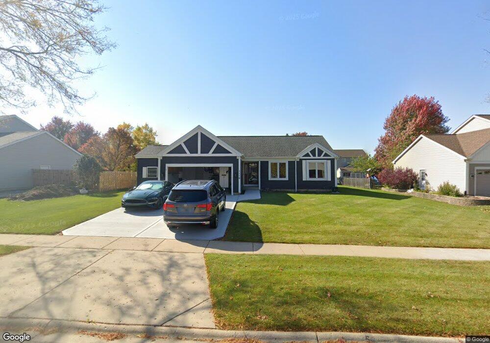
1110 Dawson Ln Algonquin, IL 60102
Estimated Value: $314,420 - $431,000
Studio
--
Bath
1,333
Sq Ft
$276/Sq Ft
Est. Value
About This Home
This home is located at 1110 Dawson Ln, Algonquin, IL 60102 and is currently estimated at $368,473, approximately $276 per square foot. 1110 Dawson Ln is a home located in McHenry County with nearby schools including Westfield Community School, Kenneth E Neubert Elementary School, and Harry D Jacobs High School.
Ownership History
Date
Name
Owned For
Owner Type
Purchase Details
Closed on
Jul 18, 2025
Sold by
Vicini Scott D and Vicini Carolyn J
Bought by
Vicini Family Trust and Vicini
Current Estimated Value
Purchase Details
Closed on
Dec 22, 1995
Sold by
Pulte Home Corp
Bought by
Vicini Scott D and Vicini Carolyn J
Home Financials for this Owner
Home Financials are based on the most recent Mortgage that was taken out on this home.
Original Mortgage
$132,350
Interest Rate
7.43%
Create a Home Valuation Report for This Property
The Home Valuation Report is an in-depth analysis detailing your home's value as well as a comparison with similar homes in the area
Purchase History
We collect this data history from publicly available records. To have your information removed, we recommend requesting removal directly through your county’s website.
| Date | Buyer | Sale Price | Title Company |
|---|---|---|---|
| Vicini Family Trust | -- | None Listed On Document | |
| Vicini Scott D | $147,500 | First American Title |
Source: Public Records
Mortgage History
We collect this data history from publicly available records. To have your information removed, we recommend requesting removal directly through your county’s website.
| Date | Status | Borrower | Loan Amount |
|---|---|---|---|
| Previous Owner | Vicini Scott D | $132,350 |
Source: Public Records
Tax History
| Year | Tax Paid | Tax Assessment Tax Assessment Total Assessment is a certain percentage of the fair market value that is determined by local assessors to be the total taxable value of land and additions on the property. | Land | Improvement |
|---|---|---|---|---|
| 2024 | $7,053 | $98,163 | $27,672 | $70,491 |
| 2023 | $6,680 | $87,794 | $24,749 | $63,045 |
| 2022 | $7,542 | $93,940 | $23,019 | $70,921 |
| 2021 | $7,233 | $87,516 | $21,445 | $66,071 |
| 2020 | $7,041 | $84,418 | $20,686 | $63,732 |
| 2019 | $6,868 | $80,798 | $19,799 | $60,999 |
| 2018 | $6,543 | $74,640 | $18,290 | $56,350 |
| 2017 | $6,405 | $70,315 | $17,230 | $53,085 |
| 2016 | $6,304 | $65,949 | $16,160 | $49,789 |
| 2013 | -- | $62,127 | $15,075 | $47,052 |
Source: Public Records
Map
Nearby Homes
- 750 Majestic Dr
- 761 Majestic Dr
- 811 Westbury Dr
- 621 Kirkland Dr
- 295 Winchester Dr
- 1713 Edgewood Dr
- 2161 Burnham Ct
- 731 Roaring Brook Ln
- 2067 Peach Tree Ln Unit 4115
- 2704 Bay View Cir
- 2117 Peach Tree Ln Unit 4084
- 2110 Peach Tree Ln
- 3025 Woods Creek Ln
- 46 Kelsey Ct
- 1721 Waverly Ln
- 1600 Huntington Dr N
- 425 Somerset Ct
- 1940 Waverly Ln
- 2004 Waverly Ln Unit 4292
- 275 Farmhill Dr
- 1100 Dawson Ln
- 1150 Sawmill Ln
- 1148 Sawmill Ln
- 1120 Dawson Ln
- 2424 Dawson Ln
- 2418 Dawson Ln Unit 133
- 2416 Dawson Ln Unit 132
- 2422 Dawson Ln Unit 135
- 2414 Dawson Ln Unit 131
- 2420 Dawson Ln Unit 134
- S Harnish Rd
- 1101 Dawson Ln
- 1146 Sawmill Ln
- 1111 Dawson Ln
- 2325 Dawson Ln Unit 381
- 1130 Dawson Ln
- 2402 Dawson Ln Unit 146
- 2412 Dawson Ln Unit 141
- 2412 Dawson Ln Unit 2412
- 2412 Dawson Ln Unit 2410
Your Personal Tour Guide
Ask me questions while you tour the home.