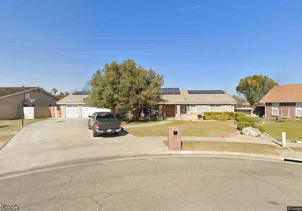
11108 Dee Dee Ct Bakersfield, CA 93312
Polo Grounds NeighborhoodEstimated Value: $496,000 - $562,000
3
Beds
2
Baths
2,242
Sq Ft
$239/Sq Ft
Est. Value
About This Home
This home is located at 11108 Dee Dee Ct, Bakersfield, CA 93312 and is currently estimated at $536,313, approximately $239 per square foot. 11108 Dee Dee Ct is a home located in Kern County with nearby schools including Rosedale-North Elementary School, Freedom Middle School, and Centennial High School.
Ownership History
Date
Name
Owned For
Owner Type
Purchase Details
Closed on
Feb 17, 2011
Sold by
Buckles Roger K and Buckles Lillian R
Bought by
Buckles Roger K and Buckles Lillian R
Current Estimated Value
Home Financials for this Owner
Home Financials are based on the most recent Mortgage that was taken out on this home.
Original Mortgage
$35,000
Interest Rate
4.67%
Mortgage Type
Credit Line Revolving
Purchase Details
Closed on
Jun 2, 2005
Sold by
Buckles Roger and Buckles Lillian
Bought by
Buckles Roger K and Buckles Lillian R
Create a Home Valuation Report for This Property
The Home Valuation Report is an in-depth analysis detailing your home's value as well as a comparison with similar homes in the area
Home Values in the Area
Average Home Value in this Area
Purchase History
| Date | Buyer | Sale Price | Title Company |
|---|---|---|---|
| Buckles Roger K | -- | Chicago Title Company | |
| Buckles Roger K | -- | Chicago Title Company | |
| Buckles Roger K | -- | -- |
Source: Public Records
Mortgage History
| Date | Status | Borrower | Loan Amount |
|---|---|---|---|
| Closed | Buckles Roger K | $35,000 |
Source: Public Records
Tax History
| Year | Tax Paid | Tax Assessment Tax Assessment Total Assessment is a certain percentage of the fair market value that is determined by local assessors to be the total taxable value of land and additions on the property. | Land | Improvement |
|---|---|---|---|---|
| 2025 | $3,506 | $266,435 | $50,760 | $215,675 |
| 2024 | $3,424 | $261,213 | $49,765 | $211,448 |
| 2023 | $3,424 | $256,093 | $48,790 | $207,303 |
| 2022 | $3,334 | $251,074 | $47,834 | $203,240 |
| 2021 | $3,220 | $246,153 | $46,897 | $199,256 |
| 2020 | $3,155 | $243,631 | $46,417 | $197,214 |
| 2019 | $3,107 | $243,631 | $46,417 | $197,214 |
| 2018 | $3,006 | $234,174 | $44,615 | $189,559 |
| 2017 | $2,973 | $229,585 | $43,741 | $185,844 |
| 2016 | $2,767 | $225,086 | $42,884 | $182,202 |
| 2015 | $2,734 | $221,707 | $42,240 | $179,467 |
| 2014 | $2,672 | $217,365 | $41,413 | $175,952 |
Source: Public Records
Map
Nearby Homes
- 11001 Aimee Way
- 3301 Beyers St
- 1900 Jewetta Ave
- 3416 Aslin St
- 3105 Silver Spur Way
- 3435 Moss St
- 3122 Campfire Dr Unit 2
- 11308 Sagebrush Ave
- 10512 Dee Ave
- 10701 Meacham Rd
- 3604 Mehgan Ave
- 3100 Woodstown St
- 2125 Verdugo Ln
- 11908 Nebula Ct
- 3622 Azure Dr
- 11910 Compass Ave
- 11265 Poulsen Way
- 2008 Torrey Dr
- 10601 Michele Ave
- 10409 Lonon Ave
- 11116 Dee Dee Ct
- 11100 Dee Dee Ct
- 11100 Dee Ct
- 11200 Dee Dee Ct
- 11200 Dee Ct
- 11109 Dee Dee Ct
- 11101 Dee Dee Ct
- 11117 Dee Dee Ct
- 11201 Dee Ct
- 11208 Dee Dee Ct
- 11201 Dee Dee Ct
- 11208 Dee Ct
- 2817 Nicole Way
- 11209 Dee Ct
- 10924 Dee Dee Ave
- 11109 Baron Ave
- 11105 Baron Ave
- 11201 Baron Ave
- 11101 Baron Ave
- 11209 Dee Dee Ct
Your Personal Tour Guide
Ask me questions while you tour the home.