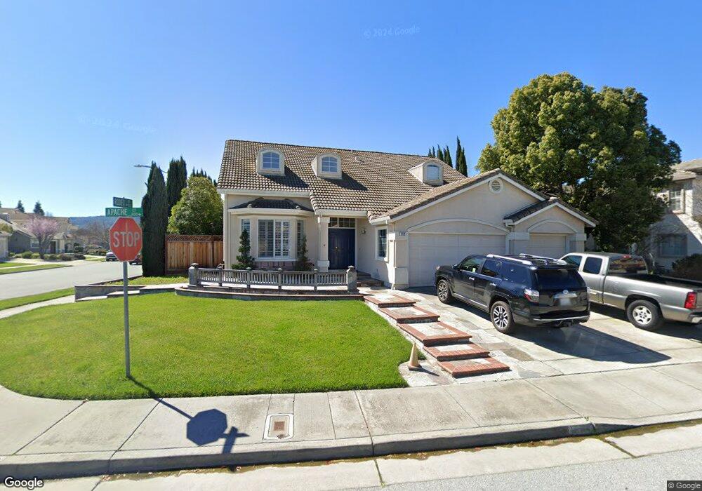
1112 Apache Ct Gilroy, CA 95020
Las Animas NeighborhoodEstimated Value: $1,138,000 - $1,279,000
4
Beds
3
Baths
2,436
Sq Ft
$494/Sq Ft
Est. Value
About This Home
This home is located at 1112 Apache Ct, Gilroy, CA 95020 and is currently estimated at $1,202,298, approximately $493 per square foot. 1112 Apache Ct is a home located in Santa Clara County with nearby schools including Luigi Aprea Elementary School, Brownell Middle School, and Solorsano Middle School.
Ownership History
Date
Name
Owned For
Owner Type
Purchase Details
Closed on
Jul 13, 1998
Sold by
Valley Title Company
Bought by
Vye Gary and Vye Susan C
Current Estimated Value
Home Financials for this Owner
Home Financials are based on the most recent Mortgage that was taken out on this home.
Original Mortgage
$290,700
Outstanding Balance
$76,586
Interest Rate
10.25%
Estimated Equity
$1,125,712
Create a Home Valuation Report for This Property
The Home Valuation Report is an in-depth analysis detailing your home's value as well as a comparison with similar homes in the area
Home Values in the Area
Average Home Value in this Area
Purchase History
| Date | Buyer | Sale Price | Title Company |
|---|---|---|---|
| Vye Gary | $323,500 | Financial Title Company |
Source: Public Records
Mortgage History
| Date | Status | Borrower | Loan Amount |
|---|---|---|---|
| Open | Vye Gary | $290,700 |
Source: Public Records
Tax History
| Year | Tax Paid | Tax Assessment Tax Assessment Total Assessment is a certain percentage of the fair market value that is determined by local assessors to be the total taxable value of land and additions on the property. | Land | Improvement |
|---|---|---|---|---|
| 2025 | $6,127 | $506,397 | $203,791 | $302,606 |
| 2024 | $6,127 | $496,469 | $199,796 | $296,673 |
| 2023 | $6,090 | $486,735 | $195,879 | $290,856 |
| 2022 | $5,988 | $477,192 | $192,039 | $285,153 |
| 2021 | $5,959 | $467,836 | $188,274 | $279,562 |
| 2020 | $5,893 | $463,040 | $186,344 | $276,696 |
| 2019 | $5,837 | $453,962 | $182,691 | $271,271 |
| 2018 | $5,450 | $445,061 | $179,109 | $265,952 |
| 2017 | $5,563 | $436,336 | $175,598 | $260,738 |
| 2016 | $5,447 | $427,781 | $172,155 | $255,626 |
| 2015 | $5,139 | $421,357 | $169,570 | $251,787 |
| 2014 | -- | $413,104 | $166,249 | $246,855 |
Source: Public Records
Map
Nearby Homes
- 9400 Benbow Dr
- 9632 Cherrywood Ct
- 946 Martiri Ct
- 1080 Sunrise Dr
- 1165 Lerma Ln
- 9465 Eagle View Way
- 803 Sunrise Dr
- 1206 Sycamore Ct
- 9130 Rancho Hills Dr
- 8980 Acorn Way
- 8940 Acorn Way
- 1180 Day Rd
- 1655 Valley Oaks Dr
- 1501 Welburn Ave
- 1510 Cielo Vista Ln
- 1810 Carob Ct
- 1925 Mantelli Dr
- 9045 Tea Tree Way
- 1920 Mantelli Dr
- 9250 Mahogany Ct
Your Personal Tour Guide
Ask me questions while you tour the home.