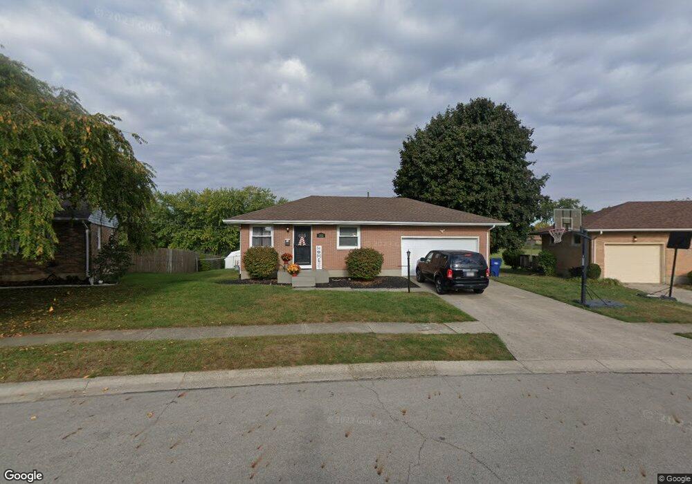
1112 Blithe Rd Springfield, OH 45503
Estimated Value: $201,392 - $237,000
3
Beds
2
Baths
1,125
Sq Ft
$194/Sq Ft
Est. Value
About This Home
This home is located at 1112 Blithe Rd, Springfield, OH 45503 and is currently estimated at $218,598, approximately $194 per square foot. 1112 Blithe Rd is a home located in Clark County with nearby schools including Northridge Elementary School, Kenton Ridge Middle & High School, and Emmanuel Christian Academy.
Ownership History
Date
Name
Owned For
Owner Type
Purchase Details
Closed on
Jun 7, 2013
Sold by
Worley Donna W
Bought by
Worley Michael T and Worley Krista J
Current Estimated Value
Home Financials for this Owner
Home Financials are based on the most recent Mortgage that was taken out on this home.
Original Mortgage
$86,020
Interest Rate
3.34%
Mortgage Type
New Conventional
Create a Home Valuation Report for This Property
The Home Valuation Report is an in-depth analysis detailing your home's value as well as a comparison with similar homes in the area
Home Values in the Area
Average Home Value in this Area
Purchase History
| Date | Buyer | Sale Price | Title Company |
|---|---|---|---|
| Worley Michael T | $84,300 | None Available |
Source: Public Records
Mortgage History
| Date | Status | Borrower | Loan Amount |
|---|---|---|---|
| Closed | Worley Michael T | $86,020 |
Source: Public Records
Tax History
| Year | Tax Paid | Tax Assessment Tax Assessment Total Assessment is a certain percentage of the fair market value that is determined by local assessors to be the total taxable value of land and additions on the property. | Land | Improvement |
|---|---|---|---|---|
| 2025 | $2,445 | $67,800 | $17,730 | $50,070 |
| 2024 | $2,365 | $55,840 | $10,310 | $45,530 |
| 2023 | $2,365 | $55,840 | $10,310 | $45,530 |
| 2022 | $2,374 | $55,840 | $10,310 | $45,530 |
| 2021 | $2,008 | $40,070 | $7,640 | $32,430 |
| 2020 | $2,010 | $40,070 | $7,640 | $32,430 |
| 2019 | $2,048 | $40,070 | $7,640 | $32,430 |
| 2018 | $1,930 | $36,230 | $9,750 | $26,480 |
| 2017 | $1,654 | $34,990 | $9,748 | $25,242 |
| 2016 | $1,642 | $34,990 | $9,748 | $25,242 |
| 2015 | $1,640 | $34,615 | $9,373 | $25,242 |
| 2014 | $1,639 | $34,615 | $9,373 | $25,242 |
| 2013 | $1,199 | $34,615 | $9,373 | $25,242 |
Source: Public Records
Map
Nearby Homes
- 4733 Curtis Dr
- 4741 Cullen Ave
- 4802 Willowbrook Dr
- 1341 Student Ave
- 4322 Midfield St Unit 15
- 4446 Ridgewood Rd E Unit 3
- 4256 Midfield St Unit 9
- 4577 Reno Ln Unit 2
- 4652 Reno Ln Unit 15
- 5033 Ridgewood Rd E
- 5235 W Ridgewood Rd
- 5300 Brookshire Ln
- 1521 Erika Dr
- 4732 Lehigh Dr
- 1644 Delmar Dr
- 3942 Harris Ln
- 1162 Kingsgate Rd
- 1201 Kingsgate Rd
- 4890 Brannan Dr W Unit 4890
- 5564 Ridgewood Rd W
- 1108 Blithe Rd
- 1116 Blithe Rd
- 1115 Blithe Rd
- 1120 Blithe Rd
- 1104 Blithe Rd
- 1060 Blaine Ave
- 1125 Blithe Rd
- 1120 Blaine Ave
- 1126 Blithe Rd
- 1126 Blaine Ave
- 1133 Blithe Rd
- 1134 Blithe Rd
- 1134 Blaine Ave
- 1109 Blaine Ave
- 1103 Blaine Ave
- 1115 Blaine Ave
- 1139 Blithe Rd
- 1061 Blaine Ave
- 1121 Blaine Ave
- 1140 Blithe Rd
Your Personal Tour Guide
Ask me questions while you tour the home.