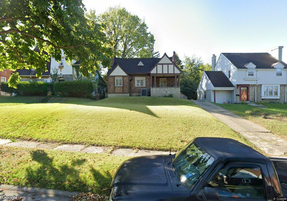
1113 Fenmore Dr Cincinnati, OH 45237
Bond Hill NeighborhoodEstimated Value: $232,833 - $290,000
5
Beds
2
Baths
1,884
Sq Ft
$136/Sq Ft
Est. Value
About This Home
This home is located at 1113 Fenmore Dr, Cincinnati, OH 45237 and is currently estimated at $255,958, approximately $135 per square foot. 1113 Fenmore Dr is a home located in Hamilton County with nearby schools including Bond Hill Academy Elementary School, Shroder High School, and Clark Montessori High School.
Ownership History
Date
Name
Owned For
Owner Type
Purchase Details
Closed on
Aug 31, 2005
Sold by
Fikes Dorothy E and Osborne Dorothy E
Bought by
Williams Jacqueline R
Current Estimated Value
Home Financials for this Owner
Home Financials are based on the most recent Mortgage that was taken out on this home.
Original Mortgage
$115,000
Outstanding Balance
$60,308
Interest Rate
5.93%
Mortgage Type
Fannie Mae Freddie Mac
Estimated Equity
$195,650
Purchase Details
Closed on
Dec 20, 1993
Sold by
Limom Inc
Bought by
Osborne Michael J
Create a Home Valuation Report for This Property
The Home Valuation Report is an in-depth analysis detailing your home's value as well as a comparison with similar homes in the area
Home Values in the Area
Average Home Value in this Area
Purchase History
| Date | Buyer | Sale Price | Title Company |
|---|---|---|---|
| Williams Jacqueline R | $90,000 | Custom Land Title Llc | |
| Osborne Michael J | $1,039 | -- |
Source: Public Records
Mortgage History
| Date | Status | Borrower | Loan Amount |
|---|---|---|---|
| Open | Williams Jacqueline R | $115,000 |
Source: Public Records
Tax History
| Year | Tax Paid | Tax Assessment Tax Assessment Total Assessment is a certain percentage of the fair market value that is determined by local assessors to be the total taxable value of land and additions on the property. | Land | Improvement |
|---|---|---|---|---|
| 2025 | $2,808 | $45,437 | $6,370 | $39,067 |
| 2024 | $2,848 | $45,437 | $6,370 | $39,067 |
| 2023 | $2,827 | $45,437 | $6,370 | $39,067 |
| 2022 | $1,660 | $23,597 | $5,453 | $18,144 |
| 2021 | $1,596 | $23,597 | $5,453 | $18,144 |
| 2020 | $1,642 | $23,597 | $5,453 | $18,144 |
| 2019 | $1,677 | $22,054 | $5,096 | $16,958 |
| 2018 | $1,679 | $22,054 | $5,096 | $16,958 |
| 2017 | $1,595 | $22,054 | $5,096 | $16,958 |
| 2016 | $1,790 | $24,500 | $5,460 | $19,040 |
| 2015 | $1,618 | $24,500 | $5,460 | $19,040 |
| 2014 | $1,626 | $24,500 | $5,460 | $19,040 |
| 2013 | $1,653 | $24,500 | $5,460 | $19,040 |
Source: Public Records
Map
Nearby Homes
- 1303 Regent Ave
- 1305 Regent Ave
- 1100 Carolina Ave
- 1144 Carolina Ave
- 1307 Regent Ave
- 1309 Regent Ave
- 1227 Carolina Ave
- 1214 Franklin Ave
- 1226 Franklin Ave
- 1301 Carolina Ave
- 0 Township Road 111
- 1435 Laidlaw Ave
- 1318 Franklin Ave
- 14 Township Ave
- 106 Township Ave
- 1409 Yarmouth Ave
- 1435 Yarmouth Ave
- 1 Spruce St
- 215 Walnut St
- 5914 Elmwood Ave
- 1109 Fenmore Dr
- 1117 Fenmore Dr
- 1121 Fenmore Dr
- 1105 Fenmore Dr
- 1128 Rossmore Ave
- 1124 Rossmore Ave
- 1132 Rossmore Ave
- 1101 Fenmore Dr
- 1125 Fenmore Dr
- 1120 Rossmore Ave
- 1136 Rossmore Ave
- 1112 Fenmore Dr
- 1116 Fenmore Dr
- 1108 Fenmore Dr
- 5042 Coad Dr
- 1120 Fenmore Dr
- 1129 Fenmore Dr
- 1140 Rossmore Ave
- 1104 Fenmore Dr
- 1124 Fenmore Dr
Your Personal Tour Guide
Ask me questions while you tour the home.