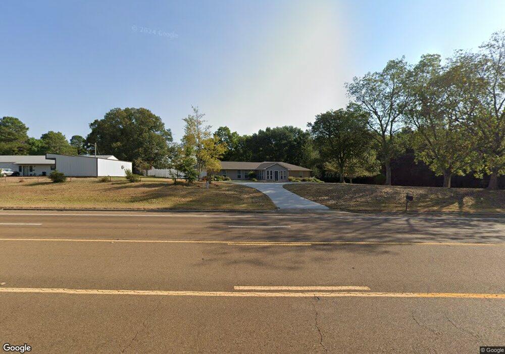
1113 Highway 98 E McComb, MS 39648
Estimated Value: $272,739 - $303,000
4
Beds
3
Baths
3,000
Sq Ft
$97/Sq Ft
Est. Value
About This Home
This home is located at 1113 Highway 98 E, McComb, MS 39648 and is currently estimated at $290,935, approximately $96 per square foot. 1113 Highway 98 E is a home with nearby schools including North Pike Elementary School, North Pike Middle School, and North Pike Senior High School.
Ownership History
Date
Name
Owned For
Owner Type
Purchase Details
Closed on
Sep 24, 2014
Sold by
Ballard Terry H and Ballard Constance J
Bought by
Givens Walter and Wilson William Kenneth
Current Estimated Value
Purchase Details
Closed on
Aug 20, 2010
Sold by
Boyd Terry and Keene Nelson
Bought by
Acts Ministries Of Mccomb Inc
Home Financials for this Owner
Home Financials are based on the most recent Mortgage that was taken out on this home.
Original Mortgage
$115,677
Interest Rate
4.61%
Mortgage Type
Future Advance Clause Open End Mortgage
Create a Home Valuation Report for This Property
The Home Valuation Report is an in-depth analysis detailing your home's value as well as a comparison with similar homes in the area
Purchase History
| Date | Buyer | Sale Price | Title Company |
|---|---|---|---|
| Givens Walter | -- | None Available | |
| Acts Ministries Of Mccomb Inc | -- | None Available |
Source: Public Records
Mortgage History
| Date | Status | Borrower | Loan Amount |
|---|---|---|---|
| Previous Owner | Acts Ministries Of Mccomb Inc | $115,677 |
Source: Public Records
Tax History
| Year | Tax Paid | Tax Assessment Tax Assessment Total Assessment is a certain percentage of the fair market value that is determined by local assessors to be the total taxable value of land and additions on the property. | Land | Improvement |
|---|---|---|---|---|
| 2025 | -- | $0 | $0 | $0 |
| 2024 | -- | $0 | $0 | $0 |
| 2023 | -- | $19,594 | $0 | $0 |
| 2022 | $0 | $19,349 | $0 | $0 |
| 2021 | $0 | $19,349 | $0 | $0 |
| 2020 | $0 | $20,947 | $0 | $0 |
| 2019 | $2,188 | $20,947 | $0 | $0 |
| 2018 | $0 | $19,982 | $0 | $0 |
| 2017 | $0 | $20,646 | $0 | $0 |
| 2016 | $0 | $20,646 | $0 | $0 |
| 2015 | -- | $20,147 | $0 | $0 |
| 2014 | -- | $11,240 | $0 | $0 |
| 2013 | -- | $11,240 | $0 | $0 |
Source: Public Records
Map
Nearby Homes
- 2159 Oakdale Rd
- 0 Old 24 Hwy
- 1047 Old Highway 24
- 0 Morgantown Rd Unit 4125975
- 0 Shady Lane Dr
- 1002 Pershing St
- No Integrity Rd
- 0 Integrity Rd
- 2067 McComb Hville Rd
- 1148 Morgantown Rd
- X Wild Estate
- 1047 Lenoir Sellers Rd
- 219 S Live Oak St
- 505 S Magnolia St
- 1019 Pearl River Avenue Extension
- XXX US Highway 98
- 318 S Cherry St
- 1031 Pearl River Ave
- 7153 US Highway 98
- 00 US Highway 98
- 1113 U S 98
- 1097 Highway 98 E
- 1097 U S 98
- 1101 U S 98
- 1097 Hwy 98 Ea St
- 1097 Highway 98 E
- 1103 U S 98
- 1105 U S 98
- 1097 E Ms Hwy 98
- 1096 Highway 98 E
- 1077 Highway 98 E
- 1021 Norwood Rd
- 1078 Highway 98 E
- 1137 Highway 98 E
- 1130 Highway 98 E
- 1075 Highway 98 E
- 1025 Fair Oaks Dr
- 1013 Fair Oaks Dr
- 1029 Fair Oaks Dr
- 1003 Fair Oaks Dr
Your Personal Tour Guide
Ask me questions while you tour the home.