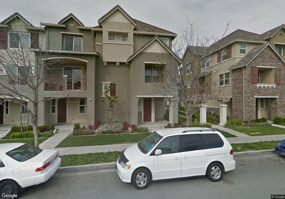
1113 Rock Ave Unit 26 San Jose, CA 95131
Estimated Value: $813,695 - $1,195,000
3
Beds
3
Baths
1,314
Sq Ft
$785/Sq Ft
Est. Value
About This Home
This home is located at 1113 Rock Ave Unit 26, San Jose, CA 95131 and is currently estimated at $1,031,424, approximately $784 per square foot. 1113 Rock Ave Unit 26 is a home located in Santa Clara County with nearby schools including Orchard Elementary School, Independence High School, and Stratford School - Milpitas.
Ownership History
Date
Name
Owned For
Owner Type
Purchase Details
Closed on
Dec 12, 2020
Sold by
Chan Brian C
Bought by
Chan Kwok Yin and Chan Irene C
Current Estimated Value
Purchase Details
Closed on
Aug 3, 2012
Sold by
Chan Brian C N and Chan Brian C
Bought by
Chan Brian C N
Home Financials for this Owner
Home Financials are based on the most recent Mortgage that was taken out on this home.
Original Mortgage
$200,000
Interest Rate
3.62%
Mortgage Type
New Conventional
Purchase Details
Closed on
Jun 14, 2011
Sold by
Taylor Morrison Of California Llc
Bought by
Chan Brian C
Home Financials for this Owner
Home Financials are based on the most recent Mortgage that was taken out on this home.
Original Mortgage
$199,278
Interest Rate
4.63%
Mortgage Type
New Conventional
Create a Home Valuation Report for This Property
The Home Valuation Report is an in-depth analysis detailing your home's value as well as a comparison with similar homes in the area
Home Values in the Area
Average Home Value in this Area
Purchase History
| Date | Buyer | Sale Price | Title Company |
|---|---|---|---|
| Chan Kwok Yin | $392,000 | None Available | |
| Chan Brian C N | -- | Old Republic Title Company | |
| Chan Brian C | $499,500 | First American Title Company |
Source: Public Records
Mortgage History
| Date | Status | Borrower | Loan Amount |
|---|---|---|---|
| Previous Owner | Chan Brian C N | $200,000 | |
| Previous Owner | Chan Brian C | $199,278 |
Source: Public Records
Tax History Compared to Growth
Tax History
| Year | Tax Paid | Tax Assessment Tax Assessment Total Assessment is a certain percentage of the fair market value that is determined by local assessors to be the total taxable value of land and additions on the property. | Land | Improvement |
|---|---|---|---|---|
| 2025 | $8,864 | $639,650 | $319,825 | $319,825 |
| 2024 | $8,864 | $627,108 | $313,554 | $313,554 |
| 2023 | $8,751 | $614,812 | $307,406 | $307,406 |
| 2022 | $8,695 | $602,758 | $301,379 | $301,379 |
| 2021 | $8,531 | $590,940 | $295,470 | $295,470 |
| 2020 | $8,286 | $584,882 | $292,441 | $292,441 |
| 2019 | $8,114 | $573,414 | $286,707 | $286,707 |
| 2018 | $8,016 | $562,172 | $281,086 | $281,086 |
| 2017 | $7,803 | $551,150 | $275,575 | $275,575 |
| 2016 | $7,382 | $540,344 | $270,172 | $270,172 |
| 2015 | $7,330 | $532,228 | $266,114 | $266,114 |
| 2014 | $6,720 | $521,804 | $260,902 | $260,902 |
Source: Public Records
Map
Nearby Homes
- 1070 Bramblewood Ln
- 2151 Oakland Rd Unit 523
- 2151 Oakland Rd Unit 308
- 2151 Oakland Rd Unit 231
- 2151 Oakland Rd Unit 14
- 2151 Oakland Rd Unit 443
- 2151 Oakland Rd Unit 559
- 2151 Oakland Rd Unit 210
- 2151 Oakland Rd Unit 297
- 2151 Oakland Rd Unit 189
- 1895 Sheri Ann Cir
- 1071 Mckay Dr
- 1156 Mckay Dr
- 1287 Marcello Dr
- 1437 Marcello Dr
- 1788 Camino Leonor
- 27 S Main St
- 1958 Trento Loop
- 1932 Trento Loop
- 1777 Hazelnut Ln
- 1109 Rock Ave Unit 27
- 1117 Rock Ave
- 1101 Rock Ave Unit 29
- 1121 Rock Ave
- 1097 Rock Ave
- 1119 Westbury Dr
- 1125 Rock Ave Unit 23
- 1111 Westbury Dr Unit 89
- 1107 Westbury Dr Unit 90
- 1115 Westbury Dr Unit 88
- 1103 Westbury Dr Unit 91
- 1093 Rock Ave Unit 31
- 1129 Rock Ave
- 1099 Westbury Dr Unit 92
- 1089 Rock Ave
- 1085 Rock Ave Unit 33
- 1085 Rock Ave
- 1133 Rock Ave
- 1095 Westbury Dr Unit 93
- 1091 Westbury Dr