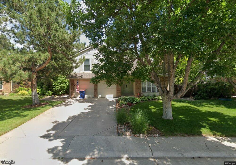
11131 Main Range Trail Littleton, CO 80127
Estimated Value: $746,540 - $854,000
3
Beds
5
Baths
2,416
Sq Ft
$339/Sq Ft
Est. Value
About This Home
This home is located at 11131 Main Range Trail, Littleton, CO 80127 and is currently estimated at $818,885, approximately $338 per square foot. 11131 Main Range Trail is a home located in Jefferson County with nearby schools including Shaffer Elementary School, Falcon Bluffs Middle School, and Chatfield High School.
Ownership History
Date
Name
Owned For
Owner Type
Purchase Details
Closed on
Feb 15, 2013
Sold by
Matycar Florence Laura
Bought by
Florence Michael
Current Estimated Value
Purchase Details
Closed on
Sep 12, 2007
Sold by
Gwartney Bucky L and Gwartney Elizabeth A
Bought by
Florence Michael Andrew and Florence Laura
Home Financials for this Owner
Home Financials are based on the most recent Mortgage that was taken out on this home.
Original Mortgage
$294,400
Outstanding Balance
$186,966
Interest Rate
6.63%
Mortgage Type
Purchase Money Mortgage
Estimated Equity
$631,919
Purchase Details
Closed on
Aug 13, 1999
Sold by
Robert Mango and Ann Shirley
Bought by
Gwartney Bucky L and Gwartney Elizabeth A
Home Financials for this Owner
Home Financials are based on the most recent Mortgage that was taken out on this home.
Original Mortgage
$203,000
Interest Rate
7.68%
Purchase Details
Closed on
May 30, 1996
Sold by
Sillin Robert C and Sillin Joanne G
Bought by
Mango Robert and Mango Shirley Ann
Home Financials for this Owner
Home Financials are based on the most recent Mortgage that was taken out on this home.
Original Mortgage
$156,000
Interest Rate
7.93%
Mortgage Type
Balloon
Create a Home Valuation Report for This Property
The Home Valuation Report is an in-depth analysis detailing your home's value as well as a comparison with similar homes in the area
Home Values in the Area
Average Home Value in this Area
Purchase History
| Date | Buyer | Sale Price | Title Company |
|---|---|---|---|
| Florence Michael | -- | None Available | |
| Florence Michael Andrew | $368,500 | Land Title Guarantee Company | |
| Gwartney Bucky L | $253,750 | -- | |
| Mango Robert | $195,000 | Land Title |
Source: Public Records
Mortgage History
| Date | Status | Borrower | Loan Amount |
|---|---|---|---|
| Open | Florence Michael Andrew | $294,400 | |
| Previous Owner | Gwartney Bucky L | $203,000 | |
| Previous Owner | Mango Robert | $156,000 | |
| Closed | Gwartney Bucky L | $25,375 |
Source: Public Records
Tax History Compared to Growth
Tax History
| Year | Tax Paid | Tax Assessment Tax Assessment Total Assessment is a certain percentage of the fair market value that is determined by local assessors to be the total taxable value of land and additions on the property. | Land | Improvement |
|---|---|---|---|---|
| 2024 | $4,575 | $42,737 | $13,309 | $29,428 |
| 2023 | $4,575 | $42,737 | $13,309 | $29,428 |
| 2022 | $3,958 | $36,153 | $10,584 | $25,569 |
| 2021 | $4,018 | $37,192 | $10,888 | $26,304 |
| 2020 | $3,634 | $33,741 | $9,878 | $23,863 |
| 2019 | $3,590 | $33,741 | $9,878 | $23,863 |
| 2018 | $3,270 | $29,677 | $9,440 | $20,237 |
| 2017 | $3,041 | $29,677 | $9,440 | $20,237 |
| 2016 | $3,112 | $28,739 | $9,834 | $18,905 |
| 2015 | $2,978 | $28,739 | $9,834 | $18,905 |
| 2014 | $2,978 | $25,921 | $9,078 | $16,843 |
Source: Public Records
Map
Nearby Homes
- 11235 San Joaquin Ridge
- 7646 S Bear Mountain
- 8140 S Storm King Peak
- 7825 Sand Mountain
- 7462 S Quail Cir Unit 426
- 7433 S Quail Cir Unit 1924
- 10645 W Sundance Mountain
- 8196 S Spring Creek Pass
- 11673 Elk Head Range Rd
- 7413 S Quail Cir Unit 1422
- 7413 S Quail Cir Unit 1435
- 11703 Elk Head Range Rd
- 11710 Elk Head Range Rd
- 10866 W Half Moon Pass
- 11872 Elk Head Range Rd
- 10685 W Apishapa Pass
- 10371 W Indore Dr
- 7369 S Gore Range Rd Unit 208
- 10606 Park Mountain W
- 10328 W Crestone Mountain
- 11161 Main Range Trail
- 11111 Main Range Trail
- 11071 Main Range Trail
- 11132 Main Range Trail
- 11162 Main Range Trail
- 11072 Main Range Trail
- 11182 Main Range Trail
- 7648 S Hahns Peak
- 7653 Sunshine Peak
- 11042 Main Range Trail
- 7643 Sunshine Peak
- 11221 Main Range Trail
- 7628 S Hahns Peak
- 7633 Sunshine Peak
- 7716 Gold Dust Peak
- 11022 Main Range Trail
- 11206 San Joaquin Ridge
- 7658 S Hahns Peak
- 11231 Main Range Trail
- 7623 Sunshine Peak