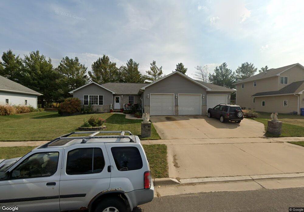
1116 Frank St Waverly, IA 50677
Estimated Value: $298,000 - $406,000
3
Beds
3
Baths
1,748
Sq Ft
$206/Sq Ft
Est. Value
About This Home
This home is located at 1116 Frank St, Waverly, IA 50677 and is currently estimated at $360,675, approximately $206 per square foot. 1116 Frank St is a home located in Bremer County with nearby schools including Waverly-Shell Rock Senior High School and St. Paul's Lutheran School.
Ownership History
Date
Name
Owned For
Owner Type
Purchase Details
Closed on
Jul 29, 2005
Sold by
Reno Holdings Inc
Bought by
Schunk David P and Schunk Holly S
Current Estimated Value
Home Financials for this Owner
Home Financials are based on the most recent Mortgage that was taken out on this home.
Original Mortgage
$196,050
Outstanding Balance
$102,988
Interest Rate
5.66%
Mortgage Type
New Conventional
Estimated Equity
$257,687
Purchase Details
Closed on
Mar 1, 2005
Sold by
J D Francis Inc
Bought by
Reno Holdings Inc
Create a Home Valuation Report for This Property
The Home Valuation Report is an in-depth analysis detailing your home's value as well as a comparison with similar homes in the area
Home Values in the Area
Average Home Value in this Area
Purchase History
| Date | Buyer | Sale Price | Title Company |
|---|---|---|---|
| Schunk David P | $206,500 | None Available | |
| Reno Holdings Inc | $75,000 | None Available |
Source: Public Records
Mortgage History
| Date | Status | Borrower | Loan Amount |
|---|---|---|---|
| Open | Schunk David P | $196,050 |
Source: Public Records
Tax History Compared to Growth
Tax History
| Year | Tax Paid | Tax Assessment Tax Assessment Total Assessment is a certain percentage of the fair market value that is determined by local assessors to be the total taxable value of land and additions on the property. | Land | Improvement |
|---|---|---|---|---|
| 2025 | $5,844 | $342,760 | $54,720 | $288,040 |
| 2024 | $5,844 | $337,090 | $54,720 | $282,370 |
| 2023 | $4,920 | $328,300 | $45,600 | $282,700 |
| 2022 | $4,748 | $262,060 | $36,480 | $225,580 |
| 2021 | $4,820 | $262,060 | $36,480 | $225,580 |
| 2020 | $4,820 | $248,860 | $36,480 | $212,380 |
| 2019 | $4,108 | $226,220 | $0 | $0 |
| 2018 | $4,022 | $226,220 | $0 | $0 |
| 2017 | $4,022 | $233,460 | $0 | $0 |
| 2016 | $4,484 | $233,460 | $0 | $0 |
| 2015 | $4,484 | $218,190 | $0 | $0 |
| 2014 | $4,276 | $218,190 | $0 | $0 |
Source: Public Records
Map
Nearby Homes
- 1608 Hillside Ave
- 607 10th Ave NW
- 1109 5th St NW
- 910 6th St NW
- 207 Deerfield Cir Unit Whitetail Bluff Lot
- 0000 17th St NW
- 1825 4th Ave NW
- 1111 Fawn Hollow Unit Whitetail Bluff Lot
- 1107 Fawn Hollow Unit Whitetail Bluff Lot
- 128 Red Fox Trail
- 102 9th Ave NW
- 415 5th St NW
- 217 21st St NW Unit 10
- 2300 3rd Ave NW
- 117 6th Ave NW
- 204 3rd Ave NW
- 109 16th St SW
- 109 Sunset St SW
- 212 2nd Ave NW
- 2419 Carstensen Dr
- 1202 Frank St
- 1112 Frank St
- 1203 Frank St
- 1213 Shepherd Ave
- 1001 12th St NW
- 1207 Dalton Dr
- 1216 Shepherd Ave
- 1217 Shepherd Ave
- 1210 Frank St
- 1003 12th St NW
- 1211 Dalton Dr
- 1005 12th St NW
- 1300 Shepherd Ave
- 1303 Shepherd Ave
- 1204 Dalton Dr
- 1208 Dalton Dr
- 1301 Dalton Dr
- 1212 Dalton Dr
- 1307 Shepherd Ave
- 1207 Park Ave