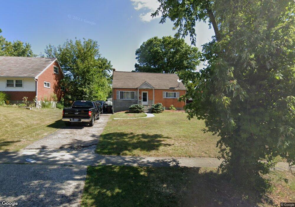
1116 Tassie Ln Cincinnati, OH 45231
Finneytown NeighborhoodEstimated Value: $220,045 - $242,000
4
Beds
2
Baths
1,439
Sq Ft
$160/Sq Ft
Est. Value
About This Home
This home is located at 1116 Tassie Ln, Cincinnati, OH 45231 and is currently estimated at $229,761, approximately $159 per square foot. 1116 Tassie Ln is a home located in Hamilton County with nearby schools including Mt Healthy High School, John Paul II Catholic School, and Central Baptist Academy.
Ownership History
Date
Name
Owned For
Owner Type
Purchase Details
Closed on
Apr 29, 2003
Sold by
Goldick Eric D and Goldick Jennifer
Bought by
Dwyer Leonard and Dwyer Arneadra
Current Estimated Value
Home Financials for this Owner
Home Financials are based on the most recent Mortgage that was taken out on this home.
Original Mortgage
$111,300
Interest Rate
6.89%
Mortgage Type
Unknown
Purchase Details
Closed on
Sep 19, 1995
Sold by
Wysong Ruth Elizabeth
Bought by
Peterson Jeffrey J and Peterson Sandra E
Home Financials for this Owner
Home Financials are based on the most recent Mortgage that was taken out on this home.
Original Mortgage
$77,096
Interest Rate
7.78%
Create a Home Valuation Report for This Property
The Home Valuation Report is an in-depth analysis detailing your home's value as well as a comparison with similar homes in the area
Home Values in the Area
Average Home Value in this Area
Purchase History
| Date | Buyer | Sale Price | Title Company |
|---|---|---|---|
| Dwyer Leonard | $117,300 | -- | |
| Peterson Jeffrey J | -- | -- |
Source: Public Records
Mortgage History
| Date | Status | Borrower | Loan Amount |
|---|---|---|---|
| Previous Owner | Dwyer Leonard | $111,300 | |
| Previous Owner | Peterson Jeffrey J | $77,096 |
Source: Public Records
Tax History Compared to Growth
Tax History
| Year | Tax Paid | Tax Assessment Tax Assessment Total Assessment is a certain percentage of the fair market value that is determined by local assessors to be the total taxable value of land and additions on the property. | Land | Improvement |
|---|---|---|---|---|
| 2024 | $3,165 | $54,646 | $6,307 | $48,339 |
| 2023 | $3,003 | $54,646 | $6,307 | $48,339 |
| 2022 | $2,976 | $39,001 | $5,299 | $33,702 |
| 2021 | $2,901 | $39,001 | $5,299 | $33,702 |
| 2020 | $2,939 | $39,001 | $5,299 | $33,702 |
| 2019 | $2,666 | $33,051 | $4,491 | $28,560 |
| 2018 | $2,681 | $33,051 | $4,491 | $28,560 |
| 2017 | $2,548 | $33,051 | $4,491 | $28,560 |
| 2016 | $2,696 | $34,479 | $4,795 | $29,684 |
| 2015 | $2,714 | $34,479 | $4,795 | $29,684 |
| 2014 | $2,701 | $34,479 | $4,795 | $29,684 |
| 2013 | $2,644 | $34,479 | $4,795 | $29,684 |
Source: Public Records
Map
Nearby Homes
- 1101 Meadowind Ct
- 1100 Gracewind Ct
- 8693 Mockingbird Ln
- 1125 Murkett Ct
- 1116 Madeleine Cir
- 8663 Mockingbird Ln
- 1052 Vacationland Dr
- 8925 Monsanto Dr
- 8622 Mockingbird Ln
- 8627 Mockingbird Ln
- 8950 Daly Rd
- 1190 Sugartree Ct
- 1013 Vacationland Dr
- 8831 Daly Rd
- 8965 Fontainebleau Terrace
- 8584 Mockingbird Ln
- 8772 Balboa Dr
- 954 Hollytree Dr
- 8543 Foxcroft Dr
- 8840 Grenada Dr
- 1120 Tassie Ln
- 1110 Tassie Ln
- 1069 Meadowind Ct
- 1126 Tassie Ln
- 1106 Tassie Ln
- 1065 Meadowind Ct
- 1073 Meadowind Ct
- 1115 Tassie Ln
- 1130 Tassie Ln
- 1119 Tassie Ln
- 1100 Tassie Ln
- 1109 Tassie Ln
- 1125 Tassie Ln
- 1136 Tassie Ln
- 1062 Meadowind Ct
- 1129 Tassie Ln
- 1081 Meadowind Ct
- 1105 Tassie Ln
- 1135 Tassie Ln
- 1140 Tassie Ln