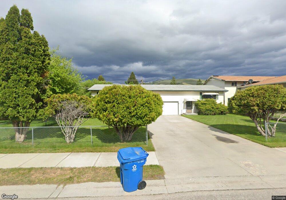
11170 Napton Way Lolo, MT 59847
Lolo NeighborhoodEstimated Value: $475,126 - $694,000
8
Beds
4
Baths
2,256
Sq Ft
$252/Sq Ft
Est. Value
About This Home
This home is located at 11170 Napton Way, Lolo, MT 59847 and is currently estimated at $569,042, approximately $252 per square foot. 11170 Napton Way is a home located in Missoula County with nearby schools including Lolo Elementary School, Lolo Middle School, and Sentinel High School.
Ownership History
Date
Name
Owned For
Owner Type
Purchase Details
Closed on
Jul 6, 2004
Sold by
Violet Evelyn Ferris Revocable Living Tr
Bought by
Cyr Craig Alan and Cyr Cary L
Current Estimated Value
Home Financials for this Owner
Home Financials are based on the most recent Mortgage that was taken out on this home.
Original Mortgage
$128,000
Outstanding Balance
$33,892
Interest Rate
6.27%
Mortgage Type
Seller Take Back
Estimated Equity
$535,150
Create a Home Valuation Report for This Property
The Home Valuation Report is an in-depth analysis detailing your home's value as well as a comparison with similar homes in the area
Home Values in the Area
Average Home Value in this Area
Purchase History
| Date | Buyer | Sale Price | Title Company |
|---|---|---|---|
| Cyr Craig Alan | -- | -- |
Source: Public Records
Mortgage History
| Date | Status | Borrower | Loan Amount |
|---|---|---|---|
| Open | Cyr Craig Alan | $128,000 |
Source: Public Records
Tax History
| Year | Tax Paid | Tax Assessment Tax Assessment Total Assessment is a certain percentage of the fair market value that is determined by local assessors to be the total taxable value of land and additions on the property. | Land | Improvement |
|---|---|---|---|---|
| 2025 | $4,598 | $499,800 | $440,501 | $59,299 |
| 2024 | $3,932 | $339,800 | $262,197 | $77,603 |
| 2023 | $3,976 | $339,800 | $262,197 | $77,603 |
| 2022 | $3,906 | $278,800 | $0 | $0 |
| 2021 | $2,942 | $278,800 | $0 | $0 |
| 2020 | $2,945 | $211,600 | $0 | $0 |
| 2019 | $2,929 | $211,600 | $0 | $0 |
| 2018 | $2,580 | $182,400 | $0 | $0 |
| 2017 | $2,595 | $182,400 | $0 | $0 |
| 2016 | $2,543 | $190,258 | $0 | $0 |
| 2015 | $2,424 | $190,258 | $0 | $0 |
| 2014 | $2,320 | $100,935 | $0 | $0 |
Source: Public Records
Map
Nearby Homes
- 11305 Napton Way
- 117 Tyler Way
- 5608 Golf Dr
- 6202 Brewery Way
- 5702 Lonesome Dove Ln
- 5692 Lonesome Dove Ln
- 5306 Avalon Ln
- 11385 Trillium Ln
- 5125 Avalon Ln
- 10840 Red Fox Ct
- NHN Hughes Ct
- 10613 Coulter Pine St
- 261 Capdevilla
- 10487 Coulter Pine St
- 6896 Jack Pine Ct
- 10291 Coulter Pine St
- 0 U S 93 Unit Lot 4 30025598
- 0 U S 93 Unit Lot 1 30025579
- 0 U S 93 Unit Lot 2 30025586
- 0 U S 93 Unit Lot 6 30025600
- 11190 Napton Way
- 11165B Napton Way
- 11230 Napton Way
- 11185 Napton Way
- 11185 Napton Way
- 11185 Napton Way Unit B
- 11165 Napton Way Unit A
- 11165 Napton Way
- 11165 Napton Way
- 11165 Napton Way Unit A
- 11165 Napton Way Unit a
- 11225 Napton Way
- 11250 Napton Way
- 529 Dorie Dr
- 531 Dorie Dr
- 11245 Napton Way
- 525 Dorie Dr
- 521 Dorie Dr
- 125 Glacier Dr
- 11265 Napton Way
Your Personal Tour Guide
Ask me questions while you tour the home.