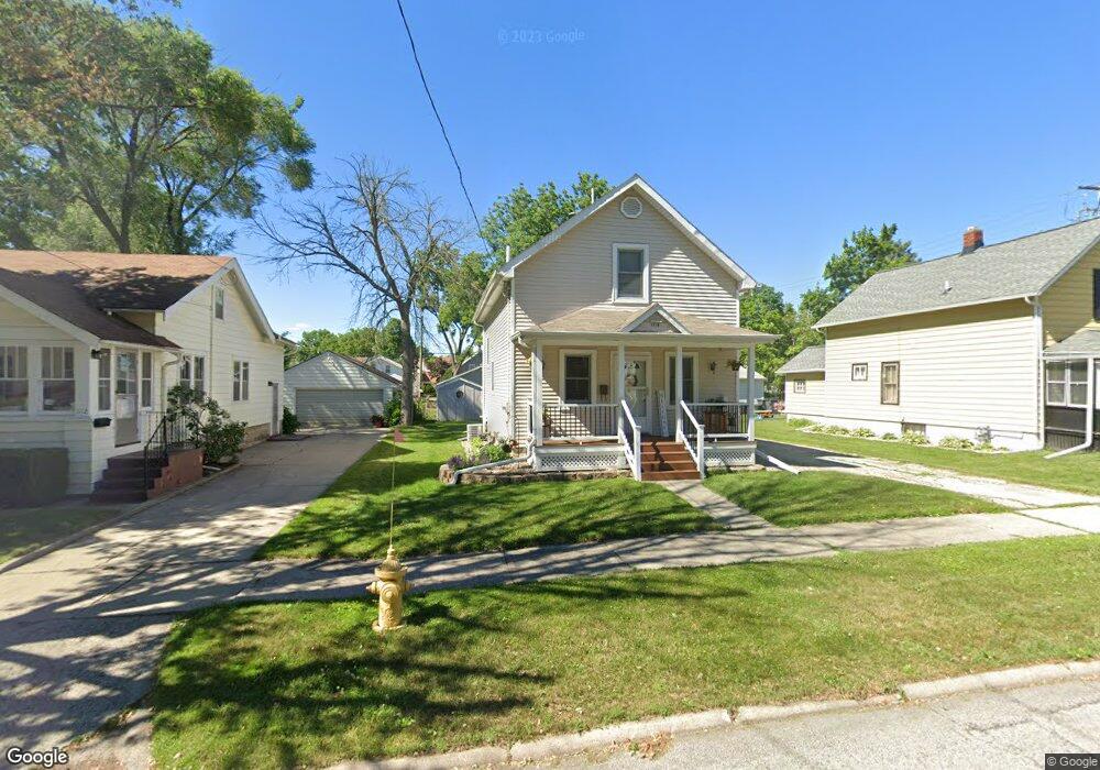
1118 Ellis St Waukesha, WI 53186
Estimated Value: $285,340 - $325,000
3
Beds
2
Baths
1,194
Sq Ft
$258/Sq Ft
Est. Value
About This Home
This home is located at 1118 Ellis St, Waukesha, WI 53186 and is currently estimated at $308,585, approximately $258 per square foot. 1118 Ellis St is a home located in Waukesha County with nearby schools including Hadfield Elementary School, Horning Middle School, and South High School.
Ownership History
Date
Name
Owned For
Owner Type
Purchase Details
Closed on
May 3, 2010
Sold by
Bregant Daniel
Bought by
Graff Brett R
Current Estimated Value
Home Financials for this Owner
Home Financials are based on the most recent Mortgage that was taken out on this home.
Original Mortgage
$147,200
Outstanding Balance
$99,000
Interest Rate
5.12%
Mortgage Type
FHA
Estimated Equity
$209,585
Purchase Details
Closed on
Feb 9, 2010
Sold by
Salb Robert E and Salb Lisa J
Bought by
Bregant Daniel
Create a Home Valuation Report for This Property
The Home Valuation Report is an in-depth analysis detailing your home's value as well as a comparison with similar homes in the area
Home Values in the Area
Average Home Value in this Area
Purchase History
| Date | Buyer | Sale Price | Title Company |
|---|---|---|---|
| Graff Brett R | $153,500 | None Available | |
| Bregant Daniel | $86,926 | None Available |
Source: Public Records
Mortgage History
| Date | Status | Borrower | Loan Amount |
|---|---|---|---|
| Open | Graff Brett R | $147,200 |
Source: Public Records
Tax History Compared to Growth
Tax History
| Year | Tax Paid | Tax Assessment Tax Assessment Total Assessment is a certain percentage of the fair market value that is determined by local assessors to be the total taxable value of land and additions on the property. | Land | Improvement |
|---|---|---|---|---|
| 2024 | $3,187 | $219,500 | $49,500 | $170,000 |
| 2023 | $3,084 | $219,500 | $49,500 | $170,000 |
| 2022 | $2,871 | $153,900 | $52,500 | $101,400 |
| 2021 | $2,927 | $153,900 | $52,500 | $101,400 |
| 2020 | $2,846 | $153,900 | $52,500 | $101,400 |
| 2019 | $2,747 | $153,900 | $52,500 | $101,400 |
| 2018 | $2,576 | $141,200 | $47,500 | $93,700 |
| 2017 | $2,581 | $141,200 | $47,500 | $93,700 |
| 2016 | $2,521 | $129,800 | $45,000 | $84,800 |
| 2015 | $2,510 | $129,800 | $45,000 | $84,800 |
| 2014 | $2,592 | $128,500 | $45,000 | $83,500 |
| 2013 | $2,592 | $128,500 | $45,000 | $83,500 |
Source: Public Records
Map
Nearby Homes
- 403 Midland Ave
- 1343 Hillside Dr
- S21W23079 Hillside Dr
- 125 Tenny Ave
- 1103 Arcadian Ave
- 1021 Arcadian Ave
- W230S2425 Morningside Dr
- 930 Harding Ave
- 953 Genesee St
- 1422 E Racine Ave
- 1037 Windsor Dr
- 1219 National Ave
- 1021 Aurora St
- 512 E Main St
- 131 Wisconsin Ave
- 1535 E Racine Ave
- 400 Sheffield Rd Unit 5
- S17W22650 Lincoln Ave
- 137 Wisconsin Ave
- 100 E Main St Unit 403
- 420 Frederick St Unit 420
- 401 Frederick St
- 1122 Ellis St
- 1119 Pearl St
- 1112 Ellis St
- 1117 Ellis St
- 1204 Ellis St
- 1110 Ellis St
- 1113 Ellis St
- 1115 Pearl St
- 1121 Ellis St
- 1205 Ellis St
- 1109 Ellis St
- 1104 Ellis St
- 1109 Pearl St Unit 1111
- 1104 Pearl St
- 1108 Pearl St
- 1111 Pearl St
- 1101 Pearl St
- 1022 Ellis St