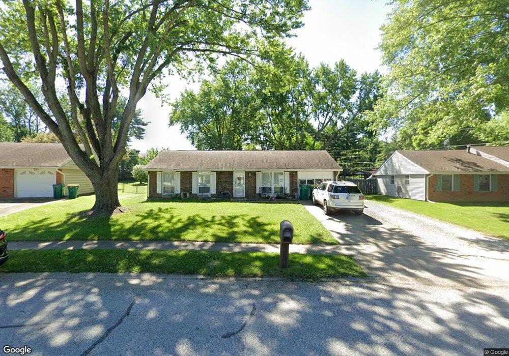
1119 Brookside Ln Plainfield, IN 46168
Estimated Value: $225,243 - $235,000
3
Beds
1
Bath
1,202
Sq Ft
$193/Sq Ft
Est. Value
About This Home
This home is located at 1119 Brookside Ln, Plainfield, IN 46168 and is currently estimated at $231,561, approximately $192 per square foot. 1119 Brookside Ln is a home located in Hendricks County with nearby schools including Van Buren Elementary School, Plainfield Community Middle School, and Plainfield High School.
Ownership History
Date
Name
Owned For
Owner Type
Purchase Details
Closed on
Oct 17, 2003
Sold by
Lewis Jimmy J and Lewis Peggie A
Bought by
Massie Jimmie L and Massie Kimberly S
Current Estimated Value
Home Financials for this Owner
Home Financials are based on the most recent Mortgage that was taken out on this home.
Original Mortgage
$85,700
Outstanding Balance
$44,433
Interest Rate
8.5%
Mortgage Type
Purchase Money Mortgage
Estimated Equity
$187,128
Create a Home Valuation Report for This Property
The Home Valuation Report is an in-depth analysis detailing your home's value as well as a comparison with similar homes in the area
Home Values in the Area
Average Home Value in this Area
Purchase History
| Date | Buyer | Sale Price | Title Company |
|---|---|---|---|
| Massie Jimmie L | -- | -- |
Source: Public Records
Mortgage History
| Date | Status | Borrower | Loan Amount |
|---|---|---|---|
| Open | Massie Jimmie L | $85,700 |
Source: Public Records
Tax History
| Year | Tax Paid | Tax Assessment Tax Assessment Total Assessment is a certain percentage of the fair market value that is determined by local assessors to be the total taxable value of land and additions on the property. | Land | Improvement |
|---|---|---|---|---|
| 2025 | $1,432 | $168,400 | $36,800 | $131,600 |
| 2024 | $1,432 | $174,700 | $28,600 | $146,100 |
| 2023 | $1,328 | $166,500 | $27,300 | $139,200 |
| 2022 | $1,351 | $158,800 | $26,000 | $132,800 |
| 2021 | $1,220 | $146,000 | $26,000 | $120,000 |
| 2020 | $1,231 | $146,600 | $26,000 | $120,600 |
| 2019 | $1,115 | $133,900 | $23,700 | $110,200 |
| 2018 | $1,096 | $129,800 | $23,700 | $106,100 |
| 2017 | $905 | $111,700 | $22,000 | $89,700 |
| 2016 | $933 | $114,000 | $22,000 | $92,000 |
| 2014 | $903 | $109,700 | $23,000 | $86,700 |
Source: Public Records
Map
Nearby Homes
- 1107 Ridgewood Dr
- 800 Walton Dr
- 2668 Marjorie Ln
- 1018 Pamela Dr
- 537 Wayside Ct
- 1713 Sycamore Dr
- 1849 Crystal Bay East Dr
- 5565 Crystal Bay West Dr
- 942 Highlander Dr
- 5968 Mia Ct
- 1771 Quaker Blvd
- 5906 Juna Ave
- 5922 Juna Ave
- 5907 Farwell Ave
- 5926 Juna Ave
- 5914 Juna Ave
- 430 Lawndale Dr
- 5986 Mia Ct
- 5834 Cross Bridge Cir
- 5826 Oberlies Way
- 1121 Brookside Ln
- 1117 Brookside Ln
- 1428 Stanley Rd
- 1424 Stanley Rd
- 1115 Brookside Ln
- 1420 Stanley Rd
- 1436 Stanley Rd
- 1112 Charles Ct
- 1116 Brookside Ln
- 1113 Brookside Ln
- 1118 Brookside Ln
- 1120 Brookside Ln
- 1111 Brookside Ln
- 1114 Brookside Ln
- 1109 Brookside Ln
- 1425 Rose Ct
- 1324 Stanley Rd
- 1107 Brookside Ln
- 1111 Charles Ct
- 1115 Pierce Dr
Your Personal Tour Guide
Ask me questions while you tour the home.