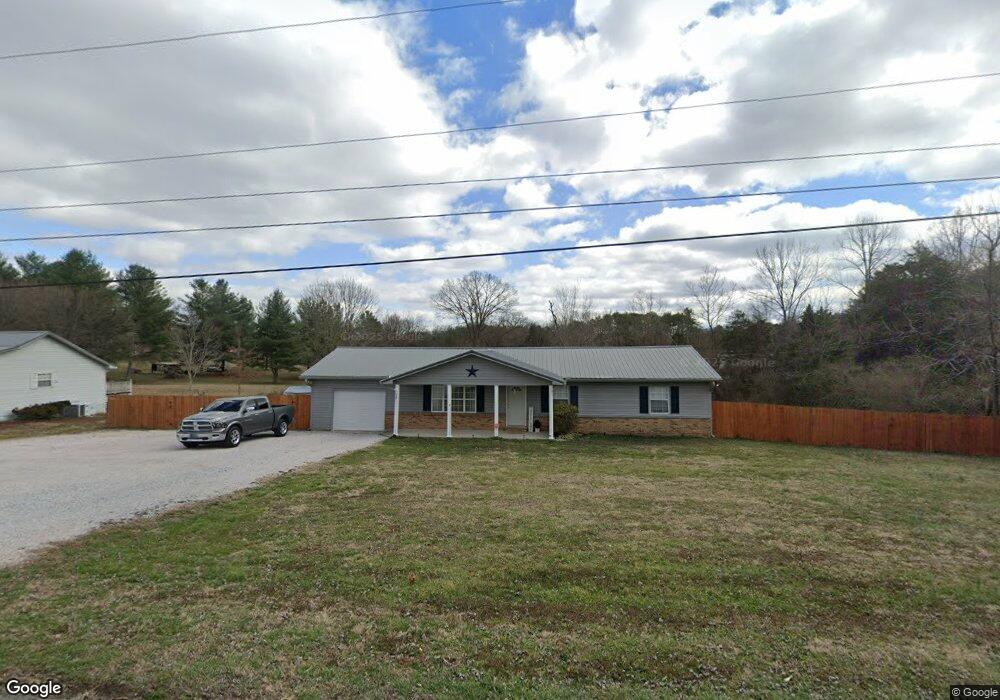
112 Clear Branch Rd Corryton, TN 37721
Plainview NeighborhoodEstimated Value: $276,725 - $343,000
Studio
2
Baths
1,512
Sq Ft
$208/Sq Ft
Est. Value
About This Home
This home is located at 112 Clear Branch Rd, Corryton, TN 37721 and is currently estimated at $313,931, approximately $207 per square foot. 112 Clear Branch Rd is a home located in Union County with nearby schools including Luttrell Elementary School, Union County High School, and H Maynard Middle School.
Ownership History
Date
Name
Owned For
Owner Type
Purchase Details
Closed on
Jan 20, 2023
Sold by
Dyer Michael Roe
Bought by
Zimmer Kristen and Zimmer Joseph
Current Estimated Value
Home Financials for this Owner
Home Financials are based on the most recent Mortgage that was taken out on this home.
Original Mortgage
$236,823
Outstanding Balance
$228,577
Interest Rate
6.31%
Mortgage Type
FHA
Estimated Equity
$85,354
Purchase Details
Closed on
Jun 22, 2006
Bought by
Dyer Michael Roe
Purchase Details
Closed on
Sep 27, 2005
Sold by
Wells Fargo Bank Minnesota
Bought by
Farmer Jackson Faira
Home Financials for this Owner
Home Financials are based on the most recent Mortgage that was taken out on this home.
Original Mortgage
$87,700
Interest Rate
5.72%
Mortgage Type
Cash
Purchase Details
Closed on
Nov 21, 1994
Purchase Details
Closed on
Sep 30, 1988
Bought by
Major David E
Purchase Details
Closed on
Dec 9, 1986
Bought by
Berkley Michael and Spires Judy
Create a Home Valuation Report for This Property
The Home Valuation Report is an in-depth analysis detailing your home's value as well as a comparison with similar homes in the area
Home Values in the Area
Average Home Value in this Area
Purchase History
| Date | Buyer | Sale Price | Title Company |
|---|---|---|---|
| Zimmer Kristen | $245,000 | -- | |
| Zimmer Kristen | $245,000 | None Listed On Document | |
| Dyer Michael Roe | $128,000 | -- | |
| Dyer Michael Roe | $128,000 | -- | |
| Farmer Jackson Faira | $66,000 | -- | |
| Farmer Jackson Faira | $66,000 | -- | |
| -- | $47,000 | -- | |
| -- | $47,000 | -- | |
| Major David E | $53,600 | -- | |
| Major David E | $53,600 | -- | |
| Berkley Michael | -- | -- | |
| Berkley Michael | -- | -- |
Source: Public Records
Mortgage History
| Date | Status | Borrower | Loan Amount |
|---|---|---|---|
| Open | Zimmer Kristen | $236,823 | |
| Closed | Zimmer Kristen | $236,823 | |
| Previous Owner | Berkley Michael | $87,700 |
Source: Public Records
Tax History
| Year | Tax Paid | Tax Assessment Tax Assessment Total Assessment is a certain percentage of the fair market value that is determined by local assessors to be the total taxable value of land and additions on the property. | Land | Improvement |
|---|---|---|---|---|
| 2025 | $771 | $40,600 | $6,800 | $33,800 |
| 2024 | $771 | $40,600 | $6,800 | $33,800 |
| 2023 | $771 | $40,600 | $6,800 | $33,800 |
| 2022 | $646 | $40,600 | $6,800 | $33,800 |
| 2021 | $599 | $27,975 | $6,525 | $21,450 |
| 2020 | $599 | $27,975 | $6,525 | $21,450 |
| 2019 | $599 | $27,975 | $6,525 | $21,450 |
| 2018 | $599 | $27,975 | $6,525 | $21,450 |
| 2017 | $599 | $27,975 | $6,525 | $21,450 |
| 2016 | $539 | $24,850 | $6,600 | $18,250 |
| 2015 | $539 | $24,850 | $6,600 | $18,250 |
| 2014 | $445 | $24,835 | $0 | $0 |
Source: Public Records
Map
Nearby Homes
- 295 Clear Branch Rd
- 265 Pecan Cir
- 157 Acorn Dr
- 408 E Mountain View Rd
- 129 Clinch View Dr
- 411 Meadowbreeze Rd
- 328 2nd St
- 540 Monday Rd
- 130 Gentry Ln
- 417 Wolfe Rd
- 233 Tennessee 370
- 0 Tazewell Pike Unit 1312170
- 204 Archer Rd
- 9326 Davis Dr
- 7527 Game Bird St
- 8408 Graceland Rd
- 409 Bull Run Rd
- 8416 Graceland Rd
- 110 Wenger Park Ln
- 8.30 acres Wolfenbarger Ln
- 116 Clear Branch Rd
- 111 Clear Branch Rd
- 203 Monday Rd
- 119 Clear Branch Rd
- 227 Monday Rd
- 126 Monday Rd
- 106 Barber Rd
- 110 Barber Rd
- 135 Clear Branch Rd
- 120 Monday Rd
- 150 Barber Rd
- 311 Monday Rd
- 315 Monday Rd
- 174 Barber Rd
- 220 Barber Rd
- 123 Stowers Dr
- 1301 Tazewell Pike
- Lot 11 Stowers Dr
- 220 Monday Rd
- 121 Stowers Dr
Your Personal Tour Guide
Ask me questions while you tour the home.