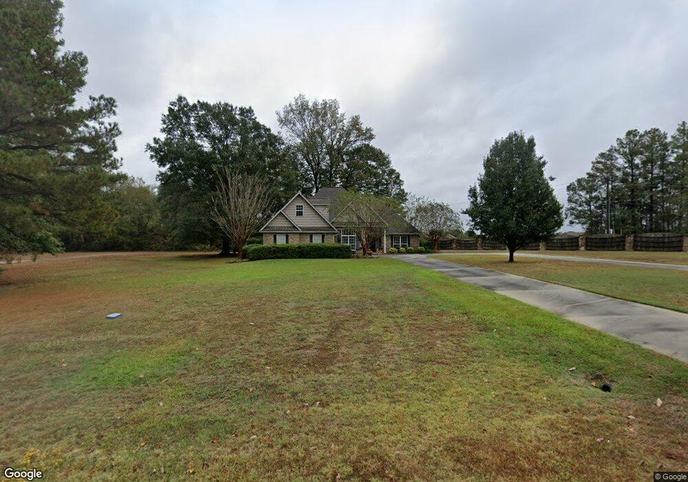
112 Creeks Edge Cir Ruston, LA 71270
Estimated Value: $374,000 - $469,000
--
Bed
1
Bath
2,172
Sq Ft
$188/Sq Ft
Est. Value
About This Home
This home is located at 112 Creeks Edge Cir, Ruston, LA 71270 and is currently estimated at $407,880, approximately $187 per square foot. 112 Creeks Edge Cir is a home located in Lincoln Parish with nearby schools including Choudrant Elementary School, Ruston Junior High School, and Choudrant High School.
Ownership History
Date
Name
Owned For
Owner Type
Purchase Details
Closed on
Dec 27, 2013
Sold by
Meadors Hunter Wayne B and Meadors Hunter Diane
Bought by
Boyette Laird Billy E and Boyette Laird Brenda
Current Estimated Value
Home Financials for this Owner
Home Financials are based on the most recent Mortgage that was taken out on this home.
Original Mortgage
$191,917
Outstanding Balance
$144,161
Interest Rate
4.26%
Mortgage Type
Future Advance Clause Open End Mortgage
Estimated Equity
$263,719
Create a Home Valuation Report for This Property
The Home Valuation Report is an in-depth analysis detailing your home's value as well as a comparison with similar homes in the area
Home Values in the Area
Average Home Value in this Area
Purchase History
| Date | Buyer | Sale Price | Title Company |
|---|---|---|---|
| Boyette Laird Billy E | $189,000 | None Available |
Source: Public Records
Mortgage History
| Date | Status | Borrower | Loan Amount |
|---|---|---|---|
| Open | Boyette Laird Billy E | $191,917 |
Source: Public Records
Tax History Compared to Growth
Tax History
| Year | Tax Paid | Tax Assessment Tax Assessment Total Assessment is a certain percentage of the fair market value that is determined by local assessors to be the total taxable value of land and additions on the property. | Land | Improvement |
|---|---|---|---|---|
| 2024 | $2,549 | $32,064 | $5,938 | $26,126 |
| 2023 | $2,342 | $28,242 | $3,700 | $24,542 |
| 2022 | $2,327 | $28,242 | $3,700 | $24,542 |
| 2021 | $2,289 | $28,241 | $3,700 | $24,541 |
| 2020 | $2,294 | $28,241 | $3,700 | $24,541 |
| 2019 | $2,443 | $29,702 | $3,700 | $26,002 |
| 2018 | $2,445 | $29,702 | $3,700 | $26,002 |
| 2017 | $2,451 | $29,702 | $3,700 | $26,002 |
| 2016 | $2,501 | $0 | $0 | $0 |
| 2015 | $2,228 | $24,389 | $3,640 | $20,749 |
| 2013 | $2,261 | $24,389 | $3,640 | $20,749 |
Source: Public Records
Map
Nearby Homes
- 111 Evergreen Dr
- 186 Deer Creek Rd
- 3252 Highway 821
- 145 Woodshire Ln
- 209 Mount Harmony Church Rd
- 193 Mount Harmony Church Rd
- 128 Marlou Cir
- 611 Stable Rd
- 137 Mount Harmony Church Rd
- Lot 1B Unit 1 Harmony Church Rd
- 197 Baxter Rd
- 136 Shade Tree Trace
- 0 Goodgoin Rd
- 641 Goodgoin Rd
- 294 Moody Rd
- 2116 Cook Rd
- 145 Timber Ridge Cir
- 2420 Highway 33
- 3114 Canal St
- 0 Spillers Rd
- 134 Creeks Edge Cir
- 111 Creeks Edge Cir
- 9 Belle Pointe Dr
- 24 Belle Pointe Dr
- 123 Creeks Edge Cir
- 116 Belle Pointe Dr
- 2860 Highway 821
- 139 Creek's Edge Cir
- 150 Creeks Edge Cir
- 2945 Highway 821
- 2867 Highway 821
- 2867 Highway 821
- 2867 Highway 821
- 151 Creeks Edge Cir
- 164 Creeks Edge Cir
- 137 Belle Pointe Dr
- 2857 Highway 821
- 160 Guy Rd
- 136 Belle Pointe Dr
- 187 Creeks Edge Cir