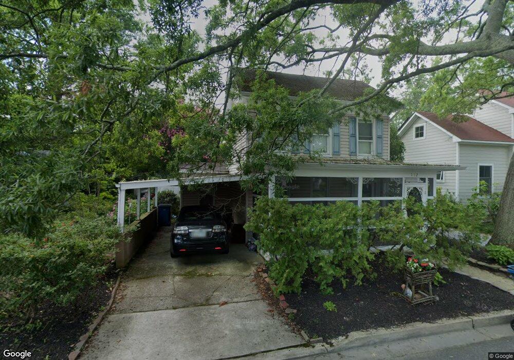
112 E Chew Ave Saint Michaels, MD 21663
Estimated Value: $579,266 - $697,000
--
Bed
2
Baths
1,515
Sq Ft
$418/Sq Ft
Est. Value
About This Home
This home is located at 112 E Chew Ave, Saint Michaels, MD 21663 and is currently estimated at $632,817, approximately $417 per square foot. 112 E Chew Ave is a home located in Talbot County with nearby schools including St. Michaels Elementary School, St. Michaels Middle/High School, and Easton High School.
Ownership History
Date
Name
Owned For
Owner Type
Purchase Details
Closed on
Jun 2, 2011
Sold by
Smith Cheryl and Caras Susan
Bought by
Reiswerg Cheryl Susan
Current Estimated Value
Purchase Details
Closed on
Jun 1, 2011
Sold by
Reiswerg Cheryl Susan and Smith Cheryl Susan Caras
Bought by
Reiswerg Cheryl Susan
Purchase Details
Closed on
Nov 20, 1991
Sold by
Read Betty S
Bought by
Smith Sterling T W
Create a Home Valuation Report for This Property
The Home Valuation Report is an in-depth analysis detailing your home's value as well as a comparison with similar homes in the area
Home Values in the Area
Average Home Value in this Area
Purchase History
| Date | Buyer | Sale Price | Title Company |
|---|---|---|---|
| Reiswerg Cheryl Susan | -- | -- | |
| Reiswerg Cheryl Susan | -- | Upper Shore Title Inc | |
| Reiswerg Cheryl Susan | -- | -- | |
| Smith Sterling T W | $120,000 | -- |
Source: Public Records
Tax History Compared to Growth
Tax History
| Year | Tax Paid | Tax Assessment Tax Assessment Total Assessment is a certain percentage of the fair market value that is determined by local assessors to be the total taxable value of land and additions on the property. | Land | Improvement |
|---|---|---|---|---|
| 2025 | $1,846 | $432,000 | $264,800 | $167,200 |
| 2024 | $1,846 | $421,000 | $0 | $0 |
| 2023 | $1,789 | $410,000 | $0 | $0 |
| 2022 | $1,713 | $399,000 | $264,800 | $134,200 |
| 2021 | $1,690 | $394,467 | $0 | $0 |
| 2020 | $1,690 | $389,933 | $0 | $0 |
| 2019 | $1,685 | $385,400 | $244,000 | $141,400 |
| 2018 | $1,635 | $362,933 | $0 | $0 |
| 2017 | $1,566 | $340,467 | $0 | $0 |
| 2016 | $1,397 | $318,000 | $0 | $0 |
| 2015 | $1,547 | $318,000 | $0 | $0 |
| 2014 | $1,547 | $318,000 | $0 | $0 |
Source: Public Records
Map
Nearby Homes
- 107 E Chestnut St
- 222 E Chestnut St
- 704 Meadow St
- 105 Seymour Ave
- Lot 16A Meadow St
- 100 Grace St
- 106 Grace St
- 807 Radcliff Ave
- 0 Grace St Unit MDTA2012346
- 25500 Chance Farm Rd
- 207 Dodson Ave
- 408 Spinnaker Ln
- 912 Calvert Ave
- 300 Perry St
- 216 Brooks Ln
- 228 Tyler Ave
- 24390 Oakwood Park Rd
- 24912 Back Creek Dr
- 24318 Oakwood Park Rd
- 108 Miles
- 110 E Chew Ave
- 114 E Chew Ave
- 108 E Chew Ave
- 200 E Chew Ave
- 115 E Chew Ave
- 106 E Chew Ave
- 109 E Chew Ave
- 111 E Chew Ave
- 109 E Marengo St
- 107 E Marengo St
- 604 New Ln
- 201 E Chew Ave
- 201 E Marengo St
- 104 E Chew Ave
- 202 W Chew Ave
- 202 E Chew Ave
- 105 E Chew Ave
- 203 E Marengo St
- 105 East Chew Ave
- 204 E Chew Ave