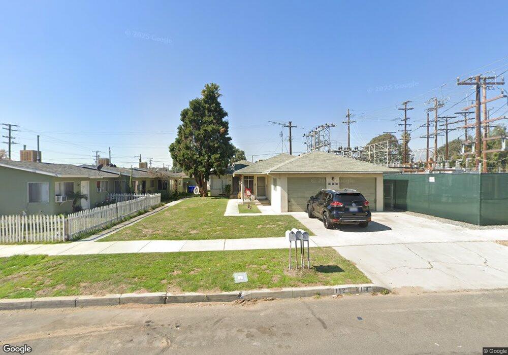
112 N Date Ave Rialto, CA 92376
Estimated Value: $406,744 - $810,000
--
Bed
4
Baths
2,112
Sq Ft
$316/Sq Ft
Est. Value
About This Home
This home is located at 112 N Date Ave, Rialto, CA 92376 and is currently estimated at $668,436, approximately $316 per square foot. 112 N Date Ave is a home located in San Bernardino County with nearby schools including Sam V. Curtis Elementary School, Rialto Middle School, and Eisenhower High School.
Ownership History
Date
Name
Owned For
Owner Type
Purchase Details
Closed on
Jul 18, 2013
Sold by
Soto Ubaldo Marquez
Bought by
Marquez Marquez Martha Martha and Marquez Soto Ubaldo
Current Estimated Value
Purchase Details
Closed on
Sep 9, 1994
Sold by
Litka Fred and Litka Shirley
Bought by
Soto Ubaldo Marquez
Purchase Details
Closed on
Sep 1, 1994
Sold by
Marquez Martha Alicia
Bought by
Soto Ubaldo Marquez
Create a Home Valuation Report for This Property
The Home Valuation Report is an in-depth analysis detailing your home's value as well as a comparison with similar homes in the area
Home Values in the Area
Average Home Value in this Area
Purchase History
| Date | Buyer | Sale Price | Title Company |
|---|---|---|---|
| Marquez Marquez Martha Martha | -- | None Available | |
| Soto Ubaldo Marquez | $100,000 | Commonwealth Land Title Co | |
| Soto Ubaldo Marquez | -- | Commonwealth Land Title Co |
Source: Public Records
Tax History Compared to Growth
Tax History
| Year | Tax Paid | Tax Assessment Tax Assessment Total Assessment is a certain percentage of the fair market value that is determined by local assessors to be the total taxable value of land and additions on the property. | Land | Improvement |
|---|---|---|---|---|
| 2025 | $2,980 | $167,976 | $41,997 | $125,979 |
| 2024 | $2,980 | $164,683 | $41,174 | $123,509 |
| 2023 | $3,112 | $161,454 | $40,367 | $121,087 |
| 2022 | $2,878 | $158,288 | $39,575 | $118,713 |
| 2021 | $2,865 | $155,184 | $38,799 | $116,385 |
| 2020 | $2,858 | $153,593 | $38,401 | $115,192 |
| 2019 | $2,810 | $150,581 | $37,648 | $112,933 |
| 2018 | $2,707 | $147,629 | $36,910 | $110,719 |
| 2017 | $2,691 | $144,734 | $36,186 | $108,548 |
| 2016 | $1,920 | $141,896 | $35,476 | $106,420 |
| 2015 | $1,928 | $139,764 | $34,943 | $104,821 |
| 2014 | $1,816 | $137,027 | $34,259 | $102,768 |
Source: Public Records
Map
Nearby Homes
- 201 N Magnolia Ave
- 117 N Orange Ave
- 352 Alice Ave
- 210 N Riverside Ave
- 139 N Palm Ave
- 228 N Orange Ave
- 365 Huntington Ct
- 236 W 1st St
- 190 W 3rd St
- 109 S Joyce Ave
- 127 S Joyce Ave
- 114 S Acacia Ave
- 114 S Encina Ave
- 251 E Ramona Dr
- 190 W Wilson St
- 161 W Wilson St
- 530 E 3rd St
- 432 N Sage Ave
- 456 E Wilson St
- 160 S Eucalyptus Ave
- 106 N Date Ave
- 100 N Date Ave
- 111 N Date Ave
- 115 N Date Ave
- 107 N Date Ave
- 101 N Date Ave
- 129 N Olive Ave
- 125 N Date Ave
- 137 N Olive Ave
- 129 N Date Ave
- 110 N Magnolia Ave
- 112 N Magnolia Ave
- 104 N Magnolia Ave
- 100 N Magnolia Ave
- 145 N Olive Ave
- 135 N Date Ave
- 118 E 1st St
- 112 N Olive Ave
- 108 N Olive Ave
- 101 S Olive Ave