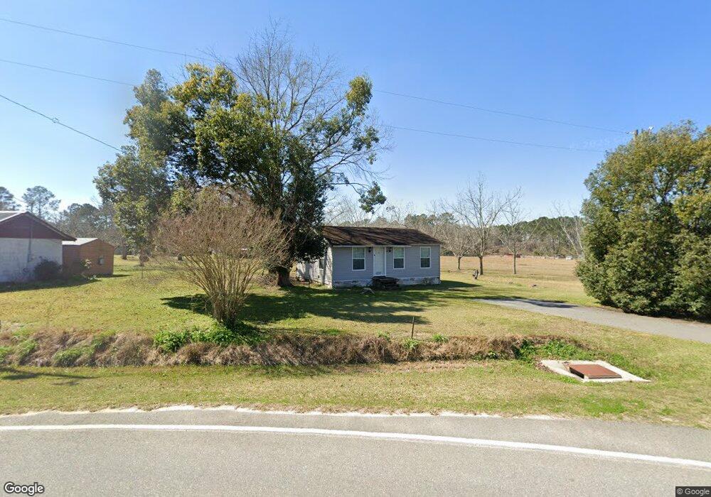
112 N Langford St Moultrie, GA 31788
Estimated Value: $33,682 - $220,000
Studio
--
Bath
617
Sq Ft
$222/Sq Ft
Est. Value
About This Home
This home is located at 112 N Langford St, Moultrie, GA 31788 and is currently estimated at $136,921, approximately $221 per square foot. 112 N Langford St is a home with nearby schools including Odom Elementary School, Willie J. Williams Middle School, and C.A. Gray Junior High School.
Ownership History
Date
Name
Owned For
Owner Type
Purchase Details
Closed on
Oct 14, 2024
Sold by
Ramirez Pedro Miguel Torres
Bought by
Rodriguez Laura Sol
Current Estimated Value
Purchase Details
Closed on
Jun 12, 2023
Sold by
Galarza Gabriel Antonio
Bought by
Ramirez Pedro Miguel Torres and Rodriguez Laura Sol
Purchase Details
Closed on
Mar 29, 2023
Sold by
Jay Roger Lynn
Bought by
Galarza Gabriel Antonio
Purchase Details
Closed on
Jun 1, 2021
Sold by
Colquitt County Tax Commissioner
Bought by
Galarza Gabriel Antonio
Purchase Details
Closed on
May 29, 2019
Sold by
Jenkins Kent E
Bought by
Jay Roger Lynn
Purchase Details
Closed on
Oct 26, 2001
Sold by
Vickers H E
Bought by
Jenkins Kent E
Purchase Details
Closed on
Mar 29, 1985
Bought by
Vickers H E
Create a Home Valuation Report for This Property
The Home Valuation Report is an in-depth analysis detailing your home's value as well as a comparison with similar homes in the area
Purchase History
| Date | Buyer | Sale Price | Title Company |
|---|---|---|---|
| Rodriguez Laura Sol | -- | -- | |
| Ramirez Pedro Miguel Torres | $15,000 | -- | |
| Galarza Gabriel Antonio | $1,000 | -- | |
| Galarza Gabriel Antonio | $6,000 | -- | |
| Galarza Gabriel Antonio | $6,000 | -- | |
| Jay Roger Lynn | $18,500 | -- | |
| Jenkins Kent E | $13,500 | -- | |
| Vickers H E | $4,200 | -- |
Source: Public Records
Tax History
| Year | Tax Paid | Tax Assessment Tax Assessment Total Assessment is a certain percentage of the fair market value that is determined by local assessors to be the total taxable value of land and additions on the property. | Land | Improvement |
|---|---|---|---|---|
| 2025 | $258 | $12,977 | $812 | $12,165 |
| 2024 | $258 | $12,194 | $812 | $11,382 |
| 2023 | $218 | $9,145 | $812 | $8,333 |
| 2022 | $208 | $8,756 | $812 | $7,944 |
| 2021 | $202 | $8,338 | $812 | $7,526 |
| 2020 | $183 | $7,971 | $812 | $7,159 |
| 2019 | $199 | $7,240 | $812 | $6,428 |
| 2018 | $185 | $7,240 | $812 | $6,428 |
| 2017 | $197 | $7,240 | $812 | $6,428 |
| 2016 | $200 | $7,240 | $812 | $6,428 |
| 2015 | $202 | $7,240 | $812 | $6,428 |
| 2014 | $198 | $7,240 | $812 | $6,428 |
| 2013 | -- | $7,240 | $812 | $6,428 |
Source: Public Records
Map
Nearby Homes
- 5808 Georgia 133
- 313 Langford St
- 128 Rogers St
- 331 Ashley St
- 410 Railroad St
- 8774 Antioch Rd
- 277 Indian Creek Subdivision
- 0 Cook Rd
- 0 Upper Trail Unit 913422
- 1833 Old Berlin Rd
- 1863 Old Berlin Rd
- 2262 Sardis Church Rd
- 0 Burton Rd Unit 23760976
- 0 Burton Rd Unit 23669194
- 182 Horseshoe Dr
- 5940 Georgia 37
- 0 Sunbelt Dr Unit 915605
- 107 Belt Ln
- 111 Belt Ln
- 0 Belt Ln Unit 914599
- 315 N Langford St
- 134 N Langford St
- 5808 Ga Highway 133 S
- 5754 Ga Highway 133 S
- 160 N Langford St
- 128 3rd St NE
- 168 N Langford St
- 168 Langford Street Berlin Ga
- 167 N Langford St
- 158 3rd St
- 3rd 3rd St SW
- 125 3rd St NE
- 5660 Ga Highway 133 S
- 250 Smith St
- 189 N Langford St
- 247 Smith Rd
- 134 Ashley St
- 115 2nd St
- 200 N Langford St
- 5880 Ga Highway 133 S
Your Personal Tour Guide
Ask me questions while you tour the home.