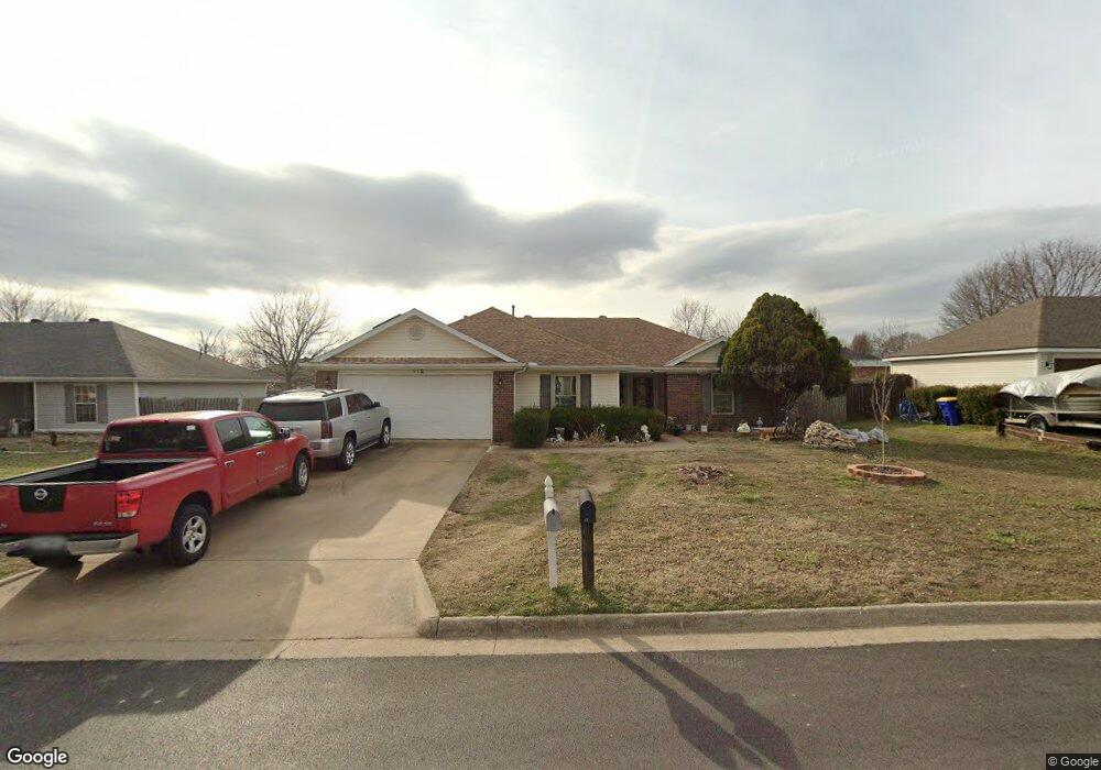
112 N Michael St Lowell, AR 72745
Estimated Value: $281,375 - $299,000
3
Beds
2
Baths
1,502
Sq Ft
$192/Sq Ft
Est. Value
About This Home
This home is located at 112 N Michael St, Lowell, AR 72745 and is currently estimated at $288,844, approximately $192 per square foot. 112 N Michael St is a home located in Benton County with nearby schools including Lowell Elementary School, Kirksey Middle School, and Rogers High School.
Ownership History
Date
Name
Owned For
Owner Type
Purchase Details
Closed on
Nov 16, 2006
Sold by
Argueta Eleazar Ibarra and Rojo Imelda
Bought by
Argueta Eleazar Ibarra and Rojo Imelda
Current Estimated Value
Home Financials for this Owner
Home Financials are based on the most recent Mortgage that was taken out on this home.
Original Mortgage
$118,800
Outstanding Balance
$70,901
Interest Rate
6.37%
Mortgage Type
Unknown
Estimated Equity
$217,943
Purchase Details
Closed on
Aug 12, 2002
Bought by
Argueta
Purchase Details
Closed on
Dec 11, 2001
Bought by
Chase
Purchase Details
Closed on
Aug 12, 1998
Bought by
Lejohn
Purchase Details
Closed on
Aug 12, 1997
Bought by
Riggins
Create a Home Valuation Report for This Property
The Home Valuation Report is an in-depth analysis detailing your home's value as well as a comparison with similar homes in the area
Home Values in the Area
Average Home Value in this Area
Purchase History
| Date | Buyer | Sale Price | Title Company |
|---|---|---|---|
| Argueta Eleazar Ibarra | -- | Professional Land Title Comp | |
| Argueta | $89,000 | -- | |
| Chase | -- | -- | |
| Lejohn | $80,000 | -- | |
| Riggins | $63,000 | -- |
Source: Public Records
Mortgage History
| Date | Status | Borrower | Loan Amount |
|---|---|---|---|
| Open | Argueta Eleazar Ibarra | $118,800 |
Source: Public Records
Tax History
| Year | Tax Paid | Tax Assessment Tax Assessment Total Assessment is a certain percentage of the fair market value that is determined by local assessors to be the total taxable value of land and additions on the property. | Land | Improvement |
|---|---|---|---|---|
| 2025 | $1,771 | $51,445 | $15,200 | $36,245 |
| 2024 | $1,566 | $51,445 | $15,200 | $36,245 |
| 2023 | $1,492 | $32,650 | $7,200 | $25,450 |
| 2022 | $1,190 | $32,650 | $7,200 | $25,450 |
| 2021 | $1,115 | $32,650 | $7,200 | $25,450 |
| 2020 | $1,012 | $23,840 | $4,000 | $19,840 |
| 2019 | $977 | $23,840 | $4,000 | $19,840 |
| 2018 | $1,002 | $23,840 | $4,000 | $19,840 |
| 2017 | $911 | $23,840 | $4,000 | $19,840 |
| 2016 | $911 | $23,840 | $4,000 | $19,840 |
| 2015 | $1,201 | $22,580 | $4,400 | $18,180 |
| 2014 | $851 | $22,580 | $4,400 | $18,180 |
Source: Public Records
Map
Nearby Homes
- 704 Mcclure Ave
- 423 Mayflower Ave
- 615 Knight Ave
- 206 N Old Wire Rd
- 1105 Maclaren Ave
- 1101 Maclaren Ave
- 1103 Maclaren Ave
- 1116 Maclaren Ave
- 1102 Maclaren Ave
- 1000 Autumn Royal Ave
- 1021 Marquis Ave
- 0 Presidential Dr Unit 1317772
- 1020 Marquis Ave
- 1025 Marquis Ave
- 407 Jackson Place
- 1029 Marquis Ave
- 1033 Marquis Ave
- 1049 Glenora Ave
- 513 N Old Wire Rd
- 615 Honeysuckle St
- 114 N Michael St
- 108 N Michael St
- 109 N Bailey St
- 115 N Bailey St
- 111 N Michael St
- 118 N Michael St
- 104 N Michael St
- 113 N Michael St
- 107 N Michael St
- 105 N Bailey St
- 119 N Bailey St
- 117 N Michael St
- 103 N Michael St
- 100 N Michael St
- 112 N Bailey St
- 112 N Oak St
- 101 N Bailey St
- 114 N Bailey St
- 108 N Bailey St
- 114 N Oak St
Your Personal Tour Guide
Ask me questions while you tour the home.