Estimated Value: $382,000 - $440,000
1
Bed
1
Bath
1,743
Sq Ft
$233/Sq Ft
Est. Value
About This Home
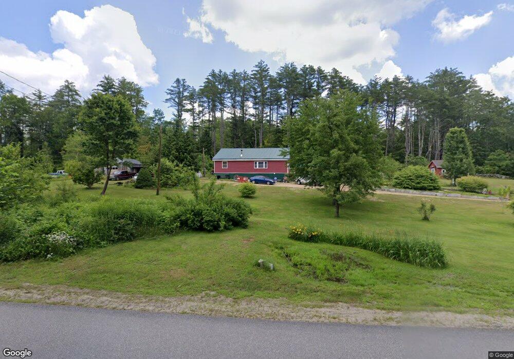
This home is located at 112 River Rd, Weare, NH 03281 and is currently estimated at $406,619, approximately $233 per square foot. 112 River Rd is a home with nearby schools including Center Woods Elementary School, Weare Middle School, and John Stark Regional High School.
Create a Home Valuation Report for This Property
The Home Valuation Report is an in-depth analysis detailing your home's value as well as a comparison with similar homes in the area
Home Values in the Area
Average Home Value in this Area
Tax History Compared to Growth
Tax History
| Year | Tax Paid | Tax Assessment Tax Assessment Total Assessment is a certain percentage of the fair market value that is determined by local assessors to be the total taxable value of land and additions on the property. | Land | Improvement |
|---|---|---|---|---|
| 2024 | $5,607 | $275,000 | $106,500 | $168,500 |
| 2023 | $5,181 | $275,000 | $106,500 | $168,500 |
| 2022 | $4,785 | $275,000 | $106,500 | $168,500 |
| 2021 | $4,484 | $260,700 | $106,500 | $154,200 |
| 2020 | $4,421 | $184,600 | $74,700 | $109,900 |
| 2019 | $4,377 | $184,600 | $74,700 | $109,900 |
| 2018 | $4,251 | $184,600 | $74,700 | $109,900 |
| 2016 | $3,828 | $171,100 | $74,700 | $96,400 |
| 2015 | $3,702 | $165,200 | $74,700 | $90,500 |
| 2014 | $3,669 | $165,200 | $74,700 | $90,500 |
| 2013 | $3,732 | $171,600 | $74,700 | $96,900 |
Source: Public Records
Map
Nearby Homes
- 174 S Stark Hwy Unit 13
- 174 S Stark Hwy Unit 1
- 174 S Stark Hwy Unit 23
- 88 Saunders Rd
- 93 Daniels Rd
- 77 Gould Rd
- 95 Wright Dr
- 103 Renshaw Rd
- 3 Stephanie Rd
- 22 Fairway Dr
- 16 Palmer Rd
- 0 Fairway Dr Unit 11
- 34 Lull Rd
- 624 S Stark Hwy
- 450 Weare Rd
- 25 Pleasant St
- 342 Weare Rd
- 12 S Mast St
- 39 S Mast St
- 99 Elm St