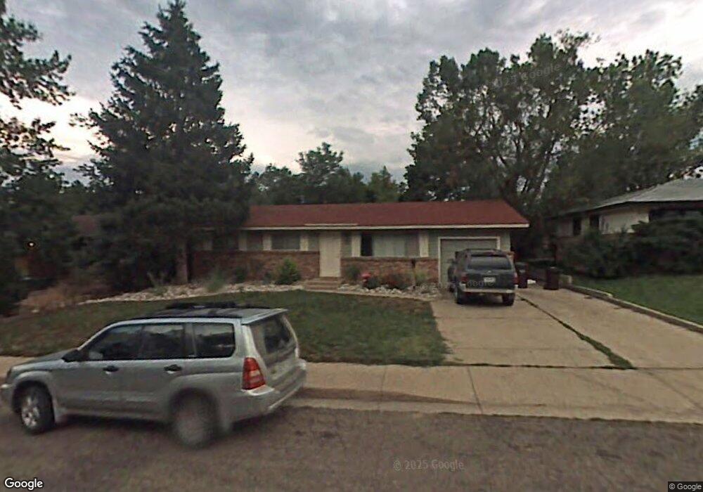
1120 Berea Dr Boulder, CO 80305
Table Mesa NeighborhoodEstimated Value: $968,000 - $1,150,000
4
Beds
3
Baths
1,958
Sq Ft
$528/Sq Ft
Est. Value
About This Home
This home is located at 1120 Berea Dr, Boulder, CO 80305 and is currently estimated at $1,033,495, approximately $527 per square foot. 1120 Berea Dr is a home located in Boulder County with nearby schools including Bear Creek Elementary School, Mesa Elementary School, and Southern Hills Middle School.
Ownership History
Date
Name
Owned For
Owner Type
Purchase Details
Closed on
Jun 7, 2021
Sold by
Lewis Christine M
Bought by
Lewis Reid A
Current Estimated Value
Home Financials for this Owner
Home Financials are based on the most recent Mortgage that was taken out on this home.
Original Mortgage
$386,470
Outstanding Balance
$346,837
Interest Rate
2.9%
Mortgage Type
New Conventional
Estimated Equity
$686,658
Purchase Details
Closed on
Mar 5, 2021
Sold by
Lewis Chrsitine M
Bought by
Lewis Reid A
Purchase Details
Closed on
Mar 2, 2021
Sold by
Lewis Christine M and Estate Of Paul K Lewis Jr
Bought by
Lewis Christine M
Purchase Details
Closed on
May 28, 1987
Bought by
Lewis Paul K and Lewis Christine M
Purchase Details
Closed on
Aug 22, 1984
Bought by
Lewis Paul K and Lewis Christine M
Purchase Details
Closed on
Jun 16, 1972
Bought by
Lewis Paul K and Lewis Christine M
Create a Home Valuation Report for This Property
The Home Valuation Report is an in-depth analysis detailing your home's value as well as a comparison with similar homes in the area
Home Values in the Area
Average Home Value in this Area
Purchase History
| Date | Buyer | Sale Price | Title Company |
|---|---|---|---|
| Lewis Reid A | -- | Mortgage Information Svcs In | |
| Lewis Reid A | -- | None Available | |
| Lewis Christine M | -- | None Available | |
| Lewis Paul K | -- | -- | |
| Lewis Paul K | $87,300 | -- | |
| Lewis Paul K | $24,000 | -- |
Source: Public Records
Mortgage History
| Date | Status | Borrower | Loan Amount |
|---|---|---|---|
| Open | Lewis Reid A | $386,470 |
Source: Public Records
Tax History
| Year | Tax Paid | Tax Assessment Tax Assessment Total Assessment is a certain percentage of the fair market value that is determined by local assessors to be the total taxable value of land and additions on the property. | Land | Improvement |
|---|---|---|---|---|
| 2025 | $5,012 | $78,188 | $53,044 | $25,144 |
| 2024 | $5,012 | $78,188 | $53,044 | $25,144 |
| 2023 | $4,925 | $57,024 | $54,638 | $6,071 |
| 2022 | $4,357 | $46,920 | $42,228 | $4,692 |
| 2021 | $4,155 | $48,270 | $43,443 | $4,827 |
| 2020 | $3,797 | $43,622 | $34,892 | $8,730 |
| 2019 | $3,739 | $43,622 | $34,892 | $8,730 |
| 2018 | $3,646 | $42,048 | $29,880 | $12,168 |
| 2017 | $3,531 | $46,486 | $33,034 | $13,452 |
| 2016 | $3,147 | $36,354 | $24,119 | $12,235 |
| 2015 | $2,980 | $31,545 | $14,248 | $17,297 |
| 2014 | $2,652 | $31,545 | $14,248 | $17,297 |
Source: Public Records
Map
Nearby Homes
- 3490 Emerson Ave
- 3450 Emerson Ave
- 3590 Endicott Dr
- 3210 Emerson Ave
- 1160 S Lashley Ln
- 4445 Squires Cir
- 2860 Table Mesa Dr
- 725 S 45th St
- 4100 Greenbriar Blvd
- 4204 Greenbriar Blvd Unit 45
- 4286 Greenbriar Blvd
- 4630 MacKy Way
- 375 S 40th St
- 3130 Kittrell Ct
- 345 S 38th St
- 623 Hartford Dr
- 2795 Vassar Dr
- 3970 Longwood Ave
- 405 S 43rd St
- 2955 Stanford Ave
Your Personal Tour Guide
Ask me questions while you tour the home.