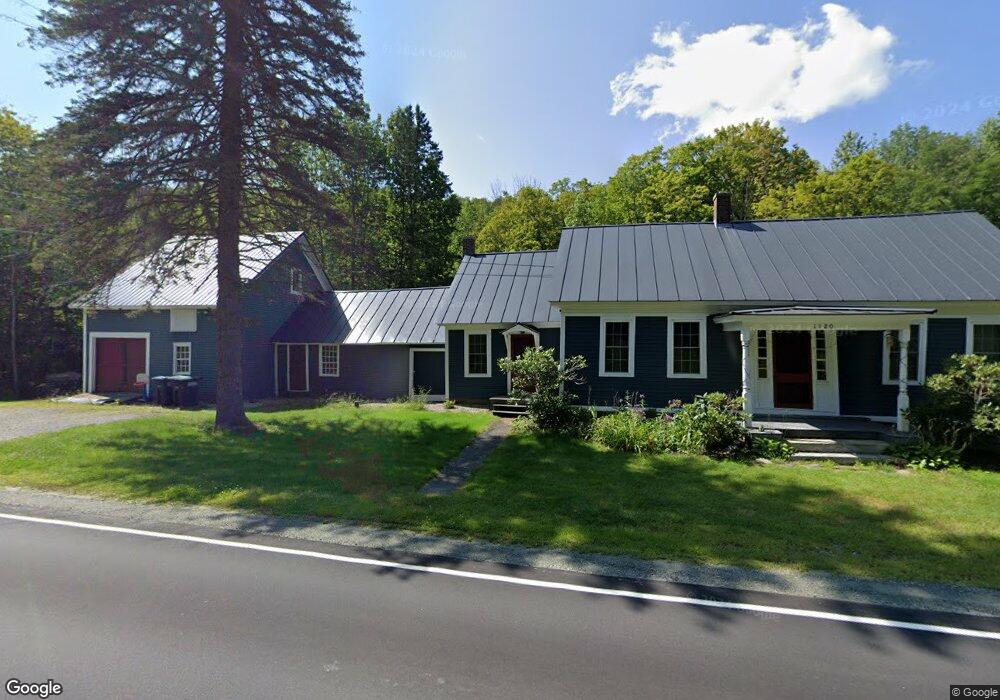
1120 Nh Route 4a Enfield, NH 03748
Estimated Value: $479,259 - $554,000
3
Beds
1
Bath
1,843
Sq Ft
$277/Sq Ft
Est. Value
About This Home
This home is located at 1120 Nh Route 4a, Enfield, NH 03748 and is currently estimated at $510,315, approximately $276 per square foot. 1120 Nh Route 4a is a home located in Grafton County with nearby schools including Enfield Village School, Indian River School, and Mascoma Valley Regional High School.
Ownership History
Date
Name
Owned For
Owner Type
Purchase Details
Closed on
Nov 13, 2020
Sold by
Hersey Acres Llc
Bought by
Goodness Brian and Goodness Faith
Current Estimated Value
Home Financials for this Owner
Home Financials are based on the most recent Mortgage that was taken out on this home.
Original Mortgage
$313,500
Outstanding Balance
$278,970
Interest Rate
2.8%
Mortgage Type
New Conventional
Estimated Equity
$231,345
Purchase Details
Closed on
Sep 27, 2018
Sold by
Swift Robert A and Swift Katja
Bought by
Hersey Todd W and Hersey Thomas C
Purchase Details
Closed on
Aug 4, 2006
Sold by
Rice William P and Rice Jennifer K
Bought by
Swift Robert A and Swift Katja
Home Financials for this Owner
Home Financials are based on the most recent Mortgage that was taken out on this home.
Original Mortgage
$184,000
Interest Rate
6.7%
Mortgage Type
Purchase Money Mortgage
Create a Home Valuation Report for This Property
The Home Valuation Report is an in-depth analysis detailing your home's value as well as a comparison with similar homes in the area
Home Values in the Area
Average Home Value in this Area
Purchase History
| Date | Buyer | Sale Price | Title Company |
|---|---|---|---|
| Goodness Brian | $330,000 | None Available | |
| Hersey Todd W | $65,000 | -- | |
| Swift Robert A | $230,000 | -- |
Source: Public Records
Mortgage History
| Date | Status | Borrower | Loan Amount |
|---|---|---|---|
| Open | Goodness Brian | $313,500 | |
| Previous Owner | Swift Robert A | $184,000 |
Source: Public Records
Tax History Compared to Growth
Tax History
| Year | Tax Paid | Tax Assessment Tax Assessment Total Assessment is a certain percentage of the fair market value that is determined by local assessors to be the total taxable value of land and additions on the property. | Land | Improvement |
|---|---|---|---|---|
| 2024 | $5,606 | $331,500 | $82,300 | $249,200 |
| 2023 | $5,918 | $217,900 | $55,600 | $162,300 |
| 2022 | $5,554 | $215,700 | $55,600 | $160,100 |
| 2021 | $5,416 | $215,700 | $55,600 | $160,100 |
| 2020 | $5,490 | $215,700 | $55,600 | $160,100 |
| 2015 | $4,211 | $167,900 | $55,100 | $112,800 |
| 2014 | $4,667 | $201,500 | $68,500 | $133,000 |
| 2013 | $4,296 | $201,500 | $68,500 | $133,000 |
| 2012 | $4,090 | $201,500 | $68,500 | $133,000 |
Source: Public Records
Map
Nearby Homes
- 62 Palmer Rd
- 0 Grafton Pond Rd Unit 64-1
- 453 Rt 4 Dr
- 672-3 Bog Rd
- 20 Bonardi Dr
- 461 Bog Rd
- 0 Oak Hill Rd Unit 1B
- Lot#47-3 Grafton Pond Rd
- 639 Bog Rd
- 13 Lark Place
- 295 Frye Ln
- 672 Bog Rd
- 64 High Pond Rd
- 21 Shore Rd
- 12 Cherry Ln
- Lot 1 Nh Route 4a
- Lot 2 Nh Route 4a
- Lot 4 Nh Route 4a
- 45 Bright Slope Way
- 23 High Pond Rd
- 1120 Nh Route 4a
- 1120 Nh Route 4a
- 1120 Route-4a
- 1099 Nh Route 4a
- 1096 Nh Route 4a
- 1096 New Hampshire 4a
- 1095 Nh Route 4a
- 1088 Route 4a
- 1088 Nh Route 4a
- 1139 Nh Route 4a
- 1084 Nh Route 4a
- 0 New Hampshire 4a
- 1081 Nh Route 4a
- 1130 Nh Route 4a
- 1135 New Hampshire 4a
- 1079 Nh Route 4a
- 1077 New Hampshire 4a
- 1069 Route 4a
- 1070 Nh Route 4a
- 1070 New Hampshire 4a