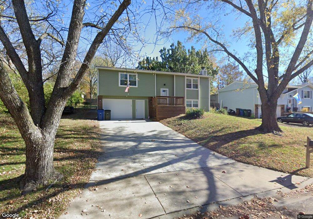
1120 Randall Rd Lawrence, KS 66049
Perry Park NeighborhoodEstimated Value: $291,496 - $309,000
3
Beds
2
Baths
1,136
Sq Ft
$263/Sq Ft
Est. Value
About This Home
This home is located at 1120 Randall Rd, Lawrence, KS 66049 and is currently estimated at $298,499, approximately $262 per square foot. 1120 Randall Rd is a home located in Douglas County with nearby schools including Sunset Hill Elementary School, West Middle School, and Lawrence Free State High School.
Ownership History
Date
Name
Owned For
Owner Type
Purchase Details
Closed on
Jun 7, 2019
Sold by
Drake Wayne and Drake Lisa
Bought by
Fuller Robert and Fuller Anna
Current Estimated Value
Home Financials for this Owner
Home Financials are based on the most recent Mortgage that was taken out on this home.
Original Mortgage
$140,000
Outstanding Balance
$108,056
Interest Rate
4.2%
Mortgage Type
New Conventional
Estimated Equity
$190,443
Purchase Details
Closed on
Mar 23, 2003
Sold by
Booth Elizabeth Mills
Bought by
Drake Wayne
Home Financials for this Owner
Home Financials are based on the most recent Mortgage that was taken out on this home.
Original Mortgage
$124,925
Interest Rate
5.8%
Mortgage Type
Purchase Money Mortgage
Create a Home Valuation Report for This Property
The Home Valuation Report is an in-depth analysis detailing your home's value as well as a comparison with similar homes in the area
Home Values in the Area
Average Home Value in this Area
Purchase History
| Date | Buyer | Sale Price | Title Company |
|---|---|---|---|
| Fuller Robert | -- | Security 1St Title | |
| Drake Wayne | -- | Kansas Secured Title |
Source: Public Records
Mortgage History
| Date | Status | Borrower | Loan Amount |
|---|---|---|---|
| Open | Fuller Robert | $140,000 | |
| Previous Owner | Drake Wayne | $124,925 |
Source: Public Records
Tax History Compared to Growth
Tax History
| Year | Tax Paid | Tax Assessment Tax Assessment Total Assessment is a certain percentage of the fair market value that is determined by local assessors to be the total taxable value of land and additions on the property. | Land | Improvement |
|---|---|---|---|---|
| 2025 | $3,998 | $32,522 | $7,475 | $25,047 |
| 2024 | $3,761 | $30,659 | $5,750 | $24,909 |
| 2023 | $3,730 | $29,187 | $5,520 | $23,667 |
| 2022 | $3,331 | $25,933 | $4,830 | $21,103 |
| 2021 | $2,808 | $21,131 | $3,795 | $17,336 |
| 2020 | $2,658 | $20,125 | $3,795 | $16,330 |
| 2019 | $2,668 | $20,217 | $3,795 | $16,422 |
| 2018 | $2,515 | $18,943 | $3,680 | $15,263 |
| 2017 | $2,409 | $17,952 | $3,680 | $14,272 |
| 2016 | $2,215 | $17,262 | $3,680 | $13,582 |
| 2015 | $2,125 | $16,572 | $3,680 | $12,892 |
| 2014 | $2,143 | $16,871 | $3,680 | $13,191 |
Source: Public Records
Map
Nearby Homes
- 1168 Parkside Cir
- 1021 Holiday Dr
- 1304 Lawrence Ave
- 3507 W 10th St
- 1008 Lawrence Ave
- 1014 Lawrence Ave
- 3510 W 9th Ct
- 1507 Medinah Cir
- 1439 Applegate Ct
- 1215 Hacienda Ln
- 3922 Willshire Dr
- 2901 University Dr
- 2901 University Dr Unit A, B, C, D, E, F
- 2609 Westdale Rd
- 1113 Somerset Cir
- 1012 Wagon Wheel Rd
- 923 Crestline Dr
- 503 Abilene St
- 4207 Timberline Ct
- 3415 Trail Rd
- 1116 Randall Rd
- 1124 Randall Rd
- 1121 Cynthia St
- 1117 Cynthia St
- 1125 Cynthia St
- 1128 Randall Rd
- 1112 Randall Rd
- 1127 Randall Rd
- 1131 Randall Rd
- 1113 Cynthia St
- 1129 Cynthia St
- 1123 Randall Rd
- 1132 Randall Rd
- 1101 Cynthia St
- 1135 Randall Rd
- 1133 Cynthia St
- 1109 Cynthia St
- 1119 Randall Rd
- 1139 Randall Rd
- 1136 Randall Rd