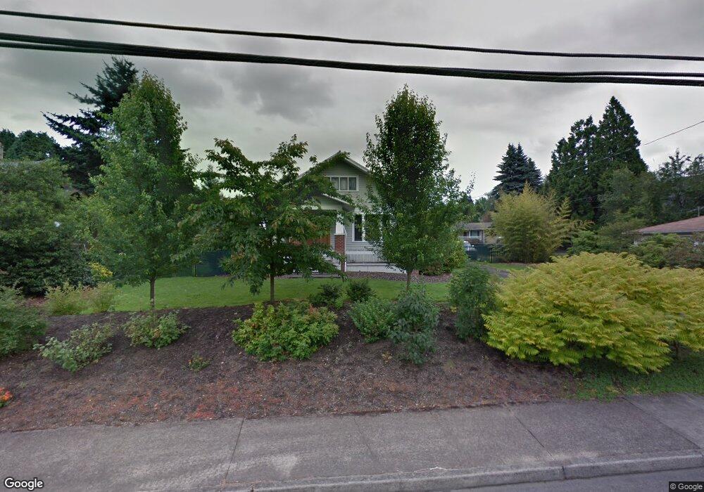
1120 SE Roberts Ave Gresham, OR 97080
Historic Southeast NeighborhoodEstimated Value: $484,000 - $630,064
4
Beds
3
Baths
2,742
Sq Ft
$214/Sq Ft
Est. Value
About This Home
This home is located at 1120 SE Roberts Ave, Gresham, OR 97080 and is currently estimated at $586,266, approximately $213 per square foot. 1120 SE Roberts Ave is a home located in Multnomah County with nearby schools including East Gresham Elementary School, Dexter McCarty Middle School, and Gresham High School.
Ownership History
Date
Name
Owned For
Owner Type
Purchase Details
Closed on
Mar 5, 1998
Sold by
Melton Robert O and Melton Peggy L
Bought by
Grover Todd Alan
Current Estimated Value
Home Financials for this Owner
Home Financials are based on the most recent Mortgage that was taken out on this home.
Original Mortgage
$172,000
Outstanding Balance
$30,422
Interest Rate
6.99%
Estimated Equity
$555,844
Create a Home Valuation Report for This Property
The Home Valuation Report is an in-depth analysis detailing your home's value as well as a comparison with similar homes in the area
Home Values in the Area
Average Home Value in this Area
Purchase History
| Date | Buyer | Sale Price | Title Company |
|---|---|---|---|
| Grover Todd Alan | $215,000 | Ticor Title |
Source: Public Records
Mortgage History
| Date | Status | Borrower | Loan Amount |
|---|---|---|---|
| Open | Grover Todd Alan | $172,000 |
Source: Public Records
Tax History
| Year | Tax Paid | Tax Assessment Tax Assessment Total Assessment is a certain percentage of the fair market value that is determined by local assessors to be the total taxable value of land and additions on the property. | Land | Improvement |
|---|---|---|---|---|
| 2025 | $6,071 | $298,330 | -- | -- |
| 2024 | $5,812 | $289,650 | -- | -- |
| 2023 | $5,295 | $281,220 | $0 | $0 |
| 2022 | $5,147 | $273,030 | $0 | $0 |
| 2021 | $5,017 | $265,080 | $0 | $0 |
| 2020 | $4,720 | $257,360 | $0 | $0 |
| 2019 | $4,597 | $249,870 | $0 | $0 |
| 2018 | $4,383 | $242,600 | $0 | $0 |
| 2017 | $4,205 | $235,540 | $0 | $0 |
| 2016 | $3,708 | $228,680 | $0 | $0 |
Source: Public Records
Map
Nearby Homes
- 511 SE 15th St
- 1414 SE Beech Place
- 1918 SE Regner Rd
- 55 SW Lovhar Dr
- 417 SE Roberts Ave
- 415 SE Roberts Ave
- 2024 SE Spruce Ave
- 1949 SE Palmquist Rd Unit 51
- 1949 SE Palmquist Rd Unit 91
- 1949 SE Palmquist Rd Unit 121
- 0 SW Miller Ct Unit 470855683
- 1715 SE 5th St Unit 1725
- 1700 SE 4th St
- 450 SE Hogan Rd
- 4740 SE 2nd St
- 4764 SE 2nd St
- 4667 SE 2nd St
- 2137 SE 15th Aly
- 732 SE Rene Ave
- 2293 SE 15th Aly
- 1130 SE Roberts Ave Unit 1132
- 1102 SE Roberts Ave
- 1142 SE Roberts Ave
- 1140 SE Spruce Ct
- 1120 SE Spruce Ct
- 1130 SE Spruce Ct
- 1060 SE Roberts Ave
- 1055 SE Spruce Ct
- 1200 SE Roberts Ave Unit 1202
- 1119 SE Roberts Ave
- 1070 SE Spruce Ct
- 1050 SE Roberts Ave
- 1141 SE Roberts Ave
- 1115 SE Roberts Ave
- 1065 SE Roberts Ave
- 1050 SE Spruce Ct
- 1041 SE Roberts Ave
- 1025 SE Spruce Ct
- 1230 SE Roberts Ave
- 1242 SE Roberts Ave Unit 1246
Your Personal Tour Guide
Ask me questions while you tour the home.