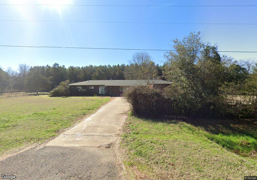
11207 Upper State Line Rd Vivian, LA 71082
Estimated Value: $190,190 - $747,000
3
Beds
2
Baths
1,944
Sq Ft
$177/Sq Ft
Est. Value
About This Home
This home is located at 11207 Upper State Line Rd, Vivian, LA 71082 and is currently estimated at $344,048, approximately $176 per square foot. 11207 Upper State Line Rd is a home located in Caddo Parish with nearby schools including Judson Fundamental Elementary School, Fairfield Magnet School, and Herndon Magnet School.
Ownership History
Date
Name
Owned For
Owner Type
Purchase Details
Closed on
Apr 18, 2008
Sold by
Phillips Jack Lee
Bought by
Shelton Randall Coby and Shelton Jessica Brooke Angle
Current Estimated Value
Home Financials for this Owner
Home Financials are based on the most recent Mortgage that was taken out on this home.
Original Mortgage
$153,000
Outstanding Balance
$97,071
Interest Rate
6%
Mortgage Type
Unknown
Estimated Equity
$246,977
Create a Home Valuation Report for This Property
The Home Valuation Report is an in-depth analysis detailing your home's value as well as a comparison with similar homes in the area
Home Values in the Area
Average Home Value in this Area
Purchase History
| Date | Buyer | Sale Price | Title Company |
|---|---|---|---|
| Shelton Randall Coby | $150,000 | First Commerce Title Company |
Source: Public Records
Mortgage History
| Date | Status | Borrower | Loan Amount |
|---|---|---|---|
| Open | Shelton Randall Coby | $153,000 |
Source: Public Records
Tax History Compared to Growth
Tax History
| Year | Tax Paid | Tax Assessment Tax Assessment Total Assessment is a certain percentage of the fair market value that is determined by local assessors to be the total taxable value of land and additions on the property. | Land | Improvement |
|---|---|---|---|---|
| 2024 | $2,847 | $18,237 | $635 | $17,602 |
| 2023 | $2,706 | $16,979 | $605 | $16,374 |
| 2022 | $2,706 | $16,979 | $605 | $16,374 |
| 2021 | $2,707 | $16,979 | $605 | $16,374 |
| 2020 | $2,695 | $16,979 | $605 | $16,374 |
| 2019 | $2,568 | $16,334 | $605 | $15,729 |
| 2018 | $1,424 | $16,334 | $605 | $15,729 |
| 2017 | $2,562 | $16,334 | $605 | $15,729 |
| 2015 | $1,390 | $16,080 | $610 | $15,470 |
| 2014 | $1,399 | $16,080 | $610 | $15,470 |
| 2013 | -- | $16,080 | $610 | $15,470 |
Source: Public Records
Map
Nearby Homes
- Lot 14 Peaceful Pines Ln
- Lot 4 Peaceful Pines Ln
- Lot 2 Peaceful Pines Ln
- Lot 6 Peaceful Pines Ln
- Lot 5 Peaceful Pines Ln
- Lot 12 Peaceful Pines Ln
- 2040 Marion County Road 3509
- 9794 Upper State Line Rd
- 122 S Bird St
- 15421 Old Atlanta Rd
- 603 S Spruce St
- 310 W Tennessee Ave
- 210 W Mississippi Ave
- 62011 Rebel Heights Rd
- 1166 County Road 4452
- 325 E Oklahoma Ave
- 109 N Huckaby St
- 1220 N Carson St
- 9420 Hosston Rd
- 1701 N Pine St
- 11188 Upper State Line Rd
- 11168 Upper State Line Rd
- 11168 Upper State Line Rd
- 11245 Upper State Line Rd
- 11190 Upper State Line Rd
- 739 County Road 4448
- 759 Cass County Rd
- 11123 Upper State Line Rd
- 11110 Upper State Line Rd
- 11107 Upper State Line Rd
- 14395 Cass County Rd
- 14395 Cass County Rd
- 11104 Upper State Line Rd
- 14391 Cass County Rd
- 11083 Upper State Line Rd
- 11083 Upper State Line Rd
- 11078 Upper State Line Rd
- 11252 Upper State Line Rd
- 11043 Upper State Line Rd
- 11090 Upper State Line Rd