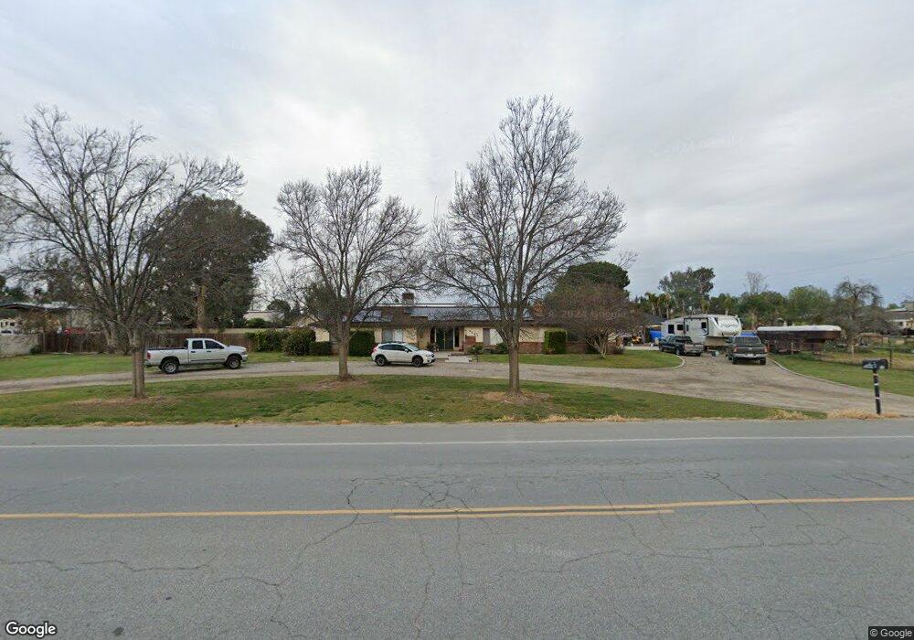
1121 Heath Rd Bakersfield, CA 93314
Estimated Value: $561,000 - $733,000
3
Beds
2
Baths
2,163
Sq Ft
$305/Sq Ft
Est. Value
About This Home
This home is located at 1121 Heath Rd, Bakersfield, CA 93314 and is currently estimated at $660,248, approximately $305 per square foot. 1121 Heath Rd is a home located in Kern County with nearby schools including Rio Bravo-Greeley Elementary School, Rio Bravo Elementary School, and Liberty High School.
Ownership History
Date
Name
Owned For
Owner Type
Purchase Details
Closed on
Jul 31, 2025
Sold by
Hudson Jack R and Hudson Jariann E
Bought by
Jack And Jariann Hudson Family Trust and Hudson
Current Estimated Value
Purchase Details
Closed on
Jun 1, 1999
Sold by
Watson John W and Watson Ellen T
Bought by
Hudson Jack R and Hudson Jariann E
Home Financials for this Owner
Home Financials are based on the most recent Mortgage that was taken out on this home.
Original Mortgage
$163,850
Interest Rate
7.05%
Create a Home Valuation Report for This Property
The Home Valuation Report is an in-depth analysis detailing your home's value as well as a comparison with similar homes in the area
Home Values in the Area
Average Home Value in this Area
Purchase History
| Date | Buyer | Sale Price | Title Company |
|---|---|---|---|
| Jack And Jariann Hudson Family Trust | -- | None Listed On Document | |
| Hudson Jack R | $172,500 | American Title Co |
Source: Public Records
Mortgage History
| Date | Status | Borrower | Loan Amount |
|---|---|---|---|
| Previous Owner | Hudson Jack R | $163,850 |
Source: Public Records
Tax History
| Year | Tax Paid | Tax Assessment Tax Assessment Total Assessment is a certain percentage of the fair market value that is determined by local assessors to be the total taxable value of land and additions on the property. | Land | Improvement |
|---|---|---|---|---|
| 2025 | $5,505 | $270,399 | $86,208 | $184,191 |
| 2024 | $5,428 | $265,098 | $84,518 | $180,580 |
| 2023 | $5,428 | $259,901 | $82,861 | $177,040 |
| 2022 | $5,412 | $254,806 | $81,237 | $173,569 |
| 2021 | $5,314 | $249,811 | $79,645 | $170,166 |
| 2020 | $5,160 | $247,251 | $78,829 | $168,422 |
| 2019 | $5,097 | $247,251 | $78,829 | $168,422 |
| 2018 | $4,954 | $237,652 | $75,769 | $161,883 |
| 2017 | $4,899 | $232,993 | $74,284 | $158,709 |
| 2016 | $4,704 | $228,426 | $72,828 | $155,598 |
| 2015 | $4,634 | $224,996 | $71,735 | $153,261 |
| 2014 | $2,791 | $220,589 | $70,330 | $150,259 |
Source: Public Records
Map
Nearby Homes
- 16725 Weatherly Ct
- 16719 Keystone Place
- 16711 Keystone Place
- 15918 Clos du Val Ave
- 16451 Barton Ln
- 8317 Littleton St
- 16030 Strebor Dr
- 13547 Philip Phelps Ave Ave
- 13601 Philip Phelps Ave Ave
- 15733 Joseph Phelps Ave
- 15357 Chateau Montelena Dr
- 15803 Screaming Eagle Ave
- 15708 Joseph Phelps Ave
- 311 Saba Way
- 15810 Lake Arrowhead Ave
- 15710 Black Hawk Ave
- 15112 Sunnybank Ave
- 17316 Brimhall Rd
- 15726 Sammie Ave Unit 2
- 16016 Clarisse St
- 16131 Brimhall Rd
- 1051 Heath Rd
- 16219 Brimhall Rd
- 1017 Heath Rd
- 16200 Brimhall Rd
- 16039 Far Niente Dr
- 16251 Brimhall Rd
- 16254 the Lords Way
- 16019 Far Niente Dr
- 1301 Heath Rd
- 16020 Rubicon Ave
- 16127 the Lords Way
- 16127 the Lords Way
- 16033 Rubicon Ave
- 16248 Brimhall Rd
- 16038 Far Niente Dr
- 16317 Brimhall Rd
- 16229 the Lords Way
- 16000 Rubicon Ave
- 15941 Far Niente Dr