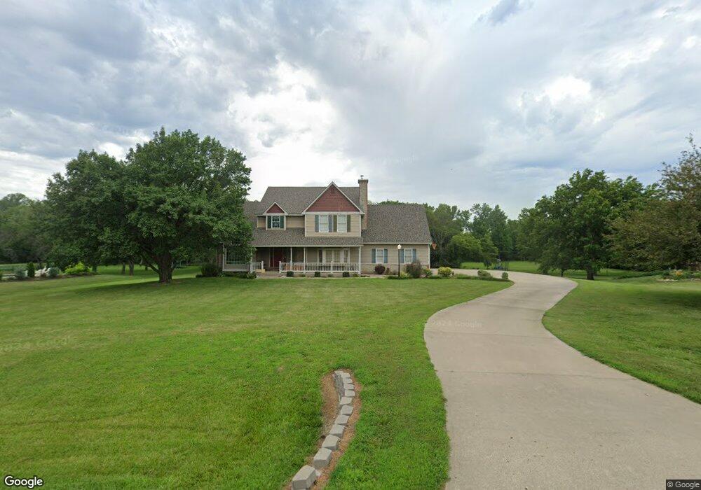
1123 E 1264 Rd Lawrence, KS 66047
Estimated Value: $548,508 - $761,000
4
Beds
4
Baths
2,878
Sq Ft
$218/Sq Ft
Est. Value
About This Home
This home is located at 1123 E 1264 Rd, Lawrence, KS 66047 and is currently estimated at $627,127, approximately $217 per square foot. 1123 E 1264 Rd is a home located in Douglas County with nearby schools including Billy Mills Middle School and Lawrence High School.
Ownership History
Date
Name
Owned For
Owner Type
Purchase Details
Closed on
Oct 13, 2025
Sold by
Harms Jeffrey W and Saxon Catherine R
Bought by
Harms Jeffrey W and Saxon Catherine R
Current Estimated Value
Purchase Details
Closed on
Dec 21, 2004
Sold by
Harms Kristen A
Bought by
Harms Jeffrey W
Home Financials for this Owner
Home Financials are based on the most recent Mortgage that was taken out on this home.
Original Mortgage
$240,000
Interest Rate
5.76%
Mortgage Type
Fannie Mae Freddie Mac
Create a Home Valuation Report for This Property
The Home Valuation Report is an in-depth analysis detailing your home's value as well as a comparison with similar homes in the area
Purchase History
| Date | Buyer | Sale Price | Title Company |
|---|---|---|---|
| Harms Jeffrey W | -- | None Listed On Document | |
| Harms Jeffrey W | -- | Kansas Secured Title |
Source: Public Records
Mortgage History
| Date | Status | Borrower | Loan Amount |
|---|---|---|---|
| Previous Owner | Harms Jeffrey W | $240,000 |
Source: Public Records
Tax History
| Year | Tax Paid | Tax Assessment Tax Assessment Total Assessment is a certain percentage of the fair market value that is determined by local assessors to be the total taxable value of land and additions on the property. | Land | Improvement |
|---|---|---|---|---|
| 2025 | $5,982 | $54,648 | $6,741 | $47,907 |
| 2024 | $5,786 | $52,567 | $6,552 | $46,015 |
| 2023 | $5,659 | $49,473 | $6,172 | $43,301 |
| 2022 | $6,804 | $57,753 | $5,413 | $52,340 |
| 2021 | $5,635 | $46,552 | $5,337 | $41,215 |
| 2020 | $5,360 | $44,642 | $5,337 | $39,305 |
| 2019 | $5,099 | $42,515 | $5,185 | $37,330 |
| 2018 | $4,814 | $39,779 | $5,105 | $34,674 |
| 2017 | $4,920 | $39,779 | $5,105 | $34,674 |
| 2016 | $4,583 | $38,457 | $6,452 | $32,005 |
| 2015 | $4,566 | $38,296 | $6,452 | $31,844 |
| 2014 | $4,229 | $35,697 | $6,452 | $29,245 |
Source: Public Records
Map
Nearby Homes
- 395.5 Acres N 1100 Rd
- 1173 N 1000 Rd
- 0000 E 1135 Rd
- 1310 N 968 Rd
- 1151 E 1135 Rd
- 125 Acres E 1296 Rd
- 3005 W 30th Ct
- 1072 E 1466 Rd
- 2913 Missouri St
- 912 W 30th Terrace
- 2728 Chipperfield Rd
- 2709 Lawrence Ave
- 1053 E 1479 Rd
- 2724 Chipperfield Rd
- 2700 Lockridge Dr
- 902 W 30th St
- 2837 Maine Ct
- 2635 Knollbrook Ct
- 804 W 30th St
- 2700 Meadow Place