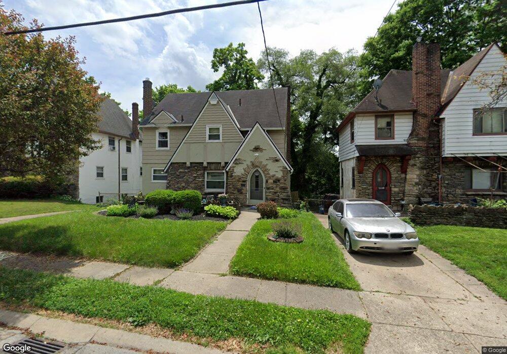
1123 Ryland Ave Cincinnati, OH 45237
Bond Hill NeighborhoodEstimated Value: $147,000 - $228,000
3
Beds
1
Bath
1,904
Sq Ft
$98/Sq Ft
Est. Value
About This Home
This home is located at 1123 Ryland Ave, Cincinnati, OH 45237 and is currently estimated at $185,928, approximately $97 per square foot. 1123 Ryland Ave is a home located in Hamilton County with nearby schools including Bond Hill Academy Elementary School, Shroder High School, and Clark Montessori High School.
Ownership History
Date
Name
Owned For
Owner Type
Purchase Details
Closed on
May 30, 2001
Sold by
Gilyard Audrey R
Bought by
Kidd Patricia A
Current Estimated Value
Home Financials for this Owner
Home Financials are based on the most recent Mortgage that was taken out on this home.
Original Mortgage
$85,300
Outstanding Balance
$32,587
Interest Rate
7.18%
Mortgage Type
FHA
Estimated Equity
$153,341
Purchase Details
Closed on
Dec 17, 1993
Sold by
Warren Loretta S
Bought by
Gilyard Audrey R
Home Financials for this Owner
Home Financials are based on the most recent Mortgage that was taken out on this home.
Original Mortgage
$55,050
Interest Rate
7.26%
Create a Home Valuation Report for This Property
The Home Valuation Report is an in-depth analysis detailing your home's value as well as a comparison with similar homes in the area
Home Values in the Area
Average Home Value in this Area
Purchase History
| Date | Buyer | Sale Price | Title Company |
|---|---|---|---|
| Kidd Patricia A | $46,000 | -- | |
| Gilyard Audrey R | $3,000 | -- |
Source: Public Records
Mortgage History
| Date | Status | Borrower | Loan Amount |
|---|---|---|---|
| Open | Kidd Patricia A | $85,300 | |
| Previous Owner | Gilyard Audrey R | $55,050 |
Source: Public Records
Tax History Compared to Growth
Tax History
| Year | Tax Paid | Tax Assessment Tax Assessment Total Assessment is a certain percentage of the fair market value that is determined by local assessors to be the total taxable value of land and additions on the property. | Land | Improvement |
|---|---|---|---|---|
| 2024 | $2,566 | $42,809 | $5,583 | $37,226 |
| 2023 | $2,624 | $42,809 | $5,583 | $37,226 |
| 2022 | $1,641 | $23,927 | $4,778 | $19,149 |
| 2021 | $1,576 | $23,927 | $4,778 | $19,149 |
| 2020 | $1,622 | $23,927 | $4,778 | $19,149 |
| 2019 | $1,657 | $22,362 | $4,466 | $17,896 |
| 2018 | $1,660 | $22,362 | $4,466 | $17,896 |
| 2017 | $1,576 | $22,362 | $4,466 | $17,896 |
| 2016 | $1,989 | $27,874 | $4,690 | $23,184 |
| 2015 | $1,794 | $27,874 | $4,690 | $23,184 |
| 2014 | $1,807 | $27,874 | $4,690 | $23,184 |
| 2013 | $1,875 | $28,442 | $4,785 | $23,657 |
Source: Public Records
Map
Nearby Homes
- 1108 Ryland Ave
- 1303 Regent Ave
- 1305 Regent Ave
- 1307 Regent Ave
- 1309 Regent Ave
- 1227 Carolina Ave
- 1318 Franklin Ave
- 1407 Regent Ave
- 1427 Regent Ave
- 1129 Elm Park Dr
- 1409 Yarmouth Ave
- 0 Township Road 111
- 5653 Prosser Ave
- 1534 Elizabeth Place
- 5703 Cedar Ave
- 3 Linden St
- 1139 Towanda Terrace
- 1640 Anita Place
- 6106 Sycamore St
- 6105 Sycamore St
- 1119 Ryland Ave
- 1127 Ryland Ave
- 1131 Ryland Ave
- 1124 Laidlaw Ave
- 1120 Laidlaw Ave
- 1128 Laidlaw Ave
- 1116 Laidlaw Ave
- 1130 Laidlaw Ave
- 1135 Ryland Ave
- 1118 Ryland Ave
- 1111 Ryland Ave
- 1122 Ryland Ave
- 1128 Ryland Ave
- 1112 Laidlaw Ave
- 1114 Ryland Ave
- 1132 Laidlaw Ave
- 1134 Ryland Ave
- 1139 Ryland Ave
- 1112 Ryland Ave
- 1108 Laidlaw Ave