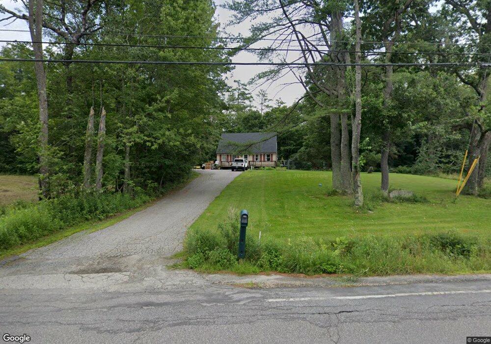
1124 Route 10 N Grantham, NH 03753
Estimated Value: $429,924 - $477,000
3
Beds
2
Baths
1,498
Sq Ft
$302/Sq Ft
Est. Value
About This Home
This home is located at 1124 Route 10 N, Grantham, NH 03753 and is currently estimated at $451,731, approximately $301 per square foot. 1124 Route 10 N is a home located in Sullivan County with nearby schools including Grantham Village School and Lebanon High School.
Ownership History
Date
Name
Owned For
Owner Type
Purchase Details
Closed on
May 5, 2022
Sold by
Tyler Jay A
Bought by
Tyler Donna M
Current Estimated Value
Home Financials for this Owner
Home Financials are based on the most recent Mortgage that was taken out on this home.
Original Mortgage
$181,500
Outstanding Balance
$171,492
Interest Rate
4.67%
Mortgage Type
Stand Alone Refi Refinance Of Original Loan
Estimated Equity
$280,239
Purchase Details
Closed on
Jun 27, 2006
Sold by
Roberts Christopher W and Roberts Edward W
Bought by
Tyler Jay A and Tayler Donna M
Home Financials for this Owner
Home Financials are based on the most recent Mortgage that was taken out on this home.
Original Mortgage
$220,400
Interest Rate
6.59%
Mortgage Type
Purchase Money Mortgage
Create a Home Valuation Report for This Property
The Home Valuation Report is an in-depth analysis detailing your home's value as well as a comparison with similar homes in the area
Home Values in the Area
Average Home Value in this Area
Purchase History
| Date | Buyer | Sale Price | Title Company |
|---|---|---|---|
| Tyler Donna M | -- | None Available | |
| Tyler Donna M | -- | None Available | |
| Tyler Jay A | $232,800 | -- | |
| Tyler Jay A | $232,800 | -- |
Source: Public Records
Mortgage History
| Date | Status | Borrower | Loan Amount |
|---|---|---|---|
| Open | Tyler Donna M | $181,500 | |
| Previous Owner | Tyler Jay A | $220,400 |
Source: Public Records
Tax History Compared to Growth
Tax History
| Year | Tax Paid | Tax Assessment Tax Assessment Total Assessment is a certain percentage of the fair market value that is determined by local assessors to be the total taxable value of land and additions on the property. | Land | Improvement |
|---|---|---|---|---|
| 2024 | $5,597 | $285,400 | $58,500 | $226,900 |
| 2023 | $5,020 | $285,400 | $58,500 | $226,900 |
| 2022 | $4,692 | $285,400 | $58,500 | $226,900 |
| 2021 | $4,171 | $182,000 | $44,900 | $137,100 |
| 2020 | $4,270 | $182,000 | $44,900 | $137,100 |
| 2019 | $4,182 | $161,700 | $35,700 | $126,000 |
| 2018 | $4,219 | $161,700 | $35,700 | $126,000 |
| 2017 | $3,836 | $161,700 | $35,700 | $126,000 |
| 2016 | $3,855 | $161,700 | $35,700 | $126,000 |
| 2015 | $3,900 | $161,700 | $35,700 | $126,000 |
| 2014 | $4,556 | $204,600 | $79,700 | $124,900 |
| 2013 | $4,387 | $204,600 | $79,700 | $124,900 |
Source: Public Records
Map
Nearby Homes
- 72 Draper Mill Rd
- 1284 Route 10 N
- 00 Route 10 N
- 8 Old Spring Dr
- 19 Rowland Rd
- 23 High Pond Rd
- 4 Bay Tree Ln
- 49 Old Beach Cir
- 6 Anderson Pond Rd
- 3 Water View
- 38 Terrace View
- 442 Olde Farms Rd
- 84 Nightingale Ln
- 64 High Pond Rd
- 13 Forest Rd
- 8 Sandy Brae
- 295 Frye Ln
- 21 Shore Rd
- 729 Olde Farm Rd
- 16 Summit Dr
- 1115 Route 10 N
- 0 Burpee Hill Rd
- 1151 Route 10 N
- 1078 Route 10 N
- 46 Burpee Hill Rd
- 1201 Route 10 N
- 46 Draper Rd
- 73 Draper Mill Rd
- 71 Burpee Hill Rd
- 95 Burpee Hill Rd
- 1272 Route 10 N
- 66 Draper Mill Rd
- 64 Draper Mill Rd Unit Map 216 Lot 77
- 28 Robin Ln
- 30 Robin Ln
- 101 Burpee Hill Rd
- 26 Robin Ln
- 1025 Route 10 N
- 24 Robin Ln
- 29 Robin Ln