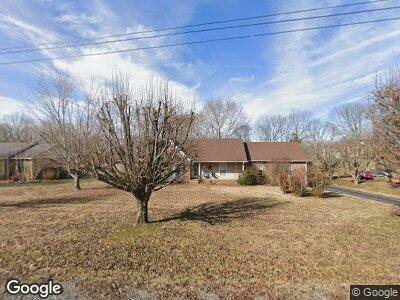
1125 Adam Dr Cottontown, TN 37048
Estimated Value: $330,376 - $436,000
--
Bed
3
Baths
1,826
Sq Ft
$217/Sq Ft
Est. Value
About This Home
This home is located at 1125 Adam Dr, Cottontown, TN 37048 and is currently estimated at $395,594, approximately $216 per square foot. 1125 Adam Dr is a home located in Robertson County with nearby schools including Robert F. Woodall Elementary School, White House Heritage Elementary School, and White House Heritage High School.
Ownership History
Date
Name
Owned For
Owner Type
Purchase Details
Closed on
Oct 28, 1993
Sold by
Hancock William R
Bought by
Upton David G
Current Estimated Value
Purchase Details
Closed on
Feb 21, 1990
Bought by
Hancock William R and Hancock Judy A
Purchase Details
Closed on
Jan 30, 1990
Bought by
Ellis Dennis and Ellis Diane
Purchase Details
Closed on
Sep 12, 1975
Bought by
Tate Tony O
Create a Home Valuation Report for This Property
The Home Valuation Report is an in-depth analysis detailing your home's value as well as a comparison with similar homes in the area
Home Values in the Area
Average Home Value in this Area
Purchase History
| Date | Buyer | Sale Price | Title Company |
|---|---|---|---|
| Upton David G | $102,000 | -- | |
| Hancock William R | $95,000 | -- | |
| Ellis Dennis | $12,400 | -- | |
| Tate Tony O | -- | -- |
Source: Public Records
Mortgage History
| Date | Status | Borrower | Loan Amount |
|---|---|---|---|
| Open | Upton David G | $36,500 | |
| Closed | Upton David G | $26,500 | |
| Closed | Upton David G | $118,500 | |
| Closed | Upton David G | $125,000 | |
| Closed | David Upton | $19,000 |
Source: Public Records
Tax History Compared to Growth
Tax History
| Year | Tax Paid | Tax Assessment Tax Assessment Total Assessment is a certain percentage of the fair market value that is determined by local assessors to be the total taxable value of land and additions on the property. | Land | Improvement |
|---|---|---|---|---|
| 2024 | $1,459 | $81,075 | $22,500 | $58,575 |
| 2023 | $1,459 | $81,075 | $22,500 | $58,575 |
| 2022 | $1,343 | $52,125 | $6,475 | $45,650 |
| 2021 | $1,343 | $52,125 | $6,475 | $45,650 |
| 2020 | $1,343 | $52,125 | $6,475 | $45,650 |
| 2019 | $1,343 | $52,125 | $6,475 | $45,650 |
| 2018 | $1,343 | $52,125 | $6,475 | $45,650 |
| 2017 | $1,176 | $38,125 | $5,525 | $32,600 |
| 2016 | $1,176 | $38,125 | $5,525 | $32,600 |
| 2015 | $1,129 | $38,125 | $5,525 | $32,600 |
| 2014 | $1,129 | $38,125 | $5,525 | $32,600 |
Source: Public Records
Map
Nearby Homes
- 1129 Adam Dr
- 3042 Killarney Park
- 111 Renee Ct
- 533 Lee Rd
- 2344 Brokeshire Dr
- 4146 Burton Dr
- 4150 Burton Dr
- 4188 Burton Dr
- 2170 Meredith Dr
- 2166 Meredith Dr
- 2088 Meredith Dr
- 2076 Meredith Dr
- 2066 Meredith Dr
- 2048 Meredith Dr
- 1274 Tisdale Dr
- 1270 Tisdale Dr
- 2016 Meredith Dr
- 1267 Tisdale Dr
- 1263 Tisdale Dr
- 2130 Brokeshire Dr
- 1125 Adam Dr
- 1121 Adam Dr
- 1213 Hollis Terrace
- 1117 Adam Dr
- 701 Amy Ct
- 1122 Adam Dr
- 1114 Adam Dr
- 1209 Hollis Terrace
- 1217 Hollis Terrace
- 1113 Adam Dr
- 1126 Adam Dr
- 1214 Hollis Terrace
- 1205 Hollis Terrace
- 1110 Adam Dr
- 709 Amy Ct
- 1212 Hollis Terrace
- 1216 Hollis Terrace
- 705 Amy Ct
- 1218 Hollis Terrace
- 1141 Adam Dr