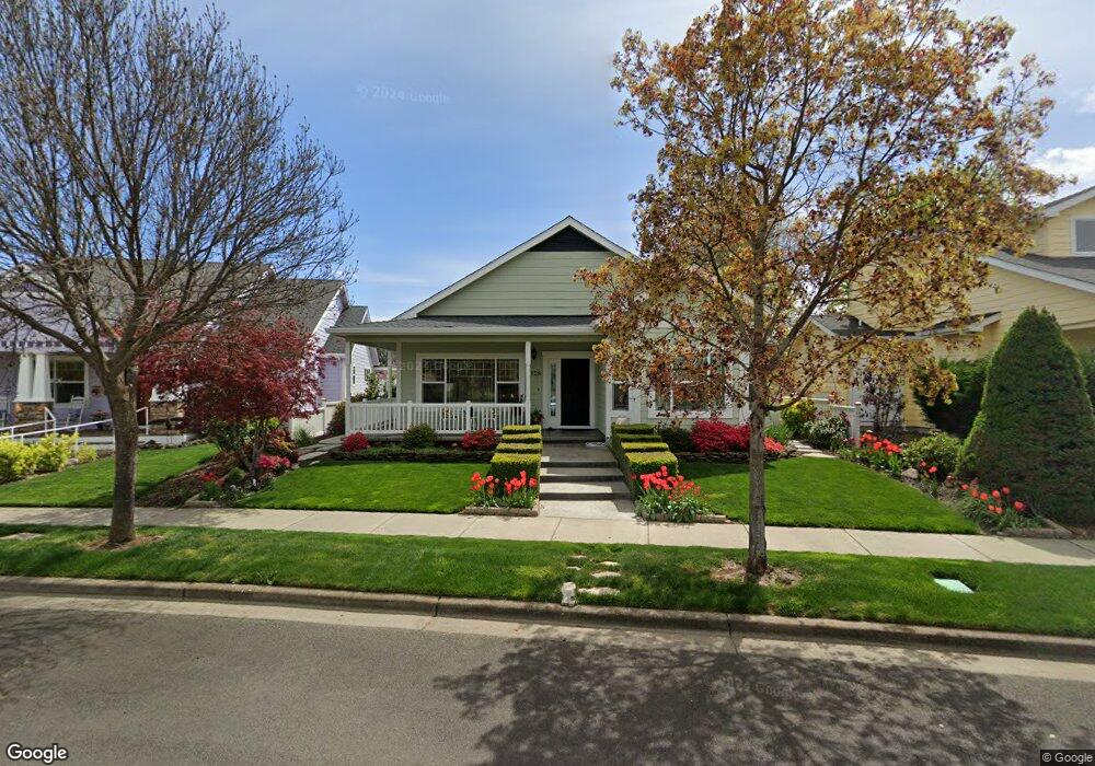
1128 Buck Point St Central Point, OR 97502
Estimated Value: $490,693 - $506,000
3
Beds
2
Baths
1,740
Sq Ft
$287/Sq Ft
Est. Value
About This Home
This home is located at 1128 Buck Point St, Central Point, OR 97502 and is currently estimated at $499,173, approximately $286 per square foot. 1128 Buck Point St is a home located in Jackson County with nearby schools including Richardson Elementary School, Scenic Middle School, and Crater High School.
Ownership History
Date
Name
Owned For
Owner Type
Purchase Details
Closed on
Apr 30, 2024
Sold by
Keefe William and Nieto-Keefe Joyce
Bought by
William F Keefe And Joyce Nieto Keefe Joint R and Keefe
Current Estimated Value
Purchase Details
Closed on
May 9, 2005
Sold by
Wickman Mark
Bought by
Keefe William and Nieto Keefe Joyce
Create a Home Valuation Report for This Property
The Home Valuation Report is an in-depth analysis detailing your home's value as well as a comparison with similar homes in the area
Home Values in the Area
Average Home Value in this Area
Purchase History
| Date | Buyer | Sale Price | Title Company |
|---|---|---|---|
| William F Keefe And Joyce Nieto Keefe Joint R | -- | None Listed On Document | |
| Keefe William | $269,900 | Lawyers Title Ins | |
| Wickman Mark | $70,000 | -- |
Source: Public Records
Tax History Compared to Growth
Tax History
| Year | Tax Paid | Tax Assessment Tax Assessment Total Assessment is a certain percentage of the fair market value that is determined by local assessors to be the total taxable value of land and additions on the property. | Land | Improvement |
|---|---|---|---|---|
| 2025 | $4,615 | $277,580 | $105,580 | $172,000 |
| 2024 | $4,615 | $269,500 | $102,510 | $166,990 |
| 2023 | $4,467 | $261,660 | $99,530 | $162,130 |
| 2022 | $4,362 | $261,660 | $99,530 | $162,130 |
| 2021 | $4,238 | $254,040 | $96,630 | $157,410 |
| 2020 | $4,114 | $246,650 | $93,820 | $152,830 |
| 2019 | $4,013 | $232,500 | $88,430 | $144,070 |
| 2018 | $3,890 | $225,730 | $85,850 | $139,880 |
| 2017 | $3,793 | $225,730 | $85,850 | $139,880 |
| 2016 | $3,682 | $212,780 | $80,920 | $131,860 |
| 2015 | $3,528 | $212,780 | $80,920 | $131,860 |
| 2014 | $3,438 | $200,580 | $76,280 | $124,300 |
Source: Public Records
Map
Nearby Homes
- 1159 Rustler Peak St
- 526 Stone Pointe Dr
- 629 Bridge Creek Dr
- 1317 River Run St
- 1407 Rustler Peak St
- 1167 Boulder Ridge St
- 1135 Shake Dr
- 0 Boulder Ridge St
- 1134 Steamboat Dr
- 426 Bridge Creek Dr
- 349 Cascade Dr
- 422 Castle Rock Dr
- 327 Brookhaven Dr
- 413 Sand Pointe Dr
- 356 Marian Ave Unit 40
- 626 Griffin Oaks Dr
- 4626 N Pacific Hwy
- 905 Comet Ave
- 407 Silver Creek Dr
- 335 Applewood Dr
- 1132 Buck Point St
- 1122 Buck Point St
- 1118 Buck Point St
- 1136 Grouse Ridge Dr
- 1167 Rustler Peak St
- 1175 Rustler Peak St
- 1132 Grouse Ridge Dr
- 1116 Buck Point St
- 1140 Grouse Ridge Dr
- 1151 Rustler Peak St
- 1130 Grouse Ridge Dr
- 1143 Rustler Peak St
- 1144 Grouse Ridge Dr
- 1114 Buck Point St
- 1135 Rustler Peak St
- 1127 Rustler Peak St
- 1128 Grouse Ridge Dr
- 1119 Rustler Peak St
- 1124 Grouse Ridge Dr
- 1166 Rustler Peak St