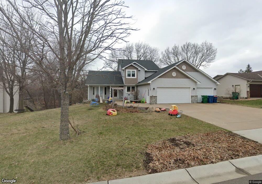
11291 Pheasant Ln N Maple Grove, MN 55369
Estimated Value: $529,000 - $542,482
6
Beds
4
Baths
3,130
Sq Ft
$172/Sq Ft
Est. Value
About This Home
This home is located at 11291 Pheasant Ln N, Maple Grove, MN 55369 and is currently estimated at $538,621, approximately $172 per square foot. 11291 Pheasant Ln N is a home located in Hennepin County with nearby schools including Cedar Island Elementary School, Maple Grove Middle School, and Osseo Senior High School.
Ownership History
Date
Name
Owned For
Owner Type
Purchase Details
Closed on
Dec 5, 2019
Sold by
Johnson Jeffrey L and Johnson Beth A
Bought by
Ender Levi C and Ender Sarah Person
Current Estimated Value
Home Financials for this Owner
Home Financials are based on the most recent Mortgage that was taken out on this home.
Original Mortgage
$327,200
Interest Rate
3.73%
Mortgage Type
New Conventional
Create a Home Valuation Report for This Property
The Home Valuation Report is an in-depth analysis detailing your home's value as well as a comparison with similar homes in the area
Home Values in the Area
Average Home Value in this Area
Purchase History
| Date | Buyer | Sale Price | Title Company |
|---|---|---|---|
| Ender Levi C | $409,900 | Titlesmart Inc |
Source: Public Records
Mortgage History
| Date | Status | Borrower | Loan Amount |
|---|---|---|---|
| Previous Owner | Ender Levi C | $327,200 |
Source: Public Records
Tax History
| Year | Tax Paid | Tax Assessment Tax Assessment Total Assessment is a certain percentage of the fair market value that is determined by local assessors to be the total taxable value of land and additions on the property. | Land | Improvement |
|---|---|---|---|---|
| 2024 | $6,599 | $499,800 | $137,000 | $362,800 |
| 2023 | $5,751 | $445,700 | $89,000 | $356,700 |
| 2022 | $4,890 | $460,600 | $96,600 | $364,000 |
| 2021 | $4,427 | $402,900 | $94,800 | $308,100 |
| 2020 | $4,451 | $360,400 | $76,600 | $283,800 |
| 2019 | $4,515 | $347,300 | $76,300 | $271,000 |
| 2018 | $4,455 | $333,600 | $77,500 | $256,100 |
| 2017 | $4,420 | $309,700 | $74,000 | $235,700 |
| 2016 | $4,530 | $312,300 | $84,000 | $228,300 |
| 2015 | $4,612 | $309,300 | $84,000 | $225,300 |
| 2014 | -- | $290,600 | $86,000 | $204,600 |
Source: Public Records
Map
Nearby Homes
- 11313 71st Ave N
- 7087 Wellington Ln N
- 11911 71st Ave N
- 6806 Deerwood Ln N
- 11081 69th Ave N
- 12060 71st Place N
- 6904 Ives Ln N
- 6905 Ives Ln N
- 6972 Trenton Ln N
- 6686 Ives Ln N
- 6576 Forestview Ln N
- 120 W Eagle Lake Dr
- 12688 74th Ave N Unit 36
- 9740 67th Ave N
- 8060 Central Park Way
- 11250 Red Fox Dr
- 8146 Balsam Ln N
- 8130 Central Park Way
- 11289 81st Way N
- 6340 Larch Ln N
- 11315 Pheasant Ln N
- 11279 Pheasant Ln N
- 11331 71st Place N
- 11267 Pheasant Ln N
- 11298 72nd Ave N
- 11289 72nd Ave N
- 11289 11289 72nd-Avenue-n
- 11255 Pheasant Ln N
- 11359 71st Place N
- 11343 Pheasant Ln N
- 11286 72nd Ave N
- 7240 Balsam Ln N
- 11257 72nd Ave N
- 11243 Pheasant Ln N
- 11272 Pheasant Ln N
- 11205 72nd Ave N
- 11260 Pheasant Ln N
- 11387 71st Place N
- 7250 Balsam Ln N
- 11384 71st Place N
Your Personal Tour Guide
Ask me questions while you tour the home.