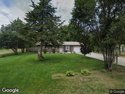
113 Hunts Ave Fruitland, IA 52749
Estimated Value: $204,000 - $232,461
3
Beds
2
Baths
960
Sq Ft
$233/Sq Ft
Est. Value
About This Home
This home is located at 113 Hunts Ave, Fruitland, IA 52749 and is currently estimated at $223,865, approximately $233 per square foot. 113 Hunts Ave is a home located in Muscatine County with nearby schools including Louisa-Muscatine Elementary School and Louisa-Muscatine High School.
Ownership History
Date
Name
Owned For
Owner Type
Purchase Details
Closed on
Oct 12, 2015
Sold by
Robinson Todd A
Bought by
Colon Tina and Colon Felix
Current Estimated Value
Home Financials for this Owner
Home Financials are based on the most recent Mortgage that was taken out on this home.
Original Mortgage
$113,850
Interest Rate
3.84%
Mortgage Type
New Conventional
Create a Home Valuation Report for This Property
The Home Valuation Report is an in-depth analysis detailing your home's value as well as a comparison with similar homes in the area
Home Values in the Area
Average Home Value in this Area
Purchase History
| Date | Buyer | Sale Price | Title Company |
|---|---|---|---|
| Colon Tina | $126,500 | None Available |
Source: Public Records
Mortgage History
| Date | Status | Borrower | Loan Amount |
|---|---|---|---|
| Closed | Colon Tina | $15,217 | |
| Closed | Colon Tina | $113,850 | |
| Previous Owner | Robinson Todd A | $110,500 | |
| Previous Owner | Robinson Todd A | $35,000 |
Source: Public Records
Tax History Compared to Growth
Tax History
| Year | Tax Paid | Tax Assessment Tax Assessment Total Assessment is a certain percentage of the fair market value that is determined by local assessors to be the total taxable value of land and additions on the property. | Land | Improvement |
|---|---|---|---|---|
| 2024 | $2,979 | $234,900 | $16,500 | $218,400 |
| 2023 | $2,955 | $245,931 | $16,494 | $229,437 |
| 2022 | $2,402 | $205,910 | $15,560 | $190,350 |
| 2021 | $2,384 | $172,230 | $15,560 | $156,670 |
| 2020 | $2,199 | $168,210 | $15,560 | $152,650 |
| 2019 | $2,131 | $141,190 | $0 | $0 |
| 2018 | $1,864 | $129,300 | $0 | $0 |
| 2017 | $1,811 | $128,530 | $0 | $0 |
| 2016 | $1,612 | $115,190 | $0 | $0 |
| 2015 | $1,612 | $108,520 | $0 | $0 |
| 2014 | $1,484 | $108,520 | $0 | $0 |
Source: Public Records
Map
Nearby Homes
- 121 Turkey Rd
- 0 Unit 24-52
- 203 Meadow View Ln
- 102 Summer Place
- 143 Emerald Ln
- 6702 Mcintire Rd
- 2348 57th St S
- 17138 County Road X61
- 1034 Kammerer Ct
- 2282 Mittman Rd
- 0 Burlington Rd
- 2253 Ridgeview Dr
- 1909 Wallace St
- 1908 Sampson St
- PARCEL
- 14391 Buttercup Ln
- 1706 Baker Ave
- 219 N Main St
- 206 E Jackson St
- 0 Towhead Island Unit 23-716