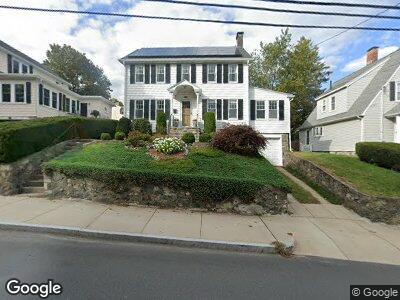
113 Savin St Malden, MA 02148
West End NeighborhoodEstimated Value: $779,277 - $830,000
3
Beds
2
Baths
1,630
Sq Ft
$497/Sq Ft
Est. Value
About This Home
This home is located at 113 Savin St, Malden, MA 02148 and is currently estimated at $810,069, approximately $496 per square foot. 113 Savin St is a home located in Middlesex County with nearby schools including Malden High School, Mystic Valley Regional Charter School, and Cheverus Catholic School.
Ownership History
Date
Name
Owned For
Owner Type
Purchase Details
Closed on
Feb 4, 2009
Sold by
Stafford Lawrence J
Bought by
Schroeder Maria and Tinstman Michael
Current Estimated Value
Home Financials for this Owner
Home Financials are based on the most recent Mortgage that was taken out on this home.
Original Mortgage
$262,000
Interest Rate
5.2%
Mortgage Type
Purchase Money Mortgage
Purchase Details
Closed on
Nov 15, 2000
Sold by
Grant Eleanor D Est and Coyne Kathryn G
Bought by
Stafford Lawrence J and Stafford Rose Marie
Create a Home Valuation Report for This Property
The Home Valuation Report is an in-depth analysis detailing your home's value as well as a comparison with similar homes in the area
Home Values in the Area
Average Home Value in this Area
Purchase History
| Date | Buyer | Sale Price | Title Company |
|---|---|---|---|
| Schroeder Maria | $327,500 | -- | |
| Stafford Lawrence J | $277,500 | -- |
Source: Public Records
Mortgage History
| Date | Status | Borrower | Loan Amount |
|---|---|---|---|
| Open | Tinstman Michael D | $241,000 | |
| Closed | Stafford Lawrence J | $262,000 | |
| Closed | Schroeder Maria | $262,000 | |
| Previous Owner | Stafford Lawrence J | $100,000 |
Source: Public Records
Tax History Compared to Growth
Tax History
| Year | Tax Paid | Tax Assessment Tax Assessment Total Assessment is a certain percentage of the fair market value that is determined by local assessors to be the total taxable value of land and additions on the property. | Land | Improvement |
|---|---|---|---|---|
| 2025 | $75 | $665,600 | $324,800 | $340,800 |
| 2024 | $7,229 | $618,400 | $301,900 | $316,500 |
| 2023 | $6,989 | $573,300 | $274,800 | $298,500 |
| 2022 | $6,726 | $544,600 | $254,000 | $290,600 |
| 2021 | $6,737 | $548,200 | $238,600 | $309,600 |
| 2020 | $6,658 | $526,300 | $227,300 | $299,000 |
| 2019 | $6,307 | $475,300 | $216,500 | $258,800 |
| 2018 | $6,314 | $448,100 | $199,800 | $248,300 |
| 2017 | $6,133 | $432,800 | $191,500 | $241,300 |
| 2016 | $5,844 | $385,500 | $168,600 | $216,900 |
| 2015 | $5,823 | $370,200 | $160,300 | $209,900 |
| 2014 | $5,501 | $341,700 | $145,700 | $196,000 |
Source: Public Records
Map
Nearby Homes
- 15 Desmond Rd
- 142 Hawthorne St
- 93 Cedar Rd N
- 30 Murray Hill Rd
- 21 Wilson St
- 27 Doonan St
- 179 Glenwood St
- 58 Watervale Rd
- 95-99 Maple St Unit 20
- 95 Maple St Unit 21
- 21 Elm St Unit 3
- 21 Elm St Unit 4
- 44 Clematis Rd
- 90 Watervale Rd
- 145 Glenwood St Unit 201
- 39 Mccormack Ave
- 72 Vista Ave
- 103 Glen St
- 14 Rockland Ave Unit 5
- 67 Watts St
- 113 Savin St
- 119 Savin St
- 109 Savin St
- 79 Fellsmere Rd
- 83 Fellsmere Rd
- 20 Cushing Rd
- 87 Fellsmere Rd
- 57 Fellsmere Rd
- 53 Fellsmere Rd
- 11 Cushing Rd
- 11 Cushing Rd (Lot 4)
- 5 Cushing Rd
- 91 Fellsmere Rd
- 23 Fellsmere Rd
- 27 Fellsmere Rd
- 78 Fellsmere Rd
- 70 Fellsmere Rd Unit 72
- 35 Fellsmere Rd
- 49 Fellsmere Rd
- 90 Fellsmere Rd Unit 92