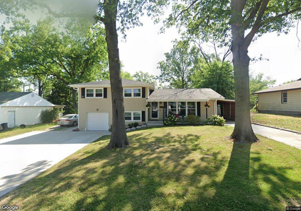
1130 Ringo St Mexico, MO 65265
Estimated Value: $176,000 - $212,000
4
Beds
2
Baths
1,728
Sq Ft
$114/Sq Ft
Est. Value
About This Home
This home is located at 1130 Ringo St, Mexico, MO 65265 and is currently estimated at $197,659, approximately $114 per square foot. 1130 Ringo St is a home located in Audrain County with nearby schools including Mexico High School, St. Brendan School, and Missouri Military Academy.
Ownership History
Date
Name
Owned For
Owner Type
Purchase Details
Closed on
Apr 27, 2017
Sold by
Demint Mitchell T and Demint Heather D
Bought by
Wilson Samantha J
Current Estimated Value
Home Financials for this Owner
Home Financials are based on the most recent Mortgage that was taken out on this home.
Original Mortgage
$112,100
Outstanding Balance
$92,630
Interest Rate
4.3%
Mortgage Type
New Conventional
Estimated Equity
$105,030
Purchase Details
Closed on
Jan 1, 2005
Bought by
Demint Mitchell T and Demint Heather D
Create a Home Valuation Report for This Property
The Home Valuation Report is an in-depth analysis detailing your home's value as well as a comparison with similar homes in the area
Home Values in the Area
Average Home Value in this Area
Purchase History
| Date | Buyer | Sale Price | Title Company |
|---|---|---|---|
| Wilson Samantha J | $140,125 | -- | |
| Demint Mitchell T | $96,000 | -- |
Source: Public Records
Mortgage History
| Date | Status | Borrower | Loan Amount |
|---|---|---|---|
| Open | Wilson Samantha J | $112,100 |
Source: Public Records
Tax History
| Year | Tax Paid | Tax Assessment Tax Assessment Total Assessment is a certain percentage of the fair market value that is determined by local assessors to be the total taxable value of land and additions on the property. | Land | Improvement |
|---|---|---|---|---|
| 2025 | $1,582 | $22,940 | $2,280 | $20,660 |
| 2024 | $1,435 | $20,890 | $2,280 | $18,610 |
| 2023 | $1,433 | $20,890 | $2,280 | $18,610 |
| 2022 | $1,403 | $20,890 | $2,280 | $18,610 |
| 2021 | $1,385 | $20,890 | $2,280 | $18,610 |
| 2020 | $1,354 | $20,890 | $2,280 | $18,610 |
| 2019 | $1,367 | $20,890 | $2,280 | $18,610 |
| 2018 | $1,357 | $0 | $0 | $0 |
| 2017 | $1,357 | $0 | $0 | $0 |
| 2012 | $1,026 | $17,430 | $0 | $0 |
Source: Public Records
Map
Nearby Homes
- 1211 Kent Rd
- 1104 Ringo St
- 1021 Robinhood Rd
- 817 Savannah Ct
- 1009 Concordia St
- 1921 Cherry St
- 608 W Pearson St
- 21231 Highway Ff
- 534 W Maple St Unit 1
- TRACT 3 State Highway Ff
- 20749 Audrain Road 918
- 601 Fairground St
- TBD Harwood St
- 917 Harwood St
- 905 Harwood St
- Km 41.8 Carret Fed Mex Chip Leonardo Bravo Plaza Route
- 1302 N Clark St
- 637 Quisenberry St
- 1403 N Washington St
- 1211 N Jefferson St
Your Personal Tour Guide
Ask me questions while you tour the home.