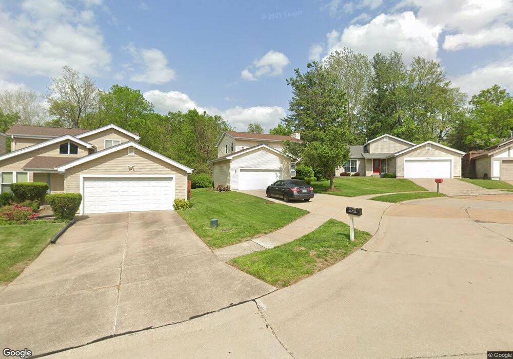
11307 Meadowside Dr Saint Louis, MO 63146
Estimated Value: $307,184 - $341,000
3
Beds
3
Baths
1,651
Sq Ft
$194/Sq Ft
Est. Value
About This Home
This home is located at 11307 Meadowside Dr, Saint Louis, MO 63146 and is currently estimated at $320,796, approximately $194 per square foot. 11307 Meadowside Dr is a home located in St. Louis County with nearby schools including Willow Brook Elementary School, Pattonville Heights Middle School, and Pattonville High School.
Ownership History
Date
Name
Owned For
Owner Type
Purchase Details
Closed on
Oct 30, 1998
Sold by
Ohara James C and Ohara Deborah G
Bought by
Burton George and Burton Denetra
Current Estimated Value
Home Financials for this Owner
Home Financials are based on the most recent Mortgage that was taken out on this home.
Original Mortgage
$115,000
Outstanding Balance
$24,419
Interest Rate
6.55%
Estimated Equity
$296,377
Create a Home Valuation Report for This Property
The Home Valuation Report is an in-depth analysis detailing your home's value as well as a comparison with similar homes in the area
Home Values in the Area
Average Home Value in this Area
Purchase History
| Date | Buyer | Sale Price | Title Company |
|---|---|---|---|
| Burton George | $131,000 | -- |
Source: Public Records
Mortgage History
| Date | Status | Borrower | Loan Amount |
|---|---|---|---|
| Open | Burton George | $115,000 |
Source: Public Records
Tax History
| Year | Tax Paid | Tax Assessment Tax Assessment Total Assessment is a certain percentage of the fair market value that is determined by local assessors to be the total taxable value of land and additions on the property. | Land | Improvement |
|---|---|---|---|---|
| 2025 | $3,357 | $58,410 | $12,390 | $46,020 |
| 2024 | $3,357 | $47,840 | $6,950 | $40,890 |
| 2023 | $3,369 | $47,840 | $6,950 | $40,890 |
| 2022 | $3,197 | $41,310 | $10,070 | $31,240 |
| 2021 | $3,180 | $41,310 | $10,070 | $31,240 |
| 2020 | $2,956 | $36,860 | $7,750 | $29,110 |
| 2019 | $2,938 | $36,860 | $7,750 | $29,110 |
| 2018 | $2,716 | $31,220 | $7,750 | $23,470 |
| 2017 | $2,723 | $31,220 | $7,750 | $23,470 |
| 2016 | $2,789 | $31,390 | $4,520 | $26,870 |
Source: Public Records
Map
Nearby Homes
- 11276 Pineside Dr
- 1467 Willow Brook Cove Unit C1467
- 1380 Willow Brook Cove Ct Unit 1
- 1411 Willow Brook Cove Unit 8
- 11120 Queensway Dr
- 11152 Port Royal Dr
- 118 Brookside Ct
- 11640 Cedar Walk Dr
- 11636 Cedar Walk Dr Unit 155
- 141 Meadowlark Dr
- 156 Forest Brook Ln
- 1840 Misty Moss Dr
- 11648 Villa Dorado Dr
- 1833 Misty Moss Dr Unit 241
- 1801 Misty Moss Dr Unit 233
- 10367 Oxford Hill Dr Unit 26
- 10381 Oxford Hill Dr Unit 6
- 10381 Oxford Hill Dr Unit 14
- 31 Ranch Ct
- 1747 Russet Valley Dr Unit 63
- 11315 Meadowside Dr
- 11301 Meadowside Dr
- 11321 Meadowside Dr
- 1624 Meadowside Dr
- 1661 Rishon Hill Dr
- 1618 Meadowside Dr
- 11327 Meadowside Dr
- 1639 Rishon Hill Dr
- 1647 Rishon Hill Dr
- 1631 Rishon Hill Dr
- 1669 Rishon Hill Dr
- 1612 Meadowside Dr
- 1627 Rishon Hill Dr
- 11322 Meadowside Dr
- 11314 Meadowside Dr
- 11333 Meadowside Dr
- 1621 Rishon Hill Dr
- 11328 Meadowside Dr
- 1611 Meadowside Dr
- 1606 Meadowside Dr
Your Personal Tour Guide
Ask me questions while you tour the home.