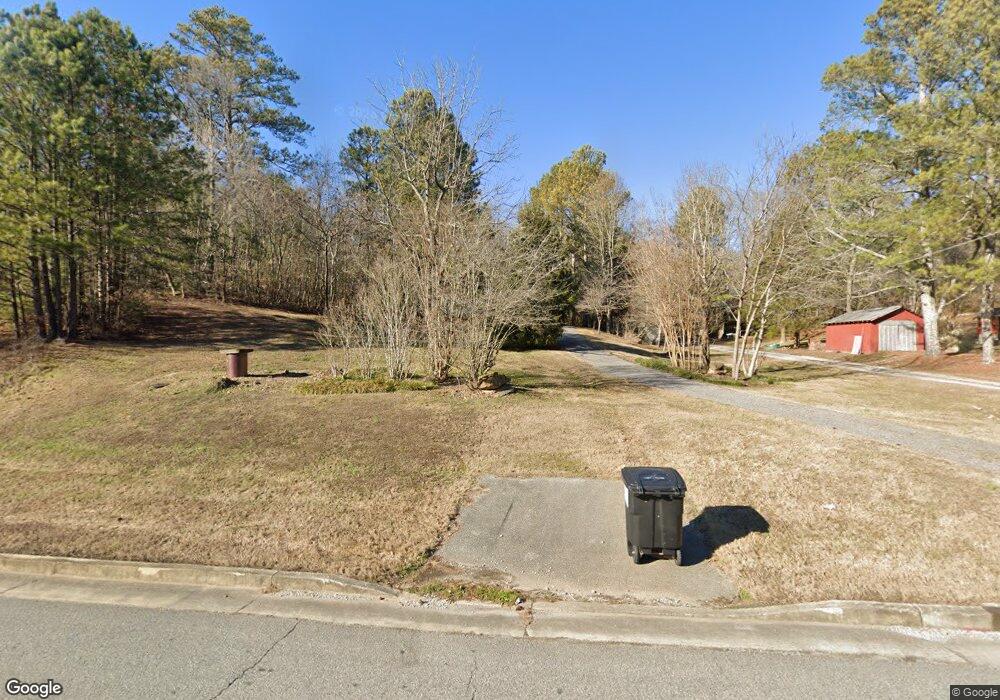
11309 Bates Rd Apison, TN 37302
Estimated Value: $154,000 - $255,000
Studio
--
Bath
864
Sq Ft
$244/Sq Ft
Est. Value
About This Home
This home is located at 11309 Bates Rd, Apison, TN 37302 and is currently estimated at $210,553, approximately $243 per square foot. 11309 Bates Rd is a home located in Hamilton County with nearby schools including Apison Elementary School, East Hamilton Middle School, and East Hamilton School.
Ownership History
Date
Name
Owned For
Owner Type
Purchase Details
Closed on
Apr 3, 2017
Sold by
Rex R Parton
Bought by
Duffy Patricia and Duffy Kevin
Current Estimated Value
Home Financials for this Owner
Home Financials are based on the most recent Mortgage that was taken out on this home.
Original Mortgage
$60,000
Outstanding Balance
$49,353
Interest Rate
4.14%
Estimated Equity
$161,200
Purchase Details
Closed on
Jul 7, 2015
Sold by
Parton Rex R
Bought by
Parton Nancy Gail
Purchase Details
Closed on
Jul 26, 2004
Sold by
Parton Rex R
Bought by
Hamilton County
Purchase Details
Closed on
Feb 26, 2001
Sold by
Jean Parton Ella
Bought by
Parton Rex R
Create a Home Valuation Report for This Property
The Home Valuation Report is an in-depth analysis detailing your home's value as well as a comparison with similar homes in the area
Home Values in the Area
Average Home Value in this Area
Purchase History
| Date | Buyer | Sale Price | Title Company |
|---|---|---|---|
| Duffy Patricia | -- | -- | |
| Parton Nancy Gail | -- | None Available | |
| Hamilton County | $400 | -- | |
| Parton Rex R | $33,000 | Legal Title & Escrow Inc |
Source: Public Records
Mortgage History
| Date | Status | Borrower | Loan Amount |
|---|---|---|---|
| Open | Duffy Patricia | $60,000 | |
| Closed | Duffy Patricia | -- |
Source: Public Records
Tax History
| Year | Tax Paid | Tax Assessment Tax Assessment Total Assessment is a certain percentage of the fair market value that is determined by local assessors to be the total taxable value of land and additions on the property. | Land | Improvement |
|---|---|---|---|---|
| 2025 | $667 | $44,025 | $0 | $0 |
| 2024 | $659 | $29,475 | $0 | $0 |
| 2023 | $659 | $29,475 | $0 | $0 |
| 2022 | $659 | $29,475 | $0 | $0 |
| 2021 | $659 | $29,475 | $0 | $0 |
| 2020 | $648 | $23,425 | $0 | $0 |
| 2019 | $648 | $23,425 | $0 | $0 |
| 2018 | $648 | $23,425 | $0 | $0 |
| 2017 | $648 | $23,425 | $0 | $0 |
| 2016 | $560 | $0 | $0 | $0 |
| 2015 | $560 | $20,250 | $0 | $0 |
| 2014 | $560 | $0 | $0 | $0 |
Source: Public Records
Map
Nearby Homes
- 5014 Orchard Dr
- 5027 Jackson Rd
- 4917 Dresden Loop
- 4917 Dresden Lp
- 11056 Valmont Ln
- 11052 Valmont Ln
- 11053 Valmont Ln
- 11049 Valmont Ln
- 11045 Valmont Ln
- 4421 Clonts Rd
- 3528 Morning Dew Cove
- 3167 Grassland Cir
- 3179 Grassland Cir
- 3187 Grassland Cir
- 3297 Grassland Cir
- 10700 Lonnie Ln
- 10849 Prairie Lake Dr
- Robie Plan at Prairie Pass
- Salem Plan at Prairie Pass
- Edmon Plan at Prairie Pass
- 11319 Bates Rd
- 0 Bates Rd
- 0 Bates Rd Unit 1100919
- 11311 Bates Rd
- 11313 Bates Rd
- 11303 Apison Pike
- 11311 Apison Pike
- 11284 Kauai Trail
- 11271 Kauai Trail
- 11207 Kauai Trail
- 11325 Bates Rd
- 0 E Brainerd Rd
- 0 E Brainerd Rd Unit 1333150
- 0 E Brainerd Rd Unit 1303864
- 0 E Brainerd Rd Unit 1318853
- 0 E Brainerd Rd Unit 1286002
- 0 E Brainerd Rd Unit 1263531
- 0 E Brainerd Rd Unit RTC2742511
- 0 E Brainerd Rd Unit RTC2730471
- 0 E Brainerd Rd Unit RTC2727709
