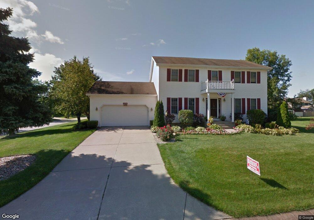
11310 Nicole Dr N Granger, IN 46530
Estimated Value: $339,000 - $416,000
3
Beds
3
Baths
1,994
Sq Ft
$188/Sq Ft
Est. Value
About This Home
This home is located at 11310 Nicole Dr N, Granger, IN 46530 and is currently estimated at $374,393, approximately $187 per square foot. 11310 Nicole Dr N is a home located in St. Joseph County with nearby schools including Horizon Elementary School, Discovery Middle School, and Penn High School.
Ownership History
Date
Name
Owned For
Owner Type
Purchase Details
Closed on
Jul 19, 2006
Sold by
Hopkins David R and Hopkins Cynthia S
Bought by
Auto Owners Inbsurance Companu
Current Estimated Value
Purchase Details
Closed on
Dec 13, 2005
Sold by
Auto Owners Insurance Company
Bought by
Weller Robert D and Weller Ann Marie
Home Financials for this Owner
Home Financials are based on the most recent Mortgage that was taken out on this home.
Original Mortgage
$129,000
Interest Rate
6.33%
Mortgage Type
New Conventional
Create a Home Valuation Report for This Property
The Home Valuation Report is an in-depth analysis detailing your home's value as well as a comparison with similar homes in the area
Home Values in the Area
Average Home Value in this Area
Purchase History
| Date | Buyer | Sale Price | Title Company |
|---|---|---|---|
| Auto Owners Inbsurance Companu | -- | Meridian Title Corp | |
| Weller Robert D | -- | Meridian Title Corp |
Source: Public Records
Mortgage History
| Date | Status | Borrower | Loan Amount |
|---|---|---|---|
| Previous Owner | Weller Robert D | $129,000 |
Source: Public Records
Tax History Compared to Growth
Tax History
| Year | Tax Paid | Tax Assessment Tax Assessment Total Assessment is a certain percentage of the fair market value that is determined by local assessors to be the total taxable value of land and additions on the property. | Land | Improvement |
|---|---|---|---|---|
| 2024 | $2,076 | $253,400 | $114,600 | $138,800 |
| 2023 | $2,260 | $253,600 | $114,600 | $139,000 |
| 2022 | $2,260 | $253,800 | $114,600 | $139,200 |
| 2021 | $1,288 | $153,800 | $23,300 | $130,500 |
| 2020 | $1,242 | $151,900 | $23,300 | $128,600 |
| 2019 | $1,217 | $149,300 | $20,700 | $128,600 |
| 2018 | $1,209 | $150,500 | $20,700 | $129,800 |
| 2017 | $1,223 | $147,300 | $20,700 | $126,600 |
| 2016 | $1,250 | $148,600 | $20,700 | $127,900 |
| 2014 | $1,279 | $147,000 | $20,700 | $126,300 |
Source: Public Records
Map
Nearby Homes
- 11580 Anderson Rd
- 11540 Greyson Alan Dr
- 11963 Peacock Cir
- 11560 Greyson Alan Dr
- 11500 Greyson Alan Dr
- 51150 Mason James Dr
- 11070 Birch Lake Dr
- 10700 Adams Rd
- 50778 Brownstone Dr
- 11487 Wilkins Mill Dr
- 10360 Red Raspberry Ln
- 51891 Covered Wagon Trail
- 50630 Mohawk Dr
- 51401 Hunters Crossing Ct
- 52303 Broken Arrow Dr
- 50633 Weeping Willow Run W
- 11625 Sharpe Bridge Ct
- 12223 Painted Ridge Trail
- 11795 Park Ln N
- 52290 Ash Rd
- 11340 Nicole Dr N
- 11313 Nicole Dr S
- 11311 Nicole Dr N
- 11341 Nicole Dr S
- 51846 Cybil Dr
- 11333 Nicole Dr N
- 51780 Cybil Dr
- 11360 Nicole Dr N
- 11363 Nicole Dr S
- 11355 Nicole Dr N
- 11312 Nicole Dr S
- 11344 Nicole Dr S
- 11362 Nicole Dr S
- 11377 Nicole Dr N
- 51811 Nicole Dr W
- 11327 Anderson Lake Dr
- 11236 Anderson Rd
- 11271 Anderson Lake Dr
- 11347 Anderson Lake Dr
- 11380 Nicole Dr S