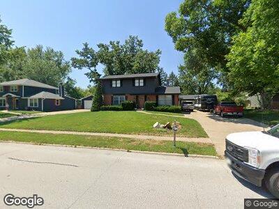
1132 39th St West Des Moines, IA 50266
Estimated Value: $347,000 - $394,000
4
Beds
3
Baths
2,316
Sq Ft
$157/Sq Ft
Est. Value
About This Home
This home is located at 1132 39th St, West Des Moines, IA 50266 and is currently estimated at $362,684, approximately $156 per square foot. 1132 39th St is a home located in Polk County with nearby schools including Crossroads Park Elementary School, Indian Hills Junior High School, and Valley Southwoods Freshman High School.
Ownership History
Date
Name
Owned For
Owner Type
Purchase Details
Closed on
Apr 11, 2013
Sold by
K Life Ministries Inc
Bought by
Stec Anthony Paul and Stec Ann Mellisa
Current Estimated Value
Home Financials for this Owner
Home Financials are based on the most recent Mortgage that was taken out on this home.
Original Mortgage
$121,125
Interest Rate
3.46%
Mortgage Type
New Conventional
Purchase Details
Closed on
Sep 21, 2001
Sold by
Blackburn Rebecca Sue and Schulte Richard M
Bought by
K Life Of Des Moines Inc
Purchase Details
Closed on
Aug 11, 2000
Sold by
Schulte Robert D and Schulte Betty J
Bought by
K Life Ministries Inc
Home Financials for this Owner
Home Financials are based on the most recent Mortgage that was taken out on this home.
Original Mortgage
$118,400
Interest Rate
8.26%
Create a Home Valuation Report for This Property
The Home Valuation Report is an in-depth analysis detailing your home's value as well as a comparison with similar homes in the area
Home Values in the Area
Average Home Value in this Area
Purchase History
| Date | Buyer | Sale Price | Title Company |
|---|---|---|---|
| Stec Anthony Paul | $127,500 | None Available | |
| K Life Of Des Moines Inc | $141,500 | -- |
Source: Public Records
Mortgage History
| Date | Status | Borrower | Loan Amount |
|---|---|---|---|
| Open | Stec Anthony Paul | $169,000 | |
| Closed | Stec Anthony Paul | $121,125 | |
| Previous Owner | K Life Of Des Moines Inc | $118,400 |
Source: Public Records
Tax History Compared to Growth
Tax History
| Year | Tax Paid | Tax Assessment Tax Assessment Total Assessment is a certain percentage of the fair market value that is determined by local assessors to be the total taxable value of land and additions on the property. | Land | Improvement |
|---|---|---|---|---|
| 2024 | $4,550 | $287,000 | $59,300 | $227,700 |
| 2023 | $4,502 | $287,000 | $59,300 | $227,700 |
| 2022 | $4,450 | $233,200 | $49,700 | $183,500 |
| 2021 | $4,284 | $233,200 | $49,700 | $183,500 |
| 2020 | $4,220 | $213,600 | $45,500 | $168,100 |
| 2019 | $3,984 | $213,600 | $45,500 | $168,100 |
| 2018 | $3,994 | $194,500 | $40,500 | $154,000 |
| 2017 | $3,448 | $194,500 | $40,500 | $154,000 |
| 2016 | $3,372 | $163,100 | $36,400 | $126,700 |
| 2015 | $3,372 | $163,100 | $36,400 | $126,700 |
| 2014 | $3,112 | $148,800 | $33,500 | $115,300 |
Source: Public Records
Map
Nearby Homes
- 1035 Clared Cir
- 1019 Maplenol Dr
- 1035 Belle Mar Dr
- 3308 Sylvania Dr
- 3405 Woodland Ave Unit 27
- 1112 Woodland Park Dr
- 1070 Woodland Park Dr
- 3500 Brookview Dr
- 1062 Woodland Park Dr
- 3215 Sylvania Dr
- 4665 Woodland Ave Unit 3
- 11257 Twilight Dr
- 4841 Woodland Ave Unit 6
- 4849 Woodland Ave Unit 3
- 4865 Woodland Ave Unit 1
- 742 34th St
- 1168 49th St Unit 1
- 1240 49th St Unit 5
- 4900 Pleasant St Unit 16
- 4918 W Park Dr Unit G3
- 1132 39th St
- 1124 39th St
- 1140 39th St
- 1133 Maplenol Dr
- 1125 Maplenol Dr
- 1141 Maplenol Dr
- 1116 39th St
- 1148 39th St
- 1117 Maplenol Dr
- 1149 Maplenol Dr
- 1108 39th St
- 1109 Maplenol Dr
- 1124 Maplenol Dr
- 1132 Maplenol Dr
- 1116 Maplenol Dr
- 3901 Francrest Dr
- 3905 Francrest Dr
- 1140 Maplenol Dr
- 1108 Maplenol Dr
- 3909 Francrest Dr