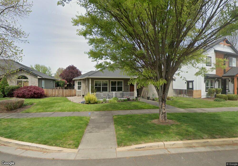
1132 Grouse Ridge Dr Central Point, OR 97502
Estimated Value: $476,464 - $529,000
3
Beds
2
Baths
1,703
Sq Ft
$292/Sq Ft
Est. Value
About This Home
This home is located at 1132 Grouse Ridge Dr, Central Point, OR 97502 and is currently estimated at $497,366, approximately $292 per square foot. 1132 Grouse Ridge Dr is a home located in Jackson County with nearby schools including Richardson Elementary School, Scenic Middle School, and Crater High School.
Ownership History
Date
Name
Owned For
Owner Type
Purchase Details
Closed on
Aug 23, 2004
Sold by
Michael A Susi Construction Llc
Bought by
Schwab Corey A and Schwab Kiley R
Current Estimated Value
Home Financials for this Owner
Home Financials are based on the most recent Mortgage that was taken out on this home.
Original Mortgage
$254,125
Outstanding Balance
$125,599
Interest Rate
5.95%
Mortgage Type
Credit Line Revolving
Estimated Equity
$371,767
Purchase Details
Closed on
Apr 16, 2004
Sold by
Twin Creeks Development Co Llc
Bought by
Michael A Susi Construction Llc
Create a Home Valuation Report for This Property
The Home Valuation Report is an in-depth analysis detailing your home's value as well as a comparison with similar homes in the area
Home Values in the Area
Average Home Value in this Area
Purchase History
| Date | Buyer | Sale Price | Title Company |
|---|---|---|---|
| Schwab Corey A | $267,500 | Lawyers Title Ins | |
| Michael A Susi Construction Llc | $138,000 | Lawyers Title Ins |
Source: Public Records
Mortgage History
| Date | Status | Borrower | Loan Amount |
|---|---|---|---|
| Open | Schwab Corey A | $254,125 |
Source: Public Records
Tax History Compared to Growth
Tax History
| Year | Tax Paid | Tax Assessment Tax Assessment Total Assessment is a certain percentage of the fair market value that is determined by local assessors to be the total taxable value of land and additions on the property. | Land | Improvement |
|---|---|---|---|---|
| 2025 | $3,732 | $224,460 | $99,540 | $124,920 |
| 2024 | $3,732 | $217,930 | $96,640 | $121,290 |
| 2023 | $3,612 | $211,590 | $93,830 | $117,760 |
| 2022 | $3,528 | $211,590 | $93,830 | $117,760 |
| 2021 | $3,427 | $205,430 | $91,090 | $114,340 |
| 2020 | $3,327 | $199,450 | $88,440 | $111,010 |
| 2019 | $3,245 | $188,010 | $83,360 | $104,650 |
| 2018 | $3,146 | $182,540 | $80,930 | $101,610 |
| 2017 | $3,067 | $182,540 | $80,930 | $101,610 |
| 2016 | $2,978 | $172,070 | $76,290 | $95,780 |
| 2015 | $2,853 | $172,070 | $76,290 | $95,780 |
| 2014 | $2,780 | $162,200 | $71,910 | $90,290 |
Source: Public Records
Map
Nearby Homes
- 1159 Rustler Peak St
- 526 Stone Pointe Dr
- 629 Bridge Creek Dr
- 1317 River Run St
- 1407 Rustler Peak St
- 1135 Shake Dr
- 1167 Boulder Ridge St
- 1134 Steamboat Dr
- 0 Boulder Ridge St
- 426 Bridge Creek Dr
- 349 Cascade Dr
- 327 Brookhaven Dr
- 422 Castle Rock Dr
- 626 Griffin Oaks Dr
- 413 Sand Pointe Dr
- 905 Comet Ave
- 356 Marian Ave Unit 40
- 4626 N Pacific Hwy
- 407 Silver Creek Dr
- 335 Applewood Dr
- 1130 Grouse Ridge Dr
- 1136 Grouse Ridge Dr
- 1128 Grouse Ridge Dr
- 1140 Grouse Ridge Dr
- 1043 Sandoz St
- 1128 Buck Point St
- 1132 Buck Point St
- 1144 Grouse Ridge Dr
- 1044 Sandoz St
- 1122 Buck Point St
- 1135 Rustler Peak St
- 1127 Rustler Peak St
- 1143 Rustler Peak St
- 1119 Rustler Peak St
- 1033 Sandoz St
- 1124 Grouse Ridge Dr
- 1151 Rustler Peak St
- 1040 Buck Point St
- 1118 Buck Point St
- 1040 Sandoz St