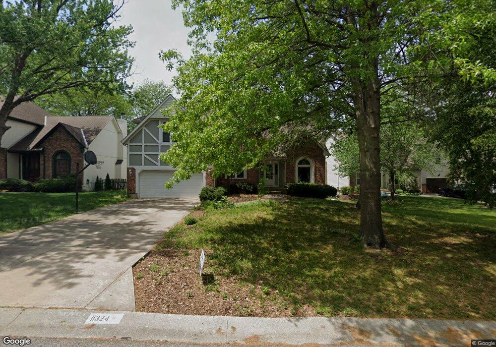
11324 Mullen Rd Lenexa, KS 66215
Estimated Value: $478,000 - $510,000
5
Beds
4
Baths
2,636
Sq Ft
$188/Sq Ft
Est. Value
About This Home
This home is located at 11324 Mullen Rd, Lenexa, KS 66215 and is currently estimated at $494,439, approximately $187 per square foot. 11324 Mullen Rd is a home located in Johnson County with nearby schools including Walnut Grove Elementary School, Pioneer Trail Middle School, and Olathe East Sr High School.
Ownership History
Date
Name
Owned For
Owner Type
Purchase Details
Closed on
Jan 27, 2020
Sold by
Creecy Michael Scott and Creecy Carmen R
Bought by
Creecy Michael Scott and Creecy Carmen R
Current Estimated Value
Home Financials for this Owner
Home Financials are based on the most recent Mortgage that was taken out on this home.
Original Mortgage
$256,410
Interest Rate
3.62%
Mortgage Type
FHA
Create a Home Valuation Report for This Property
The Home Valuation Report is an in-depth analysis detailing your home's value as well as a comparison with similar homes in the area
Home Values in the Area
Average Home Value in this Area
Purchase History
| Date | Buyer | Sale Price | Title Company |
|---|---|---|---|
| Creecy Michael Scott | -- | Avenue 365 Lender Svcs Llc |
Source: Public Records
Mortgage History
| Date | Status | Borrower | Loan Amount |
|---|---|---|---|
| Closed | Creecy Michael Scott | $256,410 |
Source: Public Records
Tax History
| Year | Tax Paid | Tax Assessment Tax Assessment Total Assessment is a certain percentage of the fair market value that is determined by local assessors to be the total taxable value of land and additions on the property. | Land | Improvement |
|---|---|---|---|---|
| 2025 | $6,126 | $51,002 | $9,900 | $41,102 |
| 2024 | $6,126 | $49,956 | $8,998 | $40,958 |
| 2023 | $5,770 | $46,080 | $8,175 | $37,905 |
| 2022 | $4,986 | $38,813 | $7,434 | $31,379 |
| 2021 | $5,198 | $38,445 | $6,760 | $31,685 |
| 2020 | $4,945 | $36,202 | $6,760 | $29,442 |
| 2019 | $4,762 | $34,592 | $5,881 | $28,711 |
| 2018 | $4,800 | $34,488 | $5,881 | $28,607 |
| 2017 | $4,549 | $31,958 | $5,116 | $26,842 |
| 2016 | $4,174 | $29,969 | $5,116 | $24,853 |
| 2015 | $3,849 | $27,611 | $5,116 | $22,495 |
| 2013 | -- | $26,140 | $4,876 | $21,264 |
Source: Public Records
Map
Nearby Homes
- 14202 W 115th St
- 14418 W 115th Terrace
- 14036 W 113th St
- 14028 W 113th St
- 13952 W 115th St
- 14004 W 113th St
- 11274 S Pflumm Rd
- 11388 S Pflumm Rd
- 11812 S Carriage Rd
- 11512 Noland St
- 13981 W 120th St
- 11931 S Rene St
- 12844 W 110th Terrace
- 12786 W 110th Terrace
- 12722 W 110th Terrace
- 10907 Gillette St
- 12659 W 110th Terrace
- 10902 Bradshaw St
- 10872 Bradshaw St
- 12604 W 110th Terrace
- 11328 Mullen Rd
- 11320 Mullen Rd
- 11325 Acuff Ln
- 11319 Acuff Ln
- 11332 Mullen Rd
- 11323 Mullen Rd
- 11317 Acuff Ln
- 11319 Mullen Rd
- 11327 Mullen Rd
- 11314 Mullen Rd
- 11331 Mullen Rd
- 11310 Mullen Rd
- 11315 Mullen Rd
- 11311 Mullen Rd
- 11313 Acuff Ln
- 11400 Mullen Rd
- 14290 W 114th St
- 14237 W 113th Terrace
- 11326 Acuff Ln
- 11403 Acuff Ln
Your Personal Tour Guide
Ask me questions while you tour the home.