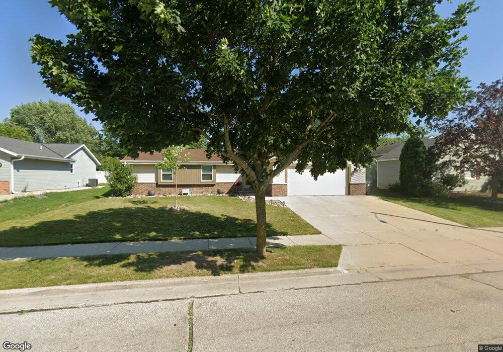
1133 Burr Oak Blvd Waukesha, WI 53189
Estimated Value: $373,000 - $415,931
3
Beds
2
Baths
1,440
Sq Ft
$277/Sq Ft
Est. Value
About This Home
This home is located at 1133 Burr Oak Blvd, Waukesha, WI 53189 and is currently estimated at $398,733, approximately $276 per square foot. 1133 Burr Oak Blvd is a home located in Waukesha County with nearby schools including Prairie Elementary School, Les Paul Middle School - Central Campus, and West High School.
Ownership History
Date
Name
Owned For
Owner Type
Purchase Details
Closed on
Jul 28, 2017
Sold by
Harman Andrew and Hayden Jessica
Bought by
Compton Kyle and Compton Sara
Current Estimated Value
Home Financials for this Owner
Home Financials are based on the most recent Mortgage that was taken out on this home.
Original Mortgage
$219,450
Outstanding Balance
$182,817
Interest Rate
3.9%
Mortgage Type
New Conventional
Estimated Equity
$215,916
Purchase Details
Closed on
May 30, 2013
Sold by
Schlut Carol
Bought by
Harmann Andrew and Hayden Jessica
Home Financials for this Owner
Home Financials are based on the most recent Mortgage that was taken out on this home.
Original Mortgage
$163,993
Interest Rate
3.34%
Mortgage Type
New Conventional
Purchase Details
Closed on
Feb 3, 2004
Sold by
Schultz Milton W
Bought by
Schlut Carol
Create a Home Valuation Report for This Property
The Home Valuation Report is an in-depth analysis detailing your home's value as well as a comparison with similar homes in the area
Home Values in the Area
Average Home Value in this Area
Purchase History
| Date | Buyer | Sale Price | Title Company |
|---|---|---|---|
| Compton Kyle | $231,000 | Knight Barry Title Inc | |
| Harmann Andrew | $179,900 | None Available | |
| Schlut Carol | -- | -- |
Source: Public Records
Mortgage History
| Date | Status | Borrower | Loan Amount |
|---|---|---|---|
| Open | Compton Kyle | $219,450 | |
| Previous Owner | Harmann Andrew | $163,993 |
Source: Public Records
Tax History Compared to Growth
Tax History
| Year | Tax Paid | Tax Assessment Tax Assessment Total Assessment is a certain percentage of the fair market value that is determined by local assessors to be the total taxable value of land and additions on the property. | Land | Improvement |
|---|---|---|---|---|
| 2024 | $5,136 | $345,700 | $67,400 | $278,300 |
| 2023 | $4,996 | $345,700 | $67,400 | $278,300 |
| 2022 | $4,643 | $242,200 | $66,000 | $176,200 |
| 2021 | $4,753 | $242,200 | $66,000 | $176,200 |
| 2020 | $4,592 | $242,200 | $66,000 | $176,200 |
| 2019 | $4,449 | $242,200 | $66,000 | $176,200 |
| 2018 | $4,083 | $218,200 | $58,200 | $160,000 |
| 2017 | $4,251 | $218,200 | $58,200 | $160,000 |
| 2016 | $3,867 | $194,800 | $56,300 | $138,500 |
| 2015 | $3,845 | $194,800 | $56,300 | $138,500 |
| 2014 | $4,010 | $194,800 | $56,300 | $138,500 |
| 2013 | $4,010 | $194,800 | $56,300 | $138,500 |
Source: Public Records
Map
Nearby Homes
- 2010 Dixie Dr
- 1722 Sycamore Dr
- 1210 Woodbury Common Unit C
- 1706 Haymarket Rd
- 1203 Woodbury Common Unit D
- 1101 Dogwood Ln
- 1909 Mallard Pointe Cir
- 1277 Market Place
- 1523 David Ln
- LtD59 White Deer Trail
- 812 Timber Ridge Ct Unit 10
- S54W25487 Pebble Brook Ct
- S54W25436 Pebble Brook Ct
- Lt6 Finch Ct
- 2415 Fox River Pkwy Unit H
- 801 Timber Ridge Dr
- 2426 Fox River Pkwy Unit G
- 300 Darlene Dr
- 2708 Fox Hill Dr
- 2700 Wyngate Way
- 1137 Burr Oak Blvd
- 1129 Burr Oak Blvd
- 1125 Burr Oak Blvd
- 2031 Chapman Dr
- 2021 Chapman Dr
- 2054 Dixie Dr
- 2046 Dixie Dr
- 2050 Dixie Dr
- 2017 Chapman Dr
- 1134 Burr Oak Blvd
- 2015 Chapman Dr
- 1132 Burr Oak Blvd
- 1121 Burr Oak Blvd
- 2032 Chapman Dr
- 2028 Chapman Dr
- 2042 Dixie Dr
- 1142 Burr Oak Blvd
- 1808 Burr Oak Ct
- 2036 Chapman Dr
- 2011 Chapman Dr