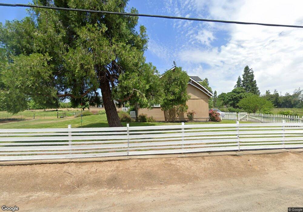
11331 E Service Rd Denair, CA 95316
Estimated Value: $427,000 - $973,000
4
Beds
1
Bath
3,112
Sq Ft
$221/Sq Ft
Est. Value
About This Home
This home is located at 11331 E Service Rd, Denair, CA 95316 and is currently estimated at $687,952, approximately $221 per square foot. 11331 E Service Rd is a home located in Stanislaus County.
Ownership History
Date
Name
Owned For
Owner Type
Purchase Details
Closed on
Apr 2, 2012
Sold by
Womack Jerry H
Bought by
Fife Mark and Fife Erin
Current Estimated Value
Home Financials for this Owner
Home Financials are based on the most recent Mortgage that was taken out on this home.
Original Mortgage
$194,880
Outstanding Balance
$134,124
Interest Rate
3.91%
Mortgage Type
FHA
Estimated Equity
$553,828
Purchase Details
Closed on
Aug 24, 2011
Sold by
Womack Jerry H
Bought by
Womack Jerry H and Womack Joann M
Create a Home Valuation Report for This Property
The Home Valuation Report is an in-depth analysis detailing your home's value as well as a comparison with similar homes in the area
Purchase History
| Date | Buyer | Sale Price | Title Company |
|---|---|---|---|
| Fife Mark | $200,000 | Chicago Title Company | |
| Womack Jerry H | -- | None Available |
Source: Public Records
Mortgage History
| Date | Status | Borrower | Loan Amount |
|---|---|---|---|
| Open | Fife Mark | $194,880 |
Source: Public Records
Tax History
| Year | Tax Paid | Tax Assessment Tax Assessment Total Assessment is a certain percentage of the fair market value that is determined by local assessors to be the total taxable value of land and additions on the property. | Land | Improvement |
|---|---|---|---|---|
| 2025 | $2,229 | $214,465 | $33,075 | $181,390 |
| 2024 | $2,255 | $210,261 | $32,427 | $177,834 |
| 2023 | $2,201 | $206,140 | $31,792 | $174,348 |
| 2022 | $2,162 | $202,099 | $31,169 | $170,930 |
| 2021 | $2,117 | $198,137 | $30,558 | $167,579 |
| 2020 | $2,086 | $196,106 | $30,245 | $165,861 |
| 2019 | $2,060 | $192,261 | $29,652 | $162,609 |
| 2018 | $1,996 | $188,492 | $29,071 | $159,421 |
| 2017 | $2,009 | $184,797 | $28,501 | $156,296 |
| 2016 | $1,920 | $181,175 | $27,943 | $153,232 |
| 2015 | $1,888 | $178,455 | $27,524 | $150,931 |
| 2014 | $1,865 | $174,960 | $26,985 | $147,975 |
Source: Public Records
Map
Nearby Homes
- 4621 Swanson Rd
- 955 Elma St
- 966 Elma St
- 770 Merriam Rd
- 4317 Roy Dan Ln
- 4215 Riopel Ave
- 4301 Windgate Dr
- 4200 Katella Dr
- 4114 Cecilia Ct
- 13249 Lake Rd
- 13571 Wimer
- 4910 E Zeering Rd
- 4449 E Zeering Rd
- 5331 Geer Rd
- 12088 Combine Ct
- 328 Burns Creek Ct
- 4224 Griffin Rd
- 3416 N Gratton Rd
- 12501 Riverside Rd
- 4115 Valkommen Dr
- 11336 E Service Rd
- 1530 Swanson Rd
- 3948 Swanson Rd
- 3913 Swanson Rd
- 3825 Swanson Rd
- 11207 E Service Rd
- 4042 Swanson Rd
- 3731 Swanson Rd
- 4018 Swanson Rd
- 11501 E Service Rd
- 3800 Swanson Rd
- 11531 E Service Rd
- 3701 Swanson Rd
- 3636 Swanson Rd
- 3734 Swanson Rd
- 3617 Swanson Rd
- 11101 E Service Rd
- 11100 E Service Rd
- 11707 E Service Rd
- 3431 Swanson Rd
Your Personal Tour Guide
Ask me questions while you tour the home.