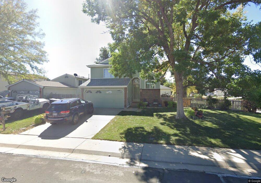
11377 Forest Dr Thornton, CO 80233
Woodglen NeighborhoodEstimated Value: $425,000 - $463,000
3
Beds
2
Baths
1,268
Sq Ft
$350/Sq Ft
Est. Value
About This Home
This home is located at 11377 Forest Dr, Thornton, CO 80233 and is currently estimated at $443,722, approximately $349 per square foot. 11377 Forest Dr is a home located in Adams County with nearby schools including Cherry Drive Elementary School, Shadow Ridge Middle School, and Mountain Range High School.
Ownership History
Date
Name
Owned For
Owner Type
Purchase Details
Closed on
Jul 26, 2012
Sold by
Corral Laurel E
Bought by
Corral Laurel E and Corral Ernest
Current Estimated Value
Home Financials for this Owner
Home Financials are based on the most recent Mortgage that was taken out on this home.
Original Mortgage
$184,637
Outstanding Balance
$126,564
Interest Rate
3.75%
Mortgage Type
FHA
Estimated Equity
$317,158
Purchase Details
Closed on
Aug 1, 2008
Sold by
Corral Ernest S
Bought by
Corral Laurel E
Purchase Details
Closed on
May 25, 1994
Sold by
Miller Christopher H and Miller Julie D
Bought by
Corral Ernest S and Corral Laurel E
Home Financials for this Owner
Home Financials are based on the most recent Mortgage that was taken out on this home.
Original Mortgage
$96,263
Interest Rate
8.19%
Mortgage Type
FHA
Purchase Details
Closed on
Nov 4, 1992
Create a Home Valuation Report for This Property
The Home Valuation Report is an in-depth analysis detailing your home's value as well as a comparison with similar homes in the area
Home Values in the Area
Average Home Value in this Area
Purchase History
| Date | Buyer | Sale Price | Title Company |
|---|---|---|---|
| Corral Laurel E | -- | Lsi | |
| Corral Laurel E | -- | None Available | |
| Corral Ernest S | $96,900 | -- | |
| -- | $87,000 | -- |
Source: Public Records
Mortgage History
| Date | Status | Borrower | Loan Amount |
|---|---|---|---|
| Open | Corral Laurel E | $184,637 | |
| Previous Owner | Corral Ernest S | $96,263 |
Source: Public Records
Tax History
| Year | Tax Paid | Tax Assessment Tax Assessment Total Assessment is a certain percentage of the fair market value that is determined by local assessors to be the total taxable value of land and additions on the property. | Land | Improvement |
|---|---|---|---|---|
| 2025 | $2,647 | $27,540 | $6,660 | $20,880 |
| 2024 | $2,647 | $25,320 | $6,130 | $19,190 |
| 2023 | $2,620 | $29,290 | $6,090 | $23,200 |
| 2022 | $2,347 | $21,310 | $6,190 | $15,120 |
| 2021 | $2,424 | $21,310 | $6,190 | $15,120 |
| 2020 | $2,428 | $21,760 | $6,360 | $15,400 |
| 2019 | $2,432 | $21,760 | $6,360 | $15,400 |
| 2018 | $2,038 | $17,710 | $6,120 | $11,590 |
| 2017 | $1,853 | $17,710 | $6,120 | $11,590 |
| 2016 | $1,460 | $13,590 | $3,340 | $10,250 |
| 2015 | $1,458 | $13,590 | $3,340 | $10,250 |
| 2014 | -- | $11,100 | $2,710 | $8,390 |
Source: Public Records
Map
Nearby Homes
- 11368 Forest Dr
- 11465 Cherry Dr
- 5063 E 112th Ct
- 5414 E 113th Ave
- 5241 E 111th Ct
- 4911 E 112th Place
- 5141 E 116th Ave
- 11323 Jersey Way
- 11117 Eudora Cir
- 11170 Cherry Cir
- 5155 E 117th Dr
- 11135 Clermont Dr
- 11030 Dahlia Dr
- 11725 Forest Ct
- 10985 Glencoe Place
- 4875 E 117th Dr
- 5005 E 117th Ave
- 10979 Grange Creek Dr
- 10899 Grange Creek Dr
- 4402 E 117th Ct
Your Personal Tour Guide
Ask me questions while you tour the home.