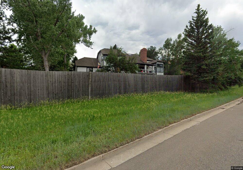
11389 W Park Range Rd Littleton, CO 80127
Estimated Value: $978,000 - $1,202,943
6
Beds
5
Baths
6,778
Sq Ft
$166/Sq Ft
Est. Value
About This Home
This home is located at 11389 W Park Range Rd, Littleton, CO 80127 and is currently estimated at $1,127,986, approximately $166 per square foot. 11389 W Park Range Rd is a home located in Jefferson County with nearby schools including Shaffer Elementary School, Falcon Bluffs Middle School, and Chatfield High School.
Ownership History
Date
Name
Owned For
Owner Type
Purchase Details
Closed on
Apr 29, 2022
Sold by
Spiller Ronald L
Bought by
Wellborn James and Wellborn Kimberly
Current Estimated Value
Home Financials for this Owner
Home Financials are based on the most recent Mortgage that was taken out on this home.
Original Mortgage
$647,200
Outstanding Balance
$608,390
Interest Rate
4.16%
Mortgage Type
New Conventional
Estimated Equity
$519,596
Purchase Details
Closed on
Nov 3, 2016
Sold by
Elster Louis A
Bought by
Spiller Ronald L
Home Financials for this Owner
Home Financials are based on the most recent Mortgage that was taken out on this home.
Original Mortgage
$458,500
Interest Rate
3.42%
Mortgage Type
New Conventional
Purchase Details
Closed on
Dec 26, 2014
Sold by
Elster Linda
Bought by
Elster Louis A
Create a Home Valuation Report for This Property
The Home Valuation Report is an in-depth analysis detailing your home's value as well as a comparison with similar homes in the area
Home Values in the Area
Average Home Value in this Area
Purchase History
| Date | Buyer | Sale Price | Title Company |
|---|---|---|---|
| Wellborn James | $945,000 | -- | |
| Spiller Ronald L | $548,900 | First American | |
| Elster Louis A | -- | None Available |
Source: Public Records
Mortgage History
| Date | Status | Borrower | Loan Amount |
|---|---|---|---|
| Open | Wellborn James | $647,200 | |
| Previous Owner | Spiller Ronald L | $458,500 |
Source: Public Records
Tax History Compared to Growth
Tax History
| Year | Tax Paid | Tax Assessment Tax Assessment Total Assessment is a certain percentage of the fair market value that is determined by local assessors to be the total taxable value of land and additions on the property. | Land | Improvement |
|---|---|---|---|---|
| 2024 | $7,692 | $71,847 | $16,270 | $55,577 |
| 2023 | $7,692 | $71,847 | $16,270 | $55,577 |
| 2022 | $5,225 | $47,732 | $13,745 | $33,987 |
| 2021 | $5,305 | $49,106 | $14,141 | $34,965 |
| 2020 | $4,724 | $43,870 | $12,709 | $31,161 |
| 2019 | $4,668 | $43,870 | $12,709 | $31,161 |
| 2018 | $4,485 | $40,702 | $10,829 | $29,873 |
| 2017 | $4,171 | $40,702 | $10,829 | $29,873 |
| 2016 | $5,000 | $46,177 | $11,623 | $34,554 |
| 2015 | $5,332 | $46,177 | $11,623 | $34,554 |
| 2014 | $5,332 | $46,405 | $10,068 | $36,337 |
Source: Public Records
Map
Nearby Homes
- 7462 S Quail Cir Unit 426
- 7646 S Bear Mountain
- 7433 S Quail Cir Unit 1924
- 11673 Elk Head Range Rd
- 7413 S Quail Cir Unit 1422
- 7413 S Quail Cir Unit 1435
- 7369 S Gore Range Rd Unit 208
- 11703 Elk Head Range Rd
- 7339 S Gore Range Rd
- 11710 Elk Head Range Rd
- 7474 S Alkire St Unit 203
- 11235 San Joaquin Ridge
- 11872 Elk Head Range Rd
- 11434 W Roxbury Dr
- 7409 S Alkire St Unit 304
- 11412 W Roxbury Place
- 8140 S Storm King Peak
- 7355 S Alkire St Unit 203
- 7359 S Mount Holy Cross
- 7825 Sand Mountain
- 11379 W Park Range Rd
- 11399 W Park Range Rd
- 7574 S Anvil Horn
- 11369 W Park Range Rd
- 7594 S Anvil Horn
- 7554 S Anvil Horn
- 7561 S Dome Peak
- 7591 S Dome Peak
- 7613 S Davis Peak
- 7603 S Davis Peak
- 11500 W Park Range Rd
- 7534 S Anvil Horn
- 7560 S Dome Peak
- 7462 S Quail Cir Unit 412
- 7462 S Quail Cir Unit 422
- 7462 S Quail Cir Unit 414
- 7462 S Quail Cir Unit 424
- 7462 S Quail Cir Unit 416
- 7462 S Quail Cir Unit 418
- 7462 S Quail Cir Unit 428