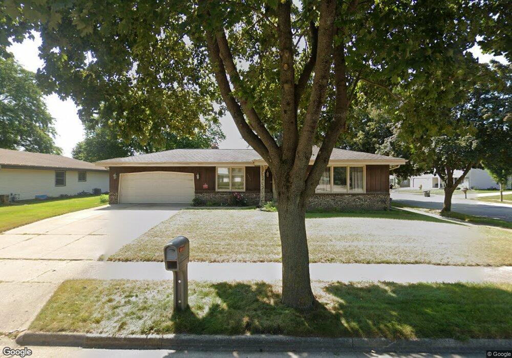
1139 Hemlock Ln Waukesha, WI 53189
Estimated Value: $342,000 - $413,000
3
Beds
2
Baths
1,382
Sq Ft
$276/Sq Ft
Est. Value
About This Home
This home is located at 1139 Hemlock Ln, Waukesha, WI 53189 and is currently estimated at $380,780, approximately $275 per square foot. 1139 Hemlock Ln is a home located in Waukesha County with nearby schools including Prairie Elementary School, Les Paul Middle School - Central Campus, and West High School.
Ownership History
Date
Name
Owned For
Owner Type
Purchase Details
Closed on
Nov 2, 2006
Sold by
Sperl Brian L
Bought by
Klessig Jeffrey J and Metzger Katy K
Current Estimated Value
Home Financials for this Owner
Home Financials are based on the most recent Mortgage that was taken out on this home.
Original Mortgage
$190,950
Outstanding Balance
$114,466
Interest Rate
6.45%
Mortgage Type
Purchase Money Mortgage
Estimated Equity
$266,314
Create a Home Valuation Report for This Property
The Home Valuation Report is an in-depth analysis detailing your home's value as well as a comparison with similar homes in the area
Home Values in the Area
Average Home Value in this Area
Purchase History
| Date | Buyer | Sale Price | Title Company |
|---|---|---|---|
| Klessig Jeffrey J | $201,000 | None Available |
Source: Public Records
Mortgage History
| Date | Status | Borrower | Loan Amount |
|---|---|---|---|
| Open | Klessig Jeffrey J | $190,950 |
Source: Public Records
Tax History Compared to Growth
Tax History
| Year | Tax Paid | Tax Assessment Tax Assessment Total Assessment is a certain percentage of the fair market value that is determined by local assessors to be the total taxable value of land and additions on the property. | Land | Improvement |
|---|---|---|---|---|
| 2024 | $4,619 | $312,200 | $68,300 | $243,900 |
| 2023 | $4,488 | $312,200 | $68,300 | $243,900 |
| 2022 | $4,252 | $222,700 | $66,000 | $156,700 |
| 2021 | $4,350 | $222,700 | $66,000 | $156,700 |
| 2020 | $4,206 | $222,700 | $66,000 | $156,700 |
| 2019 | $4,073 | $222,700 | $66,000 | $156,700 |
| 2018 | $3,739 | $200,600 | $58,200 | $142,400 |
| 2017 | $3,732 | $200,600 | $58,200 | $142,400 |
| 2016 | $3,542 | $179,100 | $56,300 | $122,800 |
| 2015 | $3,522 | $179,100 | $56,300 | $122,800 |
| 2014 | $3,674 | $179,100 | $56,300 | $122,800 |
| 2013 | $3,674 | $179,100 | $56,300 | $122,800 |
Source: Public Records
Map
Nearby Homes
- 1722 Sycamore Dr
- 1706 Haymarket Rd
- 2010 Dixie Dr
- 1101 Dogwood Ln
- 1277 Market Place
- 1804 Center Rd
- 1210 Woodbury Common Unit C
- 1203 Woodbury Common Unit D
- 1523 David Ln
- 1909 Mallard Pointe Cir
- LtD59 White Deer Trail
- S54W25487 Pebble Brook Ct
- S54W25436 Pebble Brook Ct
- 812 Timber Ridge Ct Unit 10
- Lt6 Finch Ct
- 2415 Fox River Pkwy Unit H
- 2426 Fox River Pkwy Unit G
- 801 Timber Ridge Dr
- 2708 Fox Hill Dr
- 300 Darlene Dr
- 1812 Cottonwood Dr
- 1135 Hemlock Ln
- 1817 Cottonwood Dr
- 1131 Hemlock Ln
- 1136 Hemlock Ln
- 1821 Cottonwood Dr
- 1808 Cottonwood Dr
- 1818 Cottonwood Dr
- 1132 Hemlock Ln
- 1822 Cottonwood Dr
- 1804 Cottonwood Dr
- 1127 Hemlock Ln
- 1827 Cottonwood Dr
- 1826 Cottonwood Dr
- 1801 Cottonwood Dr
- 1128 Hemlock Ln
- 1831 Cottonwood Dr
- 1123 Hemlock Ln
- 1830 Cottonwood Dr
- 1124 Hemlock Ln