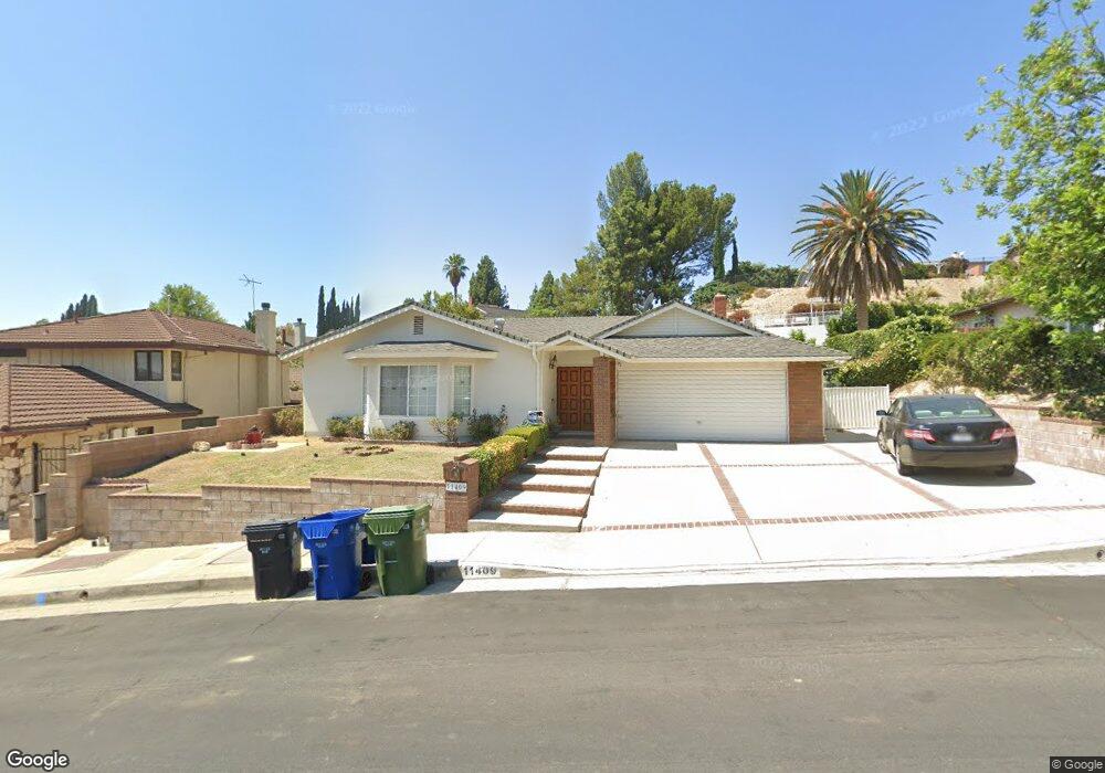
11409 Amigo Ave Porter Ranch, CA 91326
Porter Ranch NeighborhoodEstimated Value: $1,127,476 - $1,218,000
4
Beds
2
Baths
2,008
Sq Ft
$589/Sq Ft
Est. Value
About This Home
This home is located at 11409 Amigo Ave, Porter Ranch, CA 91326 and is currently estimated at $1,183,369, approximately $589 per square foot. 11409 Amigo Ave is a home located in Los Angeles County with nearby schools including Robert Frost Middle School, Northridge Academy High, and Valley Academy of Arts & Sciences.
Ownership History
Date
Name
Owned For
Owner Type
Purchase Details
Closed on
Feb 15, 2012
Sold by
Batta Nabil G and Batta Norma F
Bought by
Batta Nabil G and Batta Norma F
Current Estimated Value
Home Financials for this Owner
Home Financials are based on the most recent Mortgage that was taken out on this home.
Original Mortgage
$325,000
Interest Rate
3.84%
Mortgage Type
New Conventional
Purchase Details
Closed on
Oct 7, 2011
Sold by
Batta Nabil and Batta Norma
Bought by
Batta Nabil G and Batta Norma F
Create a Home Valuation Report for This Property
The Home Valuation Report is an in-depth analysis detailing your home's value as well as a comparison with similar homes in the area
Home Values in the Area
Average Home Value in this Area
Purchase History
| Date | Buyer | Sale Price | Title Company |
|---|---|---|---|
| Batta Nabil G | -- | First American Title | |
| Batta Nabil G | -- | First American Title | |
| Batta Nabil G | -- | None Available |
Source: Public Records
Mortgage History
| Date | Status | Borrower | Loan Amount |
|---|---|---|---|
| Closed | Batta Nabil G | $325,000 |
Source: Public Records
Tax History Compared to Growth
Tax History
| Year | Tax Paid | Tax Assessment Tax Assessment Total Assessment is a certain percentage of the fair market value that is determined by local assessors to be the total taxable value of land and additions on the property. | Land | Improvement |
|---|---|---|---|---|
| 2025 | $5,018 | $392,575 | $131,413 | $261,162 |
| 2024 | $5,018 | $384,879 | $128,837 | $256,042 |
| 2023 | $4,926 | $377,333 | $126,311 | $251,022 |
| 2022 | $4,708 | $369,935 | $123,835 | $246,100 |
| 2021 | $4,643 | $362,682 | $121,407 | $241,275 |
| 2019 | $4,510 | $351,927 | $117,807 | $234,120 |
| 2018 | $4,294 | $345,028 | $115,498 | $229,530 |
| 2016 | $4,086 | $331,632 | $111,014 | $220,618 |
| 2015 | $4,027 | $326,652 | $109,347 | $217,305 |
| 2014 | $4,049 | $320,255 | $107,206 | $213,049 |
Source: Public Records
Map
Nearby Homes
- 18771 Clearbrook St
- 11258 Yolanda Ave
- 11410 Reseda Blvd
- 11144 Viking Ave
- 11215 Wilbur Ave
- 18371 Lahey St
- 11830 Killimore Ave
- 18351 San Fernando Mission Blvd
- 11813 Killimore Ave
- 18308 Lahey St
- 19140 Lahey St Unit 4
- 19200 Lahey St Unit 3
- 18501 Calle Vista Cir
- 18352 Ludlow St
- 18301 Ludlow St
- 19009 Celtic St
- 18200 Sheffield Ln
- 19040 Celtic St
- 11959 Dunnicliffe Ct
- 10811 Amigo Ave
- 11415 Amigo Ave
- 11401 Amigo Ave
- 18717 Dylan St
- 18731 Dylan St
- 11421 Amigo Ave
- 11440 Dulcet Ave
- 18743 Dylan St
- 11410 Amigo Ave
- 11444 Dulcet Ave
- 11400 Amigo Ave
- 11418 Amigo Ave
- 11427 Amigo Ave
- 11385 Amigo Ave
- 11390 Sinclair Ave
- 11424 Amigo Ave
- 11390 Amigo Ave
- 18716 Nau Ave
- 18730 Dylan St
- 18738 Dylan St
- 18726 Nau Ave