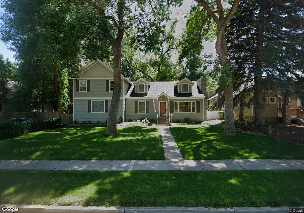
1141 Laporte Ave Fort Collins, CO 80521
City Park NeighborhoodEstimated Value: $873,630 - $1,265,000
3
Beds
4
Baths
2,436
Sq Ft
$446/Sq Ft
Est. Value
About This Home
This home is located at 1141 Laporte Ave, Fort Collins, CO 80521 and is currently estimated at $1,087,158, approximately $446 per square foot. 1141 Laporte Ave is a home located in Larimer County with nearby schools including Putnam Elementary School, Lincoln Middle School, and Poudre High School.
Ownership History
Date
Name
Owned For
Owner Type
Purchase Details
Closed on
Apr 14, 2003
Sold by
Fees Michael Anthony
Bought by
Fees Michael A and Fees Deborah J
Current Estimated Value
Home Financials for this Owner
Home Financials are based on the most recent Mortgage that was taken out on this home.
Original Mortgage
$235,000
Outstanding Balance
$100,139
Interest Rate
5.64%
Mortgage Type
Purchase Money Mortgage
Estimated Equity
$987,019
Purchase Details
Closed on
Mar 1, 1994
Sold by
Fees Michael Anthony
Bought by
Fees Michael A
Purchase Details
Closed on
Mar 1, 1993
Sold by
Fees Amy U
Bought by
Fees Michael Anthony
Purchase Details
Closed on
Nov 1, 1992
Sold by
Fees Amy Upham
Bought by
Fees Michael Anthony
Create a Home Valuation Report for This Property
The Home Valuation Report is an in-depth analysis detailing your home's value as well as a comparison with similar homes in the area
Home Values in the Area
Average Home Value in this Area
Purchase History
| Date | Buyer | Sale Price | Title Company |
|---|---|---|---|
| Fees Michael A | -- | -- | |
| Fees Michael A | -- | -- | |
| Fees Michael Anthony | -- | -- | |
| Fees Michael Anthony | -- | -- |
Source: Public Records
Mortgage History
| Date | Status | Borrower | Loan Amount |
|---|---|---|---|
| Open | Fees Michael A | $235,000 |
Source: Public Records
Tax History Compared to Growth
Tax History
| Year | Tax Paid | Tax Assessment Tax Assessment Total Assessment is a certain percentage of the fair market value that is determined by local assessors to be the total taxable value of land and additions on the property. | Land | Improvement |
|---|---|---|---|---|
| 2025 | $3,607 | $47,972 | $3,350 | $44,622 |
| 2024 | $3,432 | $47,972 | $3,350 | $44,622 |
| 2022 | $2,277 | $31,067 | $3,475 | $27,592 |
| 2021 | $2,965 | $31,961 | $3,575 | $28,386 |
| 2020 | $4,600 | $49,163 | $3,575 | $45,588 |
| 2019 | $4,620 | $49,163 | $3,575 | $45,588 |
| 2018 | $3,425 | $37,584 | $3,600 | $33,984 |
| 2017 | $3,414 | $37,584 | $3,600 | $33,984 |
| 2016 | $3,271 | $35,828 | $3,980 | $31,848 |
| 2015 | $3,247 | $35,830 | $3,980 | $31,850 |
| 2014 | $2,750 | $30,150 | $3,980 | $26,170 |
Source: Public Records
Map
Nearby Homes
- 149 Sylvan Ct
- 1121 Juniper Ct
- 219 N Shields St
- 1029 Laporte Ave
- 234 N Mckinley Ave
- 200 Bishop St
- 1349 Cherry St
- 1343 Cherry St
- 1014 W Oak St
- 1101 W Oak St
- 1031 W Oak St
- 405 Franklin St
- 408 Riddle Dr
- 1116 Beech St
- 1112 Beech St
- 317 Wood St
- 1392 Cherry St
- 219 N Grant Ave
- 816 Maple St
- 1100 W Mulberry St
- 1147 Laporte Ave
- 1133 Laporte Ave
- 1151 Laporte Ave
- 140 Pearl St
- 136 Pearl St
- 1131 Laporte Ave
- 128 Pearl St
- 1201 Laporte Ave
- 126 Pearl St
- 1148 Laporte Ave
- 1205 Laporte Ave
- 1144 Laporte Ave
- 122 Pearl St
- 1160 Laporte Ave
- 1138 Laporte Ave
- 131 Pearl St
- 1209 Laporte Ave
- 1123 Laporte Ave
- 1136 Laporte Ave
- 127 Pearl St