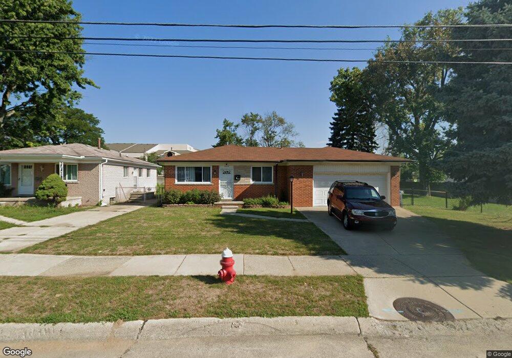
11417 Carrier Ave Unit Bldg-Unit Warren, MI 48089
Southeast Warren NeighborhoodEstimated Value: $229,000 - $243,000
3
Beds
2
Baths
1,005
Sq Ft
$234/Sq Ft
Est. Value
About This Home
This home is located at 11417 Carrier Ave Unit Bldg-Unit, Warren, MI 48089 and is currently estimated at $235,320, approximately $234 per square foot. 11417 Carrier Ave Unit Bldg-Unit is a home located in Macomb County with nearby schools including May V. Peck Elementary School, Wolfe Middle School, and Center Line High School.
Ownership History
Date
Name
Owned For
Owner Type
Purchase Details
Closed on
Feb 3, 2023
Sold by
Reaves Warren L
Bought by
Nichols Shelby Lynn
Current Estimated Value
Home Financials for this Owner
Home Financials are based on the most recent Mortgage that was taken out on this home.
Original Mortgage
$185,250
Outstanding Balance
$179,181
Interest Rate
6.09%
Mortgage Type
New Conventional
Estimated Equity
$56,139
Purchase Details
Closed on
Feb 22, 2018
Sold by
Pierfellce Amy B and Mccallister Amy B
Bought by
Reaves Warren L
Purchase Details
Closed on
May 19, 2005
Sold by
Fannie Mae
Bought by
Mccallister Amy B
Home Financials for this Owner
Home Financials are based on the most recent Mortgage that was taken out on this home.
Original Mortgage
$108,000
Interest Rate
5.91%
Mortgage Type
Fannie Mae Freddie Mac
Purchase Details
Closed on
Mar 23, 2004
Sold by
Mortgage Electronic Registration Systems
Bought by
Federal National Mortgage Association
Create a Home Valuation Report for This Property
The Home Valuation Report is an in-depth analysis detailing your home's value as well as a comparison with similar homes in the area
Home Values in the Area
Average Home Value in this Area
Purchase History
| Date | Buyer | Sale Price | Title Company |
|---|---|---|---|
| Nichols Shelby Lynn | $195,000 | Devon Title | |
| Reaves Warren L | $135,000 | Chirco Title Agency Inc | |
| Mccallister Amy B | $135,000 | Glt | |
| Federal National Mortgage Association | -- | -- |
Source: Public Records
Mortgage History
| Date | Status | Borrower | Loan Amount |
|---|---|---|---|
| Open | Nichols Shelby Lynn | $185,250 | |
| Previous Owner | Mccallister Amy B | $108,000 |
Source: Public Records
Tax History Compared to Growth
Tax History
| Year | Tax Paid | Tax Assessment Tax Assessment Total Assessment is a certain percentage of the fair market value that is determined by local assessors to be the total taxable value of land and additions on the property. | Land | Improvement |
|---|---|---|---|---|
| 2025 | $6,133 | $98,760 | $0 | $0 |
| 2024 | $5,986 | $96,660 | $0 | $0 |
| 2023 | $5,041 | $88,240 | $0 | $0 |
| 2022 | $4,871 | $80,410 | $0 | $0 |
| 2021 | $4,955 | $75,800 | $0 | $0 |
| 2020 | $4,832 | $72,800 | $0 | $0 |
| 2019 | $4,755 | $71,670 | $0 | $0 |
| 2018 | $2,623 | $49,660 | $0 | $0 |
| 2017 | $2,398 | $44,890 | $10,780 | $34,110 |
| 2016 | $2,380 | $44,890 | $0 | $0 |
| 2015 | -- | $42,800 | $0 | $0 |
| 2013 | $7,060 | $37,450 | $0 | $0 |
Source: Public Records
Map
Nearby Homes
- 11620 Herbert Ave
- 11455 E 11 Mile Rd
- 11175 Sunburst Ave
- 25841 Gunston Ave
- 11245 Mae Ave
- 27125 Gilbert Dr
- 11085 Busch Ave
- 27300 Santa Ana Dr
- 11920 Carney St
- 11771 Harold St
- 27278 Shackett Ave
- 26443 Marilyn Ave
- 27260 Norma Dr
- 27074 Bonnie Dr
- 26608 Marilyn Ave
- 11657 Engleman Rd
- 12237 Champaign Ave
- 27480 Shackett Ave
- 11478 Engleman Rd
- 12291 E 11 Mile Rd
- 11417 Carrier Ave
- 11409 Carrier Ave
- 11393 Carrier Ave
- 26450 Falmouth Dr
- 11377 Carrier Ave
- 26438 Falmouth Dr
- 11369 Carrier Ave
- 11364 Carrier Ave
- 26426 Falmouth Dr
- 11352 Carrier Ave
- 26429 Falmouth Dr
- 26414 Falmouth Dr
- 11340 Carrier Ave
- 11345 Carrier Ave
- 26417 Falmouth Dr
- 26402 Falmouth Dr
- 11337 Carrier Ave Unit Bldg-Unit
- 11337 Carrier Ave
- 11347 Lois Ct
- 11328 Carrier Ave