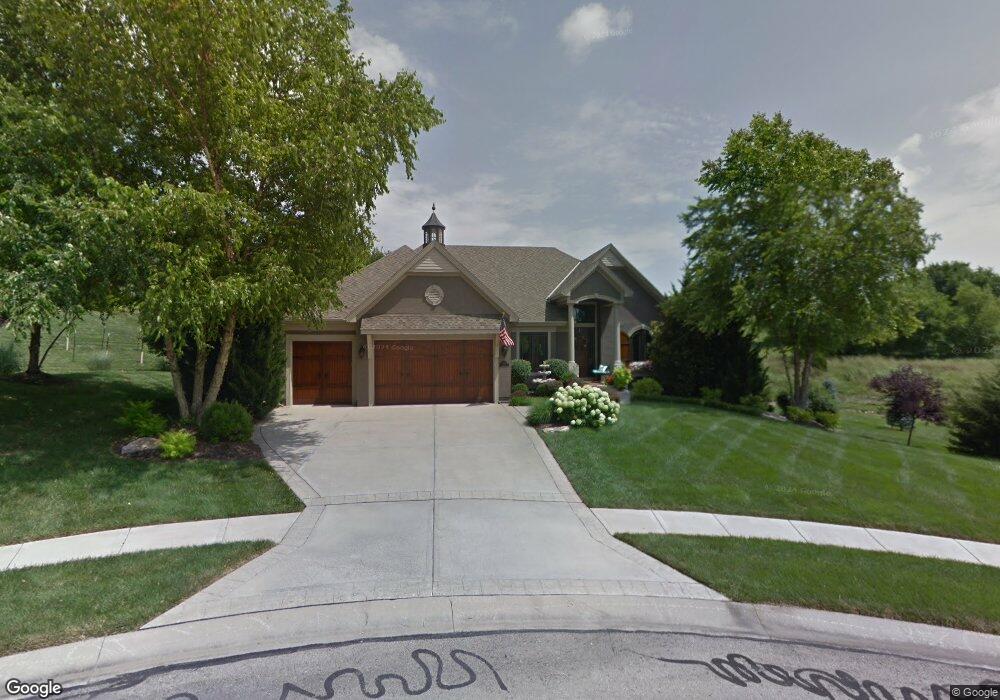
11420 S Gleason Rd Olathe, KS 66061
Estimated Value: $664,000 - $765,000
4
Beds
3
Baths
2,092
Sq Ft
$338/Sq Ft
Est. Value
About This Home
This home is located at 11420 S Gleason Rd, Olathe, KS 66061 and is currently estimated at $706,907, approximately $337 per square foot. 11420 S Gleason Rd is a home located in Johnson County with nearby schools including Cedar Creek Elementary School, Mission Trail Middle School, and Olathe West High School.
Ownership History
Date
Name
Owned For
Owner Type
Purchase Details
Closed on
Oct 23, 2008
Sold by
Brunsky Michael and Brunsky Connie J
Bought by
Herting Roger R and Herting Theresa A
Current Estimated Value
Home Financials for this Owner
Home Financials are based on the most recent Mortgage that was taken out on this home.
Original Mortgage
$419,600
Outstanding Balance
$275,654
Interest Rate
6.18%
Mortgage Type
New Conventional
Estimated Equity
$431,253
Create a Home Valuation Report for This Property
The Home Valuation Report is an in-depth analysis detailing your home's value as well as a comparison with similar homes in the area
Home Values in the Area
Average Home Value in this Area
Purchase History
| Date | Buyer | Sale Price | Title Company |
|---|---|---|---|
| Herting Roger R | -- | Homestead Title |
Source: Public Records
Mortgage History
| Date | Status | Borrower | Loan Amount |
|---|---|---|---|
| Open | Herting Roger R | $419,600 |
Source: Public Records
Tax History Compared to Growth
Tax History
| Year | Tax Paid | Tax Assessment Tax Assessment Total Assessment is a certain percentage of the fair market value that is determined by local assessors to be the total taxable value of land and additions on the property. | Land | Improvement |
|---|---|---|---|---|
| 2024 | $8,204 | $71,932 | $14,897 | $57,035 |
| 2023 | $8,026 | $69,414 | $13,540 | $55,874 |
| 2022 | $7,153 | $60,214 | $12,302 | $47,912 |
| 2021 | $7,153 | $58,109 | $11,181 | $46,928 |
| 2020 | $7,481 | $59,662 | $11,181 | $48,481 |
| 2019 | $7,286 | $57,719 | $10,180 | $47,539 |
| 2018 | $7,174 | $56,430 | $9,247 | $47,183 |
| 2017 | $7,059 | $54,947 | $9,247 | $45,700 |
| 2016 | $6,687 | $53,371 | $9,247 | $44,124 |
| 2015 | $6,471 | $51,681 | $9,247 | $42,434 |
| 2013 | -- | $51,025 | $9,709 | $41,316 |
Source: Public Records
Map
Nearby Homes
- 11248 S Gleason Rd
- 11263 S Gleason Rd
- 11275 S Gleason Rd
- 11287 S Gleason Rd
- 23930 W 112th Terrace
- 11378 S Cook St
- 11580 S Carbondale St
- 11320 S Cook St
- 11717 S Barth Rd
- 24268 W 111th Place
- 11124 S Barth Rd
- 11758 S Mesquite St
- 11775 S Kenton St
- 23717 W 118th Terrace
- 11807 S Kenton St
- 19255 113th Terrace
- 23733 W 118th Terrace
- 10981 S Parish St
- 23330 W 119th St
- 24843 W 112th St
- 11409 S Gander St
- 11405 S Gander St
- 11445 S Gleason Rd
- 24010 W 114th Place
- 11413 S Gander St
- 24020 W 114th Place
- 11401 S Gander St
- 11417 S Gander St
- 11465 S Gleason Rd
- 11383 S Gander St
- 24040 W 114th Place
- 24015 W 114th Place
- 11421 S Gander St
- 11373 S Gander St
- 11485 S Gleason Rd
- 24060 W 114th Place
- 24025 W 114th Place
- 11427 S Gander St
- 11406 S Gander St
- 11384 S Gander St